- Usage in publication:
-
- Dockum beds
- Modifications:
-
- Original reference
- Dominant lithology:
-
- Sandstone
- Conglomerate
- Clay
- AAPG geologic province:
-
- Permian basin
Summary:
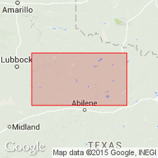
Pg. 189. Dockum beds. Water-bearing conglomerate, sandstone, and red clay, 150 feet thick, unconformably overlying clays and sandstones of Upper Permian, and entirely unlike anything heretofore seen in Texas. Unconformably underlies Blanco Canyon beds [Blanco formation]. Fossils. [Age is Late(?) Triassic.]
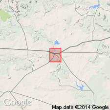
Named from Dockum, Dickens Co., western TX.
Source: US geologic names lexicon (USGS Bull. 896, p. 616); supplemental information from GNU records (USGS DDS-6; Denver GNULEX).
- Usage in publication:
-
- Dockum group*
- Modifications:
-
- Revised
- AAPG geologic province:
-
- Anadarko basin
- Palo Duro basin
Summary:
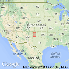
Pg. 20-29. Dockum group. Along eastern edge of Llano Estacado, in Potter and Randall Counties of the Texas Panhandle, includes (ascending) Tecovas and Trujillo formations. Thickness up to 400+ feet. Unconformably overlies Permian Quartermaster formation, and in places, unconformably underlies Tertiary sand and clay. Vertebrate fossils. Age is Triassic.
Source: Publication; GNU records (USGS DDS-6; Denver GNULEX).
- Usage in publication:
-
- Dockum group
- Modifications:
-
- Areal extent
- AAPG geologic province:
-
- Sierra Grande uplift
Summary:
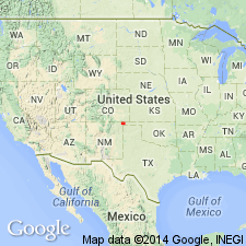
Dockum group. Name applied to the 400+ feet-thick maroon to purple conglomerate, sandstone, and shale sequence in Cimarron Valley, Union County, New Mexico. Underlies the shales and marls of the Sloan Canyon formation (new) or unconformably underlies the cross-bedded sandstones of the Exeter. Age is Triassic(?).
Source: Modified from GNU records (USGS DDS-6; Denver GNULEX).

- Usage in publication:
-
- Dockum group*
- Modifications:
-
- Overview
- AAPG geologic province:
-
- Permian basin
Summary:
Dockum group. Recognized in panhandle of Texas and southeastern New Mexico. In Texas is divided into Trujillo formation (above) and Tecovas shale (below). Unconformably overlies Permian (Double Mountain and Quatermaster formations) and unconformably underlies Blanco formation (Pliocene). Age is Late(?) Triassic.
Source: US geologic names lexicon (USGS Bull. 896, p. 616).
- Usage in publication:
-
- Dockum Group
- Modifications:
-
- Areal extent
- Biostratigraphic dating
- AAPG geologic province:
-
- Sierra Grande uplift
- Palo Duro basin
Summary:
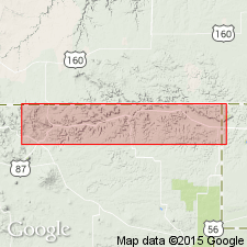
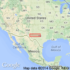
Pg. 759-766. Skull of phytosaur MACHAEROPROSOPUS discovered in Sloan Canyon formation, confirms Triassic age of rocks lying beneath Exeter (Jurassic) in valley of dry Cimarron River in Union County, New Mexico, and Cimarron County, Oklahoma. Underlying red beds, the Sloan Canyon formation, and Sheep Pen Canyon formation form continuous and conformable succession of strata. These three units should be included in Dockum group.
Source: US geologic names lexicon (USGS Bull. 1200, p. 1127-1128).
- Usage in publication:
-
- Dockum group*
- Modifications:
-
- Revised
- AAPG geologic province:
-
- Permian basin
Summary:
Pg. 556. Dockum group. Upper Triassic red shales and sandstones of terrestrial origin overlie Permian throughout much of southern Permian basin. They are placed in Dockum group and divided into (ascending) Tecovas shale, Santa Rosa sandstone, and Chinle shale.
Source: US geologic names lexicon (USGS Bull. 1200, p. 1127-1128).
- Usage in publication:
-
- Dockum group
- Modifications:
-
- Areal extent
- AAPG geologic province:
-
- Permian basin
Summary:
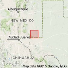
Pg. 23-24. Dockum group. In Eddy County, New Mexico, overlies Rustler formation. Consists of redbeds and sandstones. Lower part of these beds has been considered Permian and correlated with Dewey Lake redbeds by some geologists. Total thickness of group east of Artesia is about 1,000 feet. Formations exposed are Pierce Canyon redbeds, Santa Rosa sandstone, and redbeds that possibly represent the Chinle formation. Age is Triassic.
Source: US geologic names lexicon (USGS Bull. 1200, p. 1127-1128).
- Usage in publication:
-
- Dockum group
- Modifications:
-
- Areal extent
- AAPG geologic province:
-
- San Juan basin
- Estancia basin
Summary:
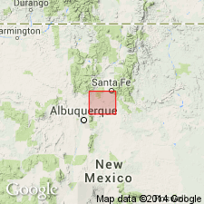
Pg. 463 (fig. 2), 467. Glorieta sandstone, in Galisteo-Tongue area, New Mexico, is overlain by about 800 feet of red and variegated sandstone and shale. These beds are generally correlated with Dockum group of eastern New Mexico.
Source: US geologic names lexicon (USGS Bull. 1200, p. 1127-1128).
- Usage in publication:
-
- Dockum group*
- Modifications:
-
- Areal extent
- AAPG geologic province:
-
- Anadarko basin
Summary:
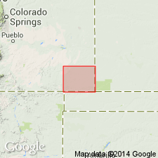
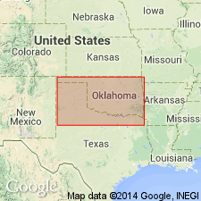
Pg. 82-87, geol. map. Dockum group [undivided]. As used in this report (Baca County, southeasternmost Colorado), includes all Triassic-age rocks between Cragin's Permian Taloga formation and Upper Jurassic Entrada sandstone. Maximum observed thickness 50 feet. In southwestern part of county, Carrizo Creek area, beds are highly fractured, variegated shale, clay, and siltstone with lesser amounts of sandstone and conglomerate. In southeastern part of county, along Cimarron River, beds are predominantly red and considerably more sandy; most are well-sorted, friable, and loosely cemented with calcium carbonate or limonite. In northwestern part of county, along Two Butte Creek, beds are mostly dense, red to maroon siltstone and sandstone, and gray limestone. Report includes geologic map.
Source: Publication.
- Usage in publication:
-
- Dockum formation*
- Modifications:
-
- Mapped 1:500k
- AAPG geologic province:
-
- Palo Duro basin
- Anadarko basin
Summary:
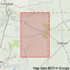
In Cimarron County, Oklahoma, Triassic Dockum formation is mapped undifferentiated with Jurassic Morrison and Exeter formations.
[Isolated exposures of Dockum around Guymon, Texas County, and along Texas-Beaver County line, Oklahoma.]
Source: Publication; US geologic names lexicon (USGS Bull. 1200, p. 1127-1128).
- Usage in publication:
-
- Dockum group
- Modifications:
-
- Revised
- AAPG geologic province:
-
- Sierra Grande uplift
Summary:
Pg. 34-42, pl. 1d. Dockum group. As used in this report, includes all beds of Triassic age exposed in Union County, northeastern New Mexico. With only one or two exceptions, exposures of the Dockum are restricted to drainage area of Dry Cimarron, where group is divided into four formations (ascending): Baldy Hill (new), Travesser (new), Sloan Canyon, and Sheep Pen. Thickness about 900 feet. Unconformably underlies Exeter sandstone. Thought to correlate with Wingate sandstone and upper part of Chinle formation of Arizona. Fossils. Age is Late Triassic.
Source: US geologic names lexicon (USGS Bull. 1200, p. 1127-1128); supplemental information from GNU records (USGS DDS-6; Denver GNULEX).
- Usage in publication:
-
- Dockum group*
- Modifications:
-
- Areal extent
- AAPG geologic province:
-
- Anadarko basin
Summary:
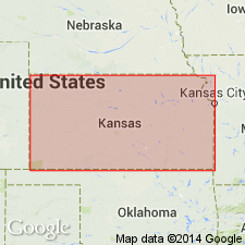
Dockum group shown on chart with statement that some part of Triassic section is believed to crop out in small in Morton County, Kansas.
Source: US geologic names lexicon (USGS Bull. 1200, p. 1127-1128).
- Usage in publication:
-
- Dockum Group, undivided
- Modifications:
-
- Mapped 1:250k
- Dominant lithology:
-
- Shale
- Sandstone
- Siltstone
- Limestone
- Gravel
- AAPG geologic province:
-
- Permian basin
Summary:
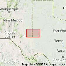
Pamphlet [p. 4]. Dockum Group, undivided. Shale, sandstone, siltstone, limestone, and gravel; mostly shale, micaceous, thin-bedded, variegated. Thickness up to 300 feet. Age is Triassic.
[Small isolated exposures mapped in Eddy and Lea Cos., NM, and in Andrews, Martin, and Midland Cos., TX.]
Source: Publication.
- Usage in publication:
-
- Dockum Group
- Modifications:
-
- Overview
- AAPG geologic province:
-
- Sierra Grande uplift
- Palo Duro basin
- Amarillo arch
Summary:
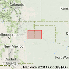
Is Upper Triassic group with 3 formations separately mapped in this sheet in northeast NM and TX Panhandle (Sierra Grande uplift, Palo Duro basin, and Amarillo arch). Mapped formations are (descending): Chinle Formation--shale, siltstone, sandstone, limestone, and mudstone; Trujillo Formation--conglomerate, sandstone, and shale; and Tecovas Formation--shale, clay, siltstone, and sand. Overlies Quartermaster Formation (Permian); overlain by Exeter Sandstone (Upper Jurassic).
Source: GNU records (USGS DDS-6; Denver GNULEX).
- Usage in publication:
-
- Dockum Formation
- Modifications:
-
- Revised
- AAPG geologic province:
-
- Permian basin
Summary:
This continental redbed sequence in the Permian basin of eastern NM and western TX was deposited unconformably on Upper Permian and is overlain by Cretaceous, Tertiary, or Quaternary sediments. Ranges in thickness from 70-700 m. A fauna was found in a quarry in Garza Co, TX that includes taxa previously unknown in the Triassic of North America. Age of Dockum thought to extend from late Carnian to early Norian. Reinstated as a formation. Divided into (ascending): Tecovas Member (formerly of formation rank), Trujillo Member (formerly of formation rank), and Cooper Member, a new name replacing use of Chinle Formation of Dockum Group in TX and NM. The name Chinle should not have been used for the upper part of the Dockum because Chinle is equivalent to all of the Dockum--a thought published in several earlier papers. Also Santa Rosa Sandstone should not be considered part of the Dockum. A fossil skull found in the basal bed of the Santa Rosa in the Tucumcari area has long been known from the Holbrook Member of the Moenkopi Formation in AZ. Dockum has phytosaur fossils of Late Triassic age. NICROSAURUS fauna found in Cooper Member in Garza Co and PARASUCHUS found in Tecovas Member. Stratigraphic diagrams.
Source: GNU records (USGS DDS-6; Denver GNULEX).
- Usage in publication:
-
- Dockum Formation*
- Modifications:
-
- Areal extent
- AAPG geologic province:
-
- Las Vegas-Raton basin
Summary:
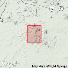
Mapped as a unit of formation rank and of Late Triassic age in central part of Temple Dome in secs 1, 2, 11 and 12, T26N, R26E, Colfax Co, NM in Las Vegas-Raton basin. Is the oldest formation in the quad; only upper part is present. Underlies Exeter Sandstone.
Source: GNU records (USGS DDS-6; Denver GNULEX).
- Usage in publication:
-
- Dockum Group
- Modifications:
-
- Not used
Summary:
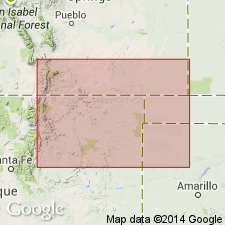
Application of term "Dockum Group" rejected for the Baldy Hill, Travesser, and Sloan Canyon Formations, and Sheep Pen Sandstone in the Dry Cimarron valley of Union Co, NM. Name Dockum has been applied, according to these authors, to rocks of various lithologies and to rocks that represent various amounts of Triassic time. Also, Dockum as it was used in Union Co included strata not equivalent to the Dockum of TX.
Source: GNU records (USGS DDS-6; Denver GNULEX).
- Usage in publication:
-
- Dockum Group*
- Modifications:
-
- Age modified
- AAPG geologic province:
-
- Palo Duro basin
Summary:
Basal formation of Dockum Group, the Santa Rosa Sandstone redescribed as Santa Rosa Formation because of its mudstone and conglomerate content in addition to sandstone. Age of Santa Rosa changed from Late Triassic to Middle and Late Triassic on basis of an amphibian skull of Anisian age in the lower sandstone member near Dilia, Guadalupe Co, NM. Plant fossils of Carnian age identified in mudstone member at principal reference section of Santa Rosa at N1/2 sec 1, T8N, R21E and SE1/4 SE1/2 sec 36, T9N, R22E and nearby, Guadalupe Co, NM. Report area is in the Palo Duro basin.
Source: GNU records (USGS DDS-6; Denver GNULEX).
- Usage in publication:
-
- Dockum Group or Formation
- Modifications:
-
- Not used
Summary:
Term not used for Upper Triassic rocks as a group or formation in San Miguel and Guadalupe Cos in east-central NM, Palo Duro basin; was not defined precisely. Term Chinle Formation not used because Upper Triassic rocks of east-central NM were deposited in a separate basin from the Chinle Formation of the Colorado Plateau. The Upper Triassic sequence formerly assigned to the Chinle or Dockum is divided into (ascending): Garita Creek (new), Trujillo (term used in preference to Cuervo, a name coined 65 years after the Trujillo), Bull Canyon (new), and Redonda (raised in stratigraphic rank to formation). Nomenclature chart.
Source: GNU records (USGS DDS-6; Denver GNULEX).
- Usage in publication:
-
- Dockum Group
- Modifications:
-
- Mapped 1:250k
- Dominant lithology:
-
- Sandstone
- Clay
- Shale
- Conglomerate
- AAPG geologic province:
-
- Palo Duro basin
- Permian basin
Summary:
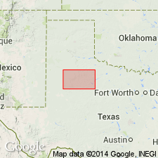
Is Triassic group mapped in mostly continuous, southward-broadening belt below Caprock Escarpment in west-central part of map sheet in southwest Motley Co, TX (Palo Duro basin) and in western Dickens, southeast and southern Crosby, southeast Lubbock, southeast Lynn, Garza, and western Kent Cos, TX (northeastern Permian basin). Overlies Quartermaster Formation (Permian); overlain by Antlers Sand (Lower Cretaceous). Map unit described as sandstone, clay, shale, and conglomerate. Sandstone, fine- to coarse-grained quartz, micaceous silty, thin-bedded to massive, cross-bedded, well indurated, greenish gray, brownish red. Clay, sandy, silty, reddish brown. Shale, sandy, locally calcareous, indistinctly bedded, various shades of red, green, gray, yellow. Conglomerate of various colored chert pebbles common in lower part; basal conglomerate also contains quartz, sandstone slabs, and petrified wood. Thickness 400+/-ft, locally absent in Motley Co, TX.
Source: GNU records (USGS DDS-6; Denver GNULEX).
For more information, please contact Nancy Stamm, Geologic Names Committee Secretary.
Asterisk (*) indicates published by U.S. Geological Survey authors.
"No current usage" (†) implies that a name has been abandoned or has fallen into disuse. Former usage and, if known, replacement name given in parentheses ( ).
Slash (/) indicates name conflicts with nomenclatural guidelines (CSN, 1933; ACSN, 1961, 1970; NACSN, 1983, 2005, 2021). May be explained within brackets ([ ]).

