The National Geologic Map Database is migrating to a new infrastructure. We apologize for any service disruptions during this process.
|
|---|


- Usage in publication:
-
- Devil's Hole Member
- Modifications:
-
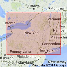
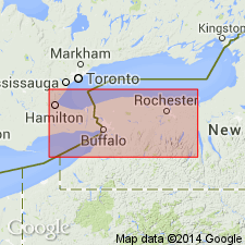
- Areal extent
- Dominant lithology:
-
- Sandstone
- AAPG geologic province:
-
- Appalachian basin
Summary:
Devil's Hole Member of Grimsby Sandstone. At Lockport and at South Haul Road to Robert Moses Power Plant, Niagara County, New York, the Power Glen is overlain by a 2-m-thick massive white quartzose sandstone referred to as the Devils Hole Member of the Grimsby Sandstone. Age is Early Silurian.
[Name preempted by Silurian †Devils Hole dolomite of Fisher (1959).]
Source: Modified from GNU records (USGS DDS-6; Reston GNULEX).
- Usage in publication:
-
- Devil's Hole Formation
- Modifications:
-
- Revised
- AAPG geologic province:
-
- Appalachian basin
Summary:
The Medina Group comprises 11 facies, which can be organized into three facies associations. The previously defined color-based formations do not conform with lithic correlations except for the Whirlpool and Manitoulin. A formal major revision is being proposed by Brett and others (in press) and Duke and others (in press). The newly revised Medina Group will include the Whirlpool Sandstone at its base (virtually unchanged), the overlying Jolley Cut Formation (a tentative renaming of the Manitoulin), the Ball's Falls Formation (new), the Art Park Phosphate Beds (new), the Devil's Hole Formation (new), the Grimsby Formation (revised), the Power Glen Formation (revised), the Thorold Formation (revised), the Cambria Formation (new), and the Kodak Formation (resurrected). The Ball's Falls interfingers with the laterally equivalent Devil's Hole. The Medina unconformably overlies Queenston Shale; unconformably underlies Clinton Group.
Source: GNU records (USGS DDS-6; Reston GNULEX).
- Usage in publication:
-
- Devils Hole Sandstone*
- Modifications:
-
- Named
- Dominant lithology:
-
- Sandstone
- Shale
- AAPG geologic province:
-
- Appalachian basin
Summary:
Named the Devils Hole Sandstone of the Medina Group for Devils Hole State Park, Lewiston, Niagara Co., western NY. Consists of well-sorted, white to very pale pink, slightly dolomitic, medium- to fine-grained quartz arenite with some horizontal to hummocky cross-laminations and minor interbeds of greenish-gray shale. Thickness is 13.1 to 14.9 feet thick. Unit is divided into a western Balls Falls facies (formerly Balls Falls formation of Duke (1991)) and an eastern condensed sandstone facies. The Balls Falls facies contains thin beds of dolomitic sandstone, fine-grained dolomite, and interbedded gray to red shale; the eastern condensed sandstone facies contains laminated, porous, calcareous, oolitic, and arkosic sandstone. The Devils Hole is well exposed at north end of Niagara River gorge at Artpark and in a roadcut at W. Jackson Street beneath the Somerset Railroad viaduct, Lockport, Niagara Co., NY. The Devils Hole was formerly part of the Power Glen Shale of Rickard (1975). Overlies the revised Power Glen Shale by a sharp contact and underlies the Artpark Phosphate Bed of the Grimsby Formation. The Devils Hole is of Early Silurian (Llandoverian) age. [Report uses Early and Late Silurian time scale of Harland and others (1982).]
Source: GNU records (USGS DDS-6; Reston GNULEX).
For more information, please contact Nancy Stamm, Geologic Names Committee Secretary.
Asterisk (*) indicates published by U.S. Geological Survey authors.
"No current usage" (†) implies that a name has been abandoned or has fallen into disuse. Former usage and, if known, replacement name given in parentheses ( ).
Slash (/) indicates name conflicts with nomenclatural guidelines (CSN, 1933; ACSN, 1961, 1970; NACSN, 1983, 2005, 2021). May be explained within brackets ([ ]).