The National Geologic Map Database is migrating to a new infrastructure. We apologize for any service disruptions during this process.
|
|---|


- Usage in publication:
-
- Devils Glen dolomite
- Modifications:
-
- Original reference
- Dominant lithology:
-
- Dolomite
- Limestone
- AAPG geologic province:
-
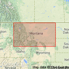
- Montana folded belt
Summary:
Pg. 40 and passim. Devils Glen dolomite. Youngest Cambrian formation in northwestern Montana. In type locality is massive, thick beds of white-gray dolomite that weathers dull gray white, usually stained buff, and occasionally with pinkish spots. Lower beds generally thinner and contain less magnesia than upper ones. Thickest (669 feet) in Dearborn region, thinnest (41 feet) in Pentagon Mountain region. Top is eroded. Overlies Switchback limestone and unconformably underlies White Ridge limestone member of Jefferson limestone (Middle Devonian). Age is Middle or Late Cambrian.
Named from Devils Glen, a local feature in S/2 sec. 1, T. 17 N., R. 8 W., which is formed of the dolomite.
Source: US geologic names lexicon (USGS Bull. 896, p. 604).
- Usage in publication:
-
- Devils Glen dolomite
- Modifications:
-
- Principal reference
- Dominant lithology:
-
- Dolomite
- AAPG geologic province:
-
- Montana folded belt
Summary:
Pg. 30, 46-47, 54 (fig. 6). Devils Glen dolomite. Top of Middle Cambrian in area. Conformably overlies and is transitional into Switchback shale; underlies White Ridge limestone. Thickness at type locality 565 feet.
Type locality: northern spur of Monitor Mountain, south of North Fork of Dearborn River, in SW/4 sec. 6, NW/4 sec. 7, T. 17 N., R. 7 W., Lewis and Clark Range, [Lewis and Clark Co., northwestern MT].
Source: US geologic names lexicon (USGS Bull. 1200, p. 1103-1104).
- Usage in publication:
-
- Devils Glen dolomite*
- Modifications:
-
- Age modified
- Areal extent
- AAPG geologic province:
-
- Sweetgrass arch
Summary:
Pg. 1131 (table 1), 1133-1134. Devils Glen dolomite. In Sawtooth Range, northwestern Montana, consists of white-gray to pale-buff-gray, finely crystalline thick- and some thin-bedded dolomite; mottled salmon pink and coarser grained in upper part. Thickness 200 to 250 feet. Overlies Switchback shale. Unconformable below unnamed Devonian formations. Age is Late Cambrian.
Source: US geologic names lexicon (USGS Bull. 1200, p. 1103-1104).

- Usage in publication:
-
- Devils Glen Dolomite*
- Modifications:
-
- Overview
- AAPG geologic province:
-
- Montana folded belt
- Sweetgrass arch
Summary:
Pg. A6-A7 (table 1), A22 (fig. 14), A25-A26. Devils Glen Dolomite. Chiefly light-gray to light-yellowish-gray, finely to very finely crystalline, thick-bedded dolomite. Thickness 100 to 400 feet. Unconformably underlies Devonian Maywood Formation; overlies Switchback Shale. Correlates with Pilgrim Limestone of south-central Montana. Fossils; thin limestone beds in upper 20 feet carry trilobite CEDARIA cf. C. MILLERI Resser (A.R. Palmer). Age is Late Cambrian.
Source: Publication.
For more information, please contact Nancy Stamm, Geologic Names Committee Secretary.
Asterisk (*) indicates published by U.S. Geological Survey authors.
"No current usage" (†) implies that a name has been abandoned or has fallen into disuse. Former usage and, if known, replacement name given in parentheses ( ).
Slash (/) indicates name conflicts with nomenclatural guidelines (CSN, 1933; ACSN, 1961, 1970; NACSN, 1983, 2005, 2021). May be explained within brackets ([ ]).