- Usage in publication:
-
- De Pass formation
- Modifications:
-
- Named
- Dominant lithology:
-
- Sandstone
- Shale
- Limestone
- AAPG geologic province:
-
- Wind River basin
Summary:
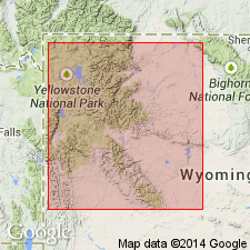
Named for a section at east end of Owl Creek Range in Fremont Co, WY in the Wind River basin. Section measured in Wind River canyon considered the type section. Unconformably overlies pre-Cambrian granite and conformably underlies Du Noir member (new) of Gallatin formation at type. Is 627 ft thick in measured type section where it consists of: basal conglomeratic arkosic sandstone that is overlain in sequence by 1) gray and yellow sandstone, 2) green shale and fossiliferous sandstone, 3) green and purple shale, 4) gray sandstone and green shale, 5) green and purple fossiliferous sandstone, 6) gray shale, and 7) gray thin-bedded fossiliferous limestone. Is 510+/-ft thick in the Dry Creek measured section in which the contacts and lithologic sequence are similar to the type. Name will be used from middle of Owl Creek Range as far east as the east end of Bridger Range, and southeast Wind River Range. Sandstone in lower part forms low ledges; sandstone in middle part forms long slopes; limestone in upper part forms a scarp. Name used in central and eastern Wind River basin east of pinchout of Death Canyon member of Gros Ventre formation where the Flathead sandstone has risen stratigraphically, the sandstone of the Flathead and shale of the Gros Ventre are not separable. Of Middle Cambrian age.
Source: GNU records (USGS DDS-6; Denver GNULEX).

- Usage in publication:
-
- Depass formation
- Modifications:
-
- Revised
- AAPG geologic province:
-
- Bighorn basin
- Wind River basin
Summary:
Pg. 1096-1101, 1102-1104. Depass formation. Redefined to include all beds in type locality between Cambrian-Precambrian contact and base of Upper Cambrian Boysen formation (new). Middle-Upper Cambrian boundary cannot be drawn upon evidence of fossils. Top of Depass is arbitrarily placed at top of two thick beds of intraformational conglomerate, which lie upon a 14-inch shale zone containing new genera of Middle Cambrian trilobites, and 12 feet below lowest horizon containing ARAPAHOIA? sp. and DICELOMUS? sp. On basis of lithology, divided into basal Flathead sandstone member and upper Gros Ventre member. Thickness emended section 580 feet. [Age is Middle Cambrian (Albertan).]
Source: US geologic names lexicon (USGS Bull. 1200, p. 1094).

- Usage in publication:
-
- Depass formation
- Modifications:
-
- Revised
- AAPG geologic province:
-
- Bighorn basin
- Green River basin
- Montana folded belt
- Powder River basin
Summary:
Depass formation. At type, restricted to upper 500 to 550 feet. The basal 92 to 100 feet-thick sandstone interval up to base of lowest, conspicuously glauconitic, SCOLITHUS [SKOLITHOS]-bored sands is lithic equivalent of Flathead sandstone and should be so named. Upper and lower boundaries of Depass are gradational and must be placed arbitrarily. Lower sandstone is not the same as Flathead member of Deiss, 1938 (GSA Bull., v. 49, p. 1067-1168). Depass (restricted) is recognized in southern Wind River Mountains, eastern Owl Creek and Bridger Ranges, and Bighorn and Pryor Mountains. Shaw (Billings Geol. Soc. Gdbk., 5th Ann. Field Conf., 1954) used name Gros Ventre formation for rocks equivalent to the Depass (restricted). However, Depass is not lithic, age, nor environmental equivalent of Gros Ventre. Also, Depass should be used in Wind River Basin rather than Shaw's (Wyoming Geol. Assoc., 10th Field Conf, Chart II, 1955) Buck Spring formation because name Depass has priority. Age is Middle Cambrian.
Source: Modified from GNU records (USGS DDS-6; Denver GNULEX).
For more information, please contact Nancy Stamm, Geologic Names Committee Secretary.
Asterisk (*) indicates published by U.S. Geological Survey authors.
"No current usage" (†) implies that a name has been abandoned or has fallen into disuse. Former usage and, if known, replacement name given in parentheses ( ).
Slash (/) indicates name conflicts with nomenclatural guidelines (CSN, 1933; ACSN, 1961, 1970; NACSN, 1983, 2005, 2021). May be explained within brackets ([ ]).

