The National Geologic Map Database is migrating to a new infrastructure. We apologize for any service disruptions during this process.
|
|---|


- Usage in publication:
-
- Densmore Creek Bed
- Modifications:
-
- First used
- Dominant lithology:
-
- Limestone
- AAPG geologic province:
-
- Appalachian basin
Summary:
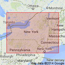
Densmore Creek Bed occurs immediately above the Thorold Sandstone at Niagara Falls, while at New Lockport it lies above the Kodak Sandstone. It marks the basal boundary of sequence II and is described as a thin (1-10 cm) but regionally extensive phosphate pebble horizon--a dark gray, phosphatic sandy limestone. It can be traced from Wayne Co., NY, west to near St. Catharines, Ontario. In contains gastropods and brachiopods (HYATTADINA), which indicate a shallow marine, but sediment-starved setting. In Niagara Co., the Densmore Creek Bed forms the base of the Maplewood Shale. Age is Silurian.
Source: GNU records (USGS DDS-6; Reston GNULEX).
- Usage in publication:
-
- Densmore Creek Bed
- Modifications:
-
- Named
- Dominant lithology:
-
- Phosphate
- Shale
- AAPG geologic province:
-
- Appalachian basin
Summary:
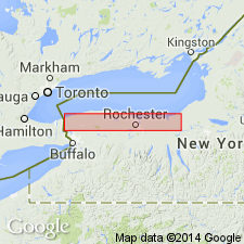
Named the Densmore Creek Bed in western NY for Densmore Creek, in the town of Irondequoit, Monroe Co. As currently defined, the basal formation of the Clinton Group is the Neahga Shale in western NY and adjacent Ontario, and the Maplewood Shale in Monroe Co., NY. Base of both units is drawn by the distinctive marker bed "herein termed" the Densmore Creek Bed. The bed is a sandy phosphatic zone up to 15 cm thick at its type section on Densmore Creek, 0.2 km east of Densmore Road, Irondequoit, NY, where it forms the base of the Neahga and overlies the Kodak Sandstone. Bed is also well exposed at the Genesee River Gorge, where it marks the base of the Maplewood Shale. Large burrows characterize the basal surface of the bed locally and its distinctive phosphatic nodules and pebbles consist of glossy black collophane clasts. Small high-spired gastropods and bellerophontids occur abundantly as phosphatic steinkerns. Westward the bed becomes a phosphatic sandy dolostone or limestone and contains the brachiopod HYATTIDINA. Eastward, where the Maplewood Shale pinches out, the Densmore Creek Bed grades into the base of the Webster Bed (new), a correlative, 20- to 30-cm thick sandy limestone with abundant brachiopods. Age is Early Silurian (middle Llandoverian).
Source: GNU records (USGS DDS-6; Reston GNULEX).
- Usage in publication:
-
- Densmore Creek Phosphate Bed*
- Modifications:
-
- Revised
- Dominant lithology:
-
- Phosphate
- Shale
- AAPG geologic province:
-
- Appalachian basin
Summary:
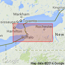
Revised the Densmore Creek to the Densmore Creek Phosphate Bed of the Neahga Shale. Unit is basal bed of Neahga Shale. Consists of phosphate pebbles and cobbles (some more than 4 in. in diameter) in dolomitic shale matrix. Unit contains abundant brachiopods, gastropods, and bryozoa. Thickness is 1 to 6 in. Well exposed in railroad cut north of intersection with Niagara Road west of Lockport, NY; roadcut along Budd Road, 1.3 mi west of Hickory Corners, NY. Unconformably overlies various units of the Clinton Group (highest unit is Kodak Sandstone) and underlies the remainder of the Neahga Shale. Unit can be traced westward into Ontario, CAN, and eastward beyond Rochester, NY. The Densmore Creek is of Early Silurian (Llandoverian) age. [Report uses Early and Late Silurian time scale of Harland and others (1982).]
Source: GNU records (USGS DDS-6; Reston GNULEX).
For more information, please contact Nancy Stamm, Geologic Names Committee Secretary.
Asterisk (*) indicates published by U.S. Geological Survey authors.
"No current usage" (†) implies that a name has been abandoned or has fallen into disuse. Former usage and, if known, replacement name given in parentheses ( ).
Slash (/) indicates name conflicts with nomenclatural guidelines (CSN, 1933; ACSN, 1961, 1970; NACSN, 1983, 2005, 2021). May be explained within brackets ([ ]).