The National Geologic Map Database is migrating to a new infrastructure. We apologize for any service disruptions during this process.
|
|---|


- Usage in publication:
-
- Dennis Bridge limestone
- Modifications:
-
- Original reference
- Dominant lithology:
-
- Limestone
- AAPG geologic province:
-
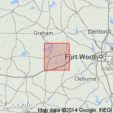
- Fort Worth syncline
Summary:
Pg. 106, 107. Dennis Bridge limestone in Millsap Lake formation. From manuscript [unpub.] of report by G. Scott and J.M. Armstrong on geology of Parker County [north-central Texas]. Age is Pennsylvanian. (See 1933 entry under Millsap Lake formation.) Type locality not stated.
Source: US geologic names lexicon (USGS Bull. 896, p. 597).
- Usage in publication:
-
- Dennis Bridge limestone
- Modifications:
-
- Revised
- AAPG geologic province:
-
- Bend arch
Summary:
Pg. 15, 16. Dennis Bridge limestone included in Lazy Bend member of Millsap Lake formation by G. Scott and J.M. Armstrong [unpub. ms.]. It is 10 feet thick and lies at base of the section conspicuously exposed on the Brazos at south end of the bridge at Dennis, Parker County, north-central Texas. Age is Pennsylvanian.
Source: US geologic names lexicon (USGS Bull. 896, p. 597).

- Usage in publication:
-
- Dennis Bridge limestone member
- Modifications:
-
- Revised
Summary:
Pg. 66 (fig. 1). Dennis Bridge limestone member of Lazy Bend formation. Rank raised. Occurs between Brannon Bridge limestone member (above) and Kickapoo Falls member (below). Age is Pennsylvanian.
Source: US geologic names lexicon (USGS Bull. 1200, p. 1091).
- Usage in publication:
-
- Dennis Bridge limestone
- Modifications:
-
- Revised
- AAPG geologic province:
-
- Fort Worth syncline
Summary:
Pg. 210. Dennis Bridge limestone. Reallocated to Rayville formation of Kickapoo Creek group (both new). Age is Pennsylvanian (Lampassas). [Some reports place Kickapoo Creek group in Strawn Series.]
Source: US geologic names lexicon (USGS Bull. 1200, p. 1091, 2005-2006, 3209).

- Usage in publication:
-
- Dennis Bridge limestone bed
- Modifications:
-
- Principal reference
- Revised
- AAPG geologic province:
-
- Fort Worth syncline
Summary:
Pg. 14, fig. 3. Dennis Bridge limestone bed of Hill Creek member of Lazy Bend formation. Rank reduced. Occurs at base of member. At type locality, overlain by 3 feet of shale; along strike, bed is covered by alluvium and Cretaceous rocks. Age is Pennsylvanian. Type locality established.
Type locality: outcrops at end of bridge over Brazos River at Dennis in southwestern part of Parker County, north-central Texas. Exposure extends westward along the Brazos for 0.25 mi to valley of tributary; basal 3 feet is exposed in small outcrop in stream bank 0.5 mi east of south end of bridge at Dennis; these are the only surface occurrences of the limestone.
Source: US geologic names lexicon (USGS Bull. 1200, p. 1091).
For more information, please contact Nancy Stamm, Geologic Names Committee Secretary.
Asterisk (*) indicates published by U.S. Geological Survey authors.
"No current usage" (†) implies that a name has been abandoned or has fallen into disuse. Former usage and, if known, replacement name given in parentheses ( ).
Slash (/) indicates name conflicts with nomenclatural guidelines (CSN, 1933; ACSN, 1961, 1970; NACSN, 1983, 2005, 2021). May be explained within brackets ([ ]).