The National Geologic Map Database is migrating to a new infrastructure. We apologize for any service disruptions during this process.
|
|---|


- Usage in publication:
-
- Denay limestone*
- Modifications:
-
- Original reference
- Dominant lithology:
-
- Limestone
- AAPG geologic province:
-
- Great Basin province
Summary:
Pg. 376. Denay Limestone of Nevada Group. Name proposed for post-McColley, pre-Devils Gate interval in northern Simpson Park Range, northeastern Nevada. McColley Canyon Formation together with Denay Limestone constitute Nevada Group at westernmost localities where limestone is predominant carbonate rock. Unconformably(?) overlies McColley Canyon Formation. Age is Middle Devonian. Contains Leptathyris circula zone fauna.
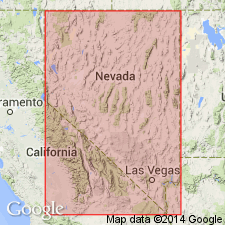
Type locality and origin of name not stated. Denay Creek is in southwestern Eureka Co., north of Roberts Mountain, northeastern NV.
Source: US geologic names lexicon (USGS Bull. 1350, p. 204); supplemental information from GNU records (USGS DDS-6; Menlo GNULEX).
- Usage in publication:
-
- Denay limestone*
- Modifications:
-
- Principal reference
- Biostratigraphic dating
- Dominant lithology:
-
- Limestone
- AAPG geologic province:
-
- Great Basin province
Summary:
Pg. 154+. Denay Limestone. New formation name justified because division of Nevada Formation to east is not applicable. Consists of lower well-bedded limestone member and overlying thick-bedded limestone as well as 1 or 2 higher members. Thickness approx. 1,000 feet at type. Overlies McColley Canyon Formation; underlies Devils Gate Limestone. Correlated with upper part of Nevada Formation in Eureka district. Brachiopod-rich unit indicates Middle Devonian age.
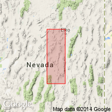
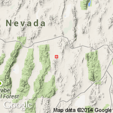
Type section: base of formation at about 6,840 feet elevation on east flank of Willow Creek Canyon, north side of Roberts Mountains [Lat. 39 deg. 57 min. 00 sec. N., Long. 116 deg. 19 min. 00 sec. W., Roberts Creek Mountain 15-min quadrangle], west central Eureka Co., northeastern NV.
[Reference] section: exposed in J-D window of northern Simpson Park Range between Red Hill (in sec. 17, T. 25 N., R. 50 E.) where the Denay is in contact with overlying Devils Gate, and a point about 1 mi to southwest where upper McColley Canyon is present.
Named from Denay Valley which separates the northeastern tip of Simpson Park Range from north flank of Roberts Mountains, northeastern NV.
Source: GNU records (USGS DDS-6; Menlo GNULEX); GNC index card files (USGS-Menlo).

- Usage in publication:
-
- Denay Limestone*
- Modifications:
-
- Areal extent
- AAPG geologic province:
-
- Great Basin province
Summary:
Herein recognized in north Simpson Park Range and at Lone Mtn. Overlies McColley Canyon Formation (Johnson, 1965); underlies beds at Red Hill (at north Simpson Park Range) and unnamed dolomite (at Lone Mtn) both underlying in turn Devils Gate Limestone. Age is Couvinian and Givetian (Middle Devonian).
Source: GNU records (USGS DDS-6; Menlo GNULEX).
- Usage in publication:
-
- Denay Limestone*
- Modifications:
-
- Areal extent
- AAPG geologic province:
-
- Great Basin province
Summary:
Recognized in N Antelope Range where underlies Fenstermaker Wash Formation (new) and overlies McColley Canyon Formation. Is predominantly argillaceous lime mudstone with a little wackestone and less packstone. Mainly gray to light olive gray with brownish-gray tones. Most beds are 2.5 to 15 cm thick. Total thickness approx 250 m. Tentaculites are present on bedding surfaces in lower 120 m. Flat limestone pebbles (15 cm long) form conglomerate 127 to 140 m above base. Is Middle Devonian age based on conodonts.
Source: GNU records (USGS DDS-6; Menlo GNULEX).
For more information, please contact Nancy Stamm, Geologic Names Committee Secretary.
Asterisk (*) indicates published by U.S. Geological Survey authors.
"No current usage" (†) implies that a name has been abandoned or has fallen into disuse. Former usage and, if known, replacement name given in parentheses ( ).
Slash (/) indicates name conflicts with nomenclatural guidelines (CSN, 1933; ACSN, 1961, 1970; NACSN, 1983, 2005, 2021). May be explained within brackets ([ ]).