The National Geologic Map Database is migrating to a new infrastructure. We apologize for any service disruptions during this process.
|
|---|


- Usage in publication:
-
- Demetrie Formation
- Modifications:
-
- Original reference
- Dominant lithology:
-
- Breccia
- Andesite
- Dacite
- Rhyolite
- Tuff
- Conglomerate
- AAPG geologic province:
-
- Basin-and-Range province
Summary:
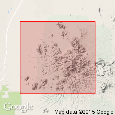
Demetrie Formation. The Cretaceous(?) sequence and the Late Cretaceous leucogranite in area are unconformably overlain by the Cretaceous-Tertiary Demetrie formation, a distinctive grayish-blue dacite to andesitic tuff-breccia and conglomerate with maximum thickness of 2,000 feet. A closely associated mudstone and conglomerate has been given informal member status. Part of the Demetrie formation occurs in a north-northwest-trending belt from 1 to 2 miles wide.
[Named from Demetrie Wash.] Present in Tascuela area, which comprises about 25 sq mi on west side of Sierrita Mountains in Palo Alto and Twin Buttes quadrangles, Pima Co., southern AZ.
Source: US geologic names lexicon (USGS Bull. 1350, p. 202-203).

- Usage in publication:
-
- Demetrie Formation*
- Modifications:
-
- Overview
- AAPG geologic province:
-
- Basin-and-Range province
Summary:
Is basal Upper Cretaceous formation in Sierrita Mountains (Pima Co, AZ), in Basin-and-Range province. Overlies the arkose of Angelica Wash with angular unconformity. Underlies Red Boy Rhyolite (Campanian and Maestrichtian) of Thoms (1967) with apparent angular unconformity. Is a several-thousand-ft-thick sequence of andesitic to dacitic breccias and flows locally containing conglomerate and rhyolite tuff. Is correlated with Silver Bell Formation in Silver Bell Mountain area. Age is shown to be Campanian (Late Cretaceous) on correlation chart (fig. 5).
Source: GNU records (USGS DDS-6; Denver GNULEX).
- Usage in publication:
-
- Demetrie Volcanics*
- Modifications:
-
- Principal reference
- Adopted
- Dominant lithology:
-
- Breccia
- Andesite
- Dacite
- Rhyolite
- Tuff
- Conglomerate
- AAPG geologic province:
-
- Basin-and-Range province
Summary:
Pg. D30-D35. Demetrie Formation of Thoms (1967) adopted by the USGS as Demetrie Volcanics. Thick sequence (as much as 8,000 feet) of andesitic and dacitic breccias and flows that locally contain conglomerate at base and two rhyolitic tuff members. Rhyolitic tuff members are conspicuous stratigraphic markers. Generally white to yellowish gray on weathered surfaces in contrast with darker colors of rest of formation. Lower member consists of ash-flow tuffs and subordinate ash-fall tuffs; average thickness 750 feet. Best exposed along a dry wash 0.75 mile southeast of Esperanza mine. Upper member is fine-grained white argillized tuff. Lies with angular unconformity on rocks as young as Angelica Arkose (Early Cretaceous) and as old as Ox Frame Volcanics (Triassic); underlies Red Boy Rhyolite (Late Cretaceous). Previously called Silver Bell Formation in some reports. Age is Late Cretaceous based on stratigraphic relations.
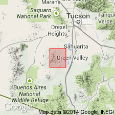
Type locality: west of Demetrie Wash in a belt extending from NW/4 sec. 15 to SW corner sec. 21, T. 18 S., R. 12 E., Twin Buttes 15-min quadrangle, Pima Co., southern AZ. Named from Demetrie Wash (crediting Thoms, 1967). Widely distributed in Sierrita Mountains.
Source: Publication; Changes in stratigraphic nomenclature, 1971 (USGS Bull. 1274-A, p. A6-A7).
For more information, please contact Nancy Stamm, Geologic Names Committee Secretary.
Asterisk (*) indicates published by U.S. Geological Survey authors.
"No current usage" (†) implies that a name has been abandoned or has fallen into disuse. Former usage and, if known, replacement name given in parentheses ( ).
Slash (/) indicates name conflicts with nomenclatural guidelines (CSN, 1933; ACSN, 1961, 1970; NACSN, 1983, 2005, 2021). May be explained within brackets ([ ]).