

- Usage in publication:
-
- Delmar sand
- Modifications:
-
- Original reference
- Dominant lithology:
-
- Sandstone
- Shale
- AAPG geologic province:
-
- Capistrano basin
Summary:
Pg. 187-246. Delmar sand. Sandstones, shales, and some beds, composed almost wholly of oysters, that might be considered limestone but usually the matrix surrounding the shells is argillaceous rather than calcareous. The sandstones are both coarse grained and fine grained, and grade into arenaceous shales. They are of prevailingly brown color, but often have a tinge of green, while a few beds have a reddish and purplish cast. Many shales are well stratified, but others grade into shaly sands. Bedding is irregular. Cross bedding is prominent in many places. Upper part contains more sand than lower part, and the sands are darker color than overlying Torrey sand, into which the Delmar sand grades. Thickness more than 200 feet. Is basal division of La Jolla formation in La Jolla quadrangle. Rests unconformably on Chico Cretaceous.
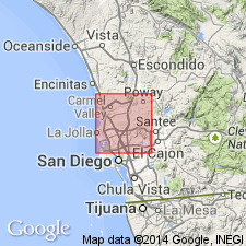
Named from excellent exposures in sea cliff at town of Delmar, San Diego Co., southern CA.
Source: US geologic names lexicon (USGS Bull. 896, p. 594-595).
- Usage in publication:
-
- Delmar sand member
- Modifications:
-
- Revised
- AAPG geologic province:
-
- Capistrano basin
Summary:
Pg. 65. Delmar sand member of La Jolla formation. Lowest member of La Jolla. Underlies Torrey sand member. Maximum thickness about 100 feet, base not exposed. [Age is Eocene.]
Source: US geologic names lexicon (USGS Bull. 1200, p. 1082).
- Usage in publication:
-
- Delmar sand member
- Modifications:
-
- Age modified
- AAPG geologic province:
-
- Capistrano basin
Summary:
Pg. 21 (fig. 4). Listed on chart as member of La Jolla formation. Age is middle Eocene.
Source: US geologic names lexicon (USGS Bull. 1200, p. 1082).
- Usage in publication:
-
- Delmar sand
- Modifications:
-
- Areal extent
- AAPG geologic province:
-
- Capistrano basin
Summary:
Pg. 254 (table). Table lists Delmar sand (formation); underlies Torrey sand.
Source: US geologic names lexicon (USGS Bull. 1200, p. 1082).
- Usage in publication:
-
- Delmar Formation*
- Modifications:
-
- Principal reference
- Revised
- Adopted
- AAPG geologic province:
-
- Capistrano basin
Summary:
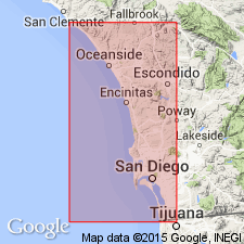
Delmar Sand Member of La Jolla Formation of Hanna (1926) is adopted and raised in rank to Delmar Formation, one of lowermost formations in La Jolla Group. Type section is designated as short canyon 2 km south of Del Mar railroad station Del Mar 7.5' quad, San Diego Co, CA. Composed of dusky-yellowish-green sandy claystone interbedded with medium-gray coarse-grained sandstone. Layers of OSTREA IDRIAENSIS Gabb indicate probable lagoonal origin. Underlies and interfingers with Torrey Sandstone of La Jolla Group. Assigned middle Eocene age on basis of fossils in Ardath Shale with which it is chronologically correlative.
Source: GNU records (USGS DDS-6; Menlo GNULEX).

- Usage in publication:
-
- Delmar Formation*
- Modifications:
-
- Biostratigraphic dating
- AAPG geologic province:
-
- Capistrano basin
Summary:
Pollen evidence from Ardath Shale and Mission Valley Formation and lack of these certain species in Delmar Formation indicate Delmar Formation is probably older than Ardath Shale. Delmar is underlain by Mount Soledad Formation which contains several foraminifers not known to range below middle Eocene in age. Thus Delmar appears to be of early or middle calcareous nannofossil subzone CP126 (middle Eocene age).
Source: GNU records (USGS DDS-6; Menlo GNULEX).
For more information, please contact Nancy Stamm, Geologic Names Committee Secretary.
Asterisk (*) indicates published by U.S. Geological Survey authors.
"No current usage" (†) implies that a name has been abandoned or has fallen into disuse. Former usage and, if known, replacement name given in parentheses ( ).
Slash (/) indicates name conflicts with nomenclatural guidelines (CSN, 1933; ACSN, 1961, 1970; NACSN, 1983, 2005, 2021). May be explained within brackets ([ ]).