

- Usage in publication:
-
- Del Rio clay*
- Modifications:
-
- Original reference
- Dominant lithology:
-
- Clay
- AAPG geologic province:
-
- Ouachita folded belt
- Permian basin
Summary:
Pg. 2; USGS 18th Ann. Rpt., pt. 2, p. 236-237. Del Rio clay of Washita group. Greenish laminated clay, weathering yellow, with beds of limestone. Included in Washita division. Overlies Fort Worth limestone [broad sense and = Georgetown limestone] and underlies Shoal Creek [Buda] limestone. Fossiliferous. Formerly called EXOGYRA ARIETINA Marl by Shumard (1860). Age is Early Cretaceous (Comanche).
[Named from Del Rio, Val Verde Co., southern TX.]
Source: US geologic names lexicon (USGS Bull. 896, p. 595).

- Usage in publication:
-
- Del Rio clay
- Modifications:
-
- Areal extent
- AAPG geologic province:
-
- Ouachita folded belt
Summary:
Pg. 387. Del Rio Clay. Considered synonym of Grayson formation. [Age is Late Cretaceous (Cenomanian).]
Type locality: a conical butte, Loma de la Cruz, and surrounding clay lowlands, 2 mi south of Del Rio, [Val Verde Co., southern TX], citing Hill and Vaughan, 1898, p. 236.
Source: Publication; US geologic names lexicon (USGS Bull. 1200, p. 1084).
- Usage in publication:
-
- Del Rio clay
- Modifications:
-
- Not used
- AAPG geologic province:
-
- Gulf Coast basin
- Ouachita folded belt
Summary:
Grayson shale used in lithostratigraphic correlations of the Gulf Coastal Plain in TX, LA, AR, and northern MX. "Grayson shale (Del Rio)" used in south TX on fig. 4 in Bexar Co, Ouachita tectonic belt province and Frio Co, Gulf Coast basin. [This use of "Grayson shale" instead of "Del Rio clay" was misinterpreted as abandonment of the Del Rio by some subsequent workers.]
Source: GNU records (USGS DDS-6; Denver GNULEX).
- Usage in publication:
-
- Del Rio clay*
- Modifications:
-
- Biostratigraphic dating
- AAPG geologic province:
-
- Fort Worth syncline
Summary:
Del Rio clay. Discussion of fossils from limestone of Buda age in Denton County, southern Texas. If it is admitted that this limestone is a facies of Buda age in upper part of Grayson marl, then the Grayson is not exact equivalent of Del Rio but includes equivalents of both Del Rio and Buda. [Age is Late Cretaceous (Cenomanian).]
Source: US geologic names lexicon (USGS Bull. 1200, p. 1084).
- Usage in publication:
-
- Del Rio shale
- Modifications:
-
- Biostratigraphic dating
- AAPG geologic province:
-
- Ouachita folded belt
Summary:
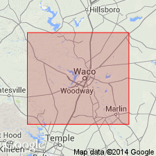
Is formation at Austin, Travis Co, TX in the Ouachita tectonic belt province. Overlies Georgetown limestone of Albian (Early Cretaceous) age. Underlies Buda limestone of Cenomanian (Late Cretaceous) age with transitional contact. Main components are bedded calcareous clays and claystone with local sandstone lenses and thin limestones; clays and claystones contain gypsum, pyrite, ferruginous nodules, and bentonitic layers. Is estimated to be 80 ft thick. Tentative correlation of three measured sections is based on megafossils. Microfauna (foraminifers) is noted to be prolific and part is described in detail; it is interpreted to represent a neritic environment of relatively warm, shallow water. Is assigned a Cenomanian age. Albian-Cenomanian boundary is queried at base of formation (fig. 1). Diversity of the polymorphinid faunas supports the hypothesis of Stanton (1947, p. 2) that the base of Del Rio is synchronous with that of Grayson formation; however, doubtful that the two are exact time equivalents.
Source: GNU records (USGS DDS-6; Denver GNULEX).
- Usage in publication:
-
- Grayson marl*
- Modifications:
-
- Areal extent
- AAPG geologic province:
-
- Ouachita folded belt
Summary:
Pg. 58. Grayson marl (formerly Del Rio clay) unconformably underlies Pepper shale member of Woodbine formation (Gulf). [Age is Late Cretaceous (Comanche).]
Section on Bird Creek, Bell Co., eastern TX.
Source: US geologic names lexicon (USGS Bull. 1200, p. 1587-1588); supplemental information from GNU records (USGS DDS-6; Denver GNULEX).
- Usage in publication:
-
- Del Rio shale
- Modifications:
-
- Areal extent
- AAPG geologic province:
-
- East Texas basin
Summary:
Considered equivalent to Grayson marl. Underlies Buda limestone of Washita group. Overlies Georgetown limestone of Washita group. Is middle formation of Washita group in Comanche series. Is extended in subsurface into southeastern Kaufman Co, TX in the East Texas basin. Thickness in the Ham Gossett field is 80 ft. Depth to top is 4,234 ft. Assigned to Comanche series.
Source: GNU records (USGS DDS-6; Denver GNULEX).
- Usage in publication:
-
- Del Rio clay
- Modifications:
-
- Areal extent
- AAPG geologic province:
-
- Ouachita folded belt
Summary:
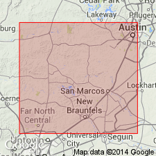
Pg. 74 (fig. 5), 89-90. Del Rio clay. Described in Purgatory Creek area, Texas, where it is as much as 30 feet thick, overlies Georgetown limestone and underlies Buda limestone. Age is Late Cretaceous [Cenomanian].
Source: US geologic names lexicon (USGS Bull. 1200, p. 1084).
- Usage in publication:
-
- Del Rio Clay
- Modifications:
-
- Not used
- AAPG geologic province:
-
- Permian basin
Summary:
Is not used in this report. Grayson Formation (Del Rio Clay of former usage) is mapped in eastern Brewster and southwest Terrell Cos, TX in Permian basin. [No explanation given for choice of nomenclature; probably a result of Imlay's (1944) general use of the Grayson nomenclature, which was misinterpreted as abandonment of the Del Rio by some subsequent workers. Del Rio nomenclature is currently appropriate for south-central to west TX area.]
Source: GNU records (USGS DDS-6; Denver GNULEX).
- Usage in publication:
-
- Del Rio Formation
- Modifications:
-
- Redescribed
- Dominant lithology:
-
- Shale
- Limestone
- AAPG geologic province:
-
- Orogrande basin
Summary:
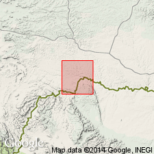
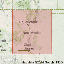
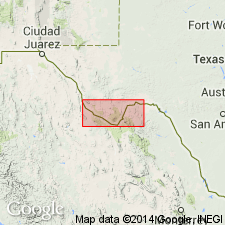
Mapped in Cerro de Cristo Rey, Dona Ana Co, NM, Orogrande basin and Chihuahua, MX. Consists of dark-gray shale with some limestone beds and nodules near top and bottom. Forms colluvium-covered slopes. Most extensive outcrops are on north, east, and south sides of Cerro de Cristo Rey intrusion. Thickness is 24-27 m. Conformably overlies Anapra Formation; conformably underlies Buda Formation. EXOGYRA abundant in lower part of unit. Cross sections. Early Cretaceous (Cenomanian, Comanchean) age. [Author places lower part of Cenomanian in Lower Cretaceous.]
Source: GNU records (USGS DDS-6; Denver GNULEX).

- Usage in publication:
-
- Del Rio Clay
- Modifications:
-
- Mapped 1:250k
- Dominant lithology:
-
- Clay
- Siltstone
- AAPG geologic province:
-
- Ouachita folded belt
- Permian basin
Summary:
Del Rio Clay. Calcareous and gypsiferous becoming less calcareous and more gypsiferous upward, pyrite common, blocky, medium-gray, weathers light-gray to yellowish-gray; some thin lenticular beds of highly calcareous siltstone; marine megafossils include abundant EXOGYRA ARIETINA and other pelecypods. Thickness up to 200 feet, feathers out northwestward. Underlies Buda Limestone. Age is Late Cretaceous.
Mapped in Kinney, Terrell, Uvalde, and Val Verde Cos., TX.
Source: Publication; supplemental information from GNU records (USGS DDS-6; Denver GNULEX).
- Usage in publication:
-
- Del Rio Clay
- Modifications:
-
- Mapped 1:250k
- Dominant lithology:
-
- Clay
- AAPG geologic province:
-
- Permian basin
Summary:
Del Rio Clay. Mapped (undifferentiated) with Buda Limestone in Terrell, Brewster, and Presidio Counties, Texas. Consists of mostly clay, some interbedded, flaggy, siliceous limestone, friable sandstone, and thin beds of ferruginous clay; clay, soft, bluish- to greenish-gray, weathers yellow to light-brown; thickness up to 180 feet in Terlingua district, 185 feet in western part of Black Gap area, feathers out eastward toward Rio Grande, 70 feet thick in Hood Spring, Santiago Peak, and Tascotal Mesa quadrangles. Overlies Santa Elena Limestone; underlies Buda Limestone. Age is Early Cretaceous.
Source: Publication; supplemental information from GNU records (USGS DDS-6; Denver GNULEX).

- Usage in publication:
-
- Del Rio Clay
- Modifications:
-
- Mapped 1:250k
- Dominant lithology:
-
- Clay
- Siltstone
- AAPG geologic province:
-
- Kerr basin
- Ouachita folded belt
Summary:
Del Rio Clay. Mapped in Real, Uvalde, Medina, Bexar, Comal, and Hays Counties, Texas; mapped areas are small and generally fault-bounded. Consists of clay and some thin lenticular beds of highly calcareous siltstone; clay, calcareous and gypsiferous becoming less calcareous and more gypsiferous upward, pyrite common, blocky, medium-gray, weathers light-gray to yellowish-gray; marine megafossils include abundant EXOGYRA ARIETINA and other pelecypods. Thickness 60 to 120 feet; thickens westward. Underlies Buda Limestone. Overlies: Salmon Peak Limestone west of Dry Frio River; Devils River Limestone between Dry Frio and Medina Rivers; Edwards Limestone east of Medina River; Segovia Member of Edwards Limestone, just west of Real-Kerr County line. Locally (e.g. eastern Medina and western Bexar Counties), Del Rio, Buda, and Eagle Ford are faulted-out entirely. Age is Late Cretaceous.
[Misprint (1974 ed.): Del Rio Clay and Buda Limestone assigned to Lower Cretaceous in pamphlet that accompanies map; assigned to Upper Cretaceous on map sheet explanation. Both Del Rio and Buda are Upper Cretaceous (corrected in 1983 revised ed.).]
Source: Publication; supplemental information from GNU records (USGS DDS-6; Denver GNULEX).
For more information, please contact Nancy Stamm, Geologic Names Committee Secretary.
Asterisk (*) indicates published by U.S. Geological Survey authors.
"No current usage" (†) implies that a name has been abandoned or has fallen into disuse. Former usage and, if known, replacement name given in parentheses ( ).
Slash (/) indicates name conflicts with nomenclatural guidelines (CSN, 1933; ACSN, 1961, 1970; NACSN, 1983, 2005, 2021). May be explained within brackets ([ ]).