- Usage in publication:
-
- Deer Plain formation*
- Modifications:
-
- Original reference
- Dominant lithology:
-
- Gravel
- Sand
- Clay
- AAPG geologic province:
-
- Illinois basin
Summary:
Pg. 12 (chart), 90-96, pl. 1. Deer Plain formation. A variable series of gravel, sand, and clay; along Mississippi River and near mouth of Illinois River, consists largely of gravel; up valley of Illinois River, becomes finer grained and passes within only a few miles through sand into silt and clay; at all exposures, material becomes progressively finer grained upward. True maximum thickness unknown; near Deer Plain at least 50 feet; in many smaller remnants 5 to 20 feet. Stratigraphic and physiographic evidence shows that Deer Plain formation is younger than Brussels formation and loess; physiographic relations demonstrate that Deer Plain terrace is younger than Metz Creek terrace and the scattered pebbles of igneous and metamorphic rocks that lie upon it; also evidence shows that Deer Plain formation is too old to be included within the latest or Recent stage of earth history. Age is Pleistocene (Wisconsin).
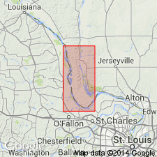
Named from exposures near village of Deer Plain, in sec. 16, T. 13 S., R. 1 W., Calhoun Co., IL. Deposits occur as a wide terrace in lowlands west of Illinois River and as small terrace remnants along Illinois and Mississippi Rivers; some terrace and deposits are well developed lowlands west of Mississippi River from Winfield to Old Monroe in Lincoln Co., MO.
Source: US geologic names lexicon (USGS Bull. 1200, p. 1072).
For more information, please contact Nancy Stamm, Geologic Names Committee Secretary.
Asterisk (*) indicates published by U.S. Geological Survey authors.
"No current usage" (†) implies that a name has been abandoned or has fallen into disuse. Former usage and, if known, replacement name given in parentheses ( ).
Slash (/) indicates name conflicts with nomenclatural guidelines (CSN, 1933; ACSN, 1961, 1970; NACSN, 1983, 2005, 2021). May be explained within brackets ([ ]).

