

- Usage in publication:
-
- Deep Creek formation*
- Modifications:
-
- Original reference
- Dominant lithology:
-
- Siltstone
- Limestone
- AAPG geologic province:
-
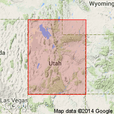
- Snake River basin
Summary:
Pg. C181-C183. Deep Creek Formation. In type section, and elsewhere in region, formation divisible into two mappable members. Lower, 750 feet thick, mainly light-gray to brown or black siltstone interbedded with subordinate amounts of silty limestone and shale. Upper, 1,500 feet thick, gray to blue-gray, mostly thin- to medium-bedded limestone that contains dark chert, and locally is silty, platy, and weathers purplish. Lower contact is base of first shale or siltstone above Lodgepole limestone; upper contact, normally gradational, placed at change from thin-bedded cherty limestone to the more massive ledges of Great Blue limestone. Fossils rare; present age assignment based mostly on stratigraphic position. Age is Mississippian. May contain beds of both late Osage and early Meramec age.
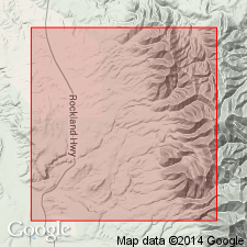
Type section: measured in SW/4 NE/4 sec. 35, T. 9 S., R. 31 E., Deep Creek Mountains, 25 mi southwest of Pocatello, Power Co., eastern ID.
Source: US geologic names lexicon (USGS Bull. 1350, p. 197); supplemental information from GNU records (USGS DDS-6; Denver GNULEX).
- Usage in publication:
-
- Deep Creek Formation*
- Modifications:
-
- Revised
- Overview
- AAPG geologic province:
-
- Snake River basin
Summary:
Divided into (ascending order): Delle Phosphatic Member (new) of Osagean and Meramecian age, Needle Siltstone equivalent, and thin-bedded limestone member of Meramecian age in Hunter Canyon, Deep Creek Mountains, ID in the Snake River basin. Hunter Canyon lays on the foreland basin. Delle was called phosphatic member in earlier reports. Deep Creek overlies Lodgepole Limestone and underlies Great Blue Limestone. Basal contact of Delle is a hardground developed on top of Lodgepole. Delle also assigned as basal member of Aspen Range, Little Flat, and Woodman Formations, and of Chainman Shale, Deseret Limestone, and Brazer Dolomite at other localities. Correlation of Deep Creek with other lithostratigraphic units in the Great Basin province and on the Wasatch uplift, UT, and in the Snake River basin, ID, shown on correlation chart. Areal limit map for Delle and for formations.
Source: GNU records (USGS DDS-6; Denver GNULEX).
For more information, please contact Nancy Stamm, Geologic Names Committee Secretary.
Asterisk (*) indicates published by U.S. Geological Survey authors.
"No current usage" (†) implies that a name has been abandoned or has fallen into disuse. Former usage and, if known, replacement name given in parentheses ( ).
Slash (/) indicates name conflicts with nomenclatural guidelines (CSN, 1933; ACSN, 1961, 1970; NACSN, 1983, 2005, 2021). May be explained within brackets ([ ]).