

- Usage in publication:
-
- Deadwood formation*
- Modifications:
-
- Original reference
- Dominant lithology:
-
- Sandstone
- Conglomerate
- Quartzite
- AAPG geologic province:
-
- Chadron arch
- Powder River basin
- Williston basin
Summary:
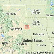
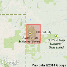
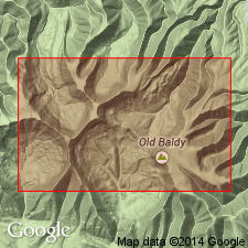
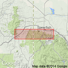
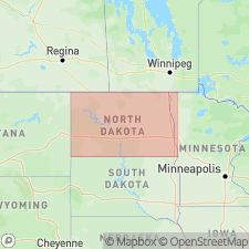
Pg. 505. Deadwood formation. Red brown quartzite and sandstone, locally conglomeratic, and partly massive. Thickness 4 to 150 feet in Black Hills. Upper part is thinner bedded softer sandstones, in some cases interbedded with more or less shale. Basal member is usually hard massive reddish brown quartzite; portions of basal beds are conglomeratic, ranging from a sprinkling of quartz pebbles in the sandstone to a very coarse heavy congloemrate of large rounded masses of crystalline rocks and vein quartz in a red-brown matrix. Rests unconformably on pre-Cambrian granites and schists and underlies Englewood limestone [Mississippian]. In northern Black Hills is separated from Englewood limestone by a mass of buff limestone of Silurian age [Whitewood limestone, of pre-Richmond Late Ordovician age]. [Age is Late Cambrian. Recognized in western South Dakota (Black Hills), eastern Wyoming, and southeastern Montana.]
[Type locality on west side of Whitewood Creek just below Deadwood, Lawrence Co., western SD. See also Jaggar, 1901, USGS 21st Ann. Rpt., Pt. 3, p. 176; Darton, 1904, GSA Bull., v. 15, p. 382, pl. 24 (typical exposure); Darton, 1909, USGS Prof. Paper 65, p. 14 (measured section), pl. 5; Darton and Paige, USGS Geol. Atlas of the US, Central Black Hills folio, no. 219, p. 6; Furnish and others, 1936, GSA Bull., v. 20, no. 10, p. 1329-1341.]
Source: US geologic names lexicon (USGS Bull. 896, p. 577-578).
- Usage in publication:
-
- Deadwood formation*
- Modifications:
-
- Revised
- Age modified
- AAPG geologic province:
-
- Williston basin
Summary:
Pg. 5-7. Deadwood formation. Locally stratigraphically extended to include slabby light-colored sandstone showing fucoid markings and worm burrows (originally assigned to overlying Upper Ordovician Whitewood limestone). Fossils (identified by C.D. Walcott) indicate age is Late Cambrian (St. Croixan).
Source: Publication.
- Usage in publication:
-
- Deadwood formation
- Modifications:
-
- Areal extent
- AAPG geologic province:
-
- Chadron arch
Summary:
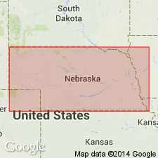
Pg. 275-277. Deadwood formation. Recognized on Chadron dome in subsurface of northwestern Nebraska, depth-interval 2,595 to 2,870 feet. Chiefly sandstone, 275 feet thick, above pre-Cambrian crystalline rocks and below Englewood(?) formation; Dr. Lugn believes the (descending) sandstone and limestone, 20 feet, and shale, 25 feet, assigned to Englewood(?) may belong to Deadwood. Age is Cambrian.
Described from Nebraska Oil Corp. Duthie well [near SD state line], about 18 mi northeast of Chadron, in sec. 33, T. 35 N., R. 47 W., [Chadron NE 7.5-min quadrangle], Dawes Co., northwestern NE.
Source: Publication.
- Usage in publication:
-
- Deadwood formation
- Modifications:
-
- Revised
- AAPG geologic province:
-
- Williston basin
Summary:
Pg. 1329-1341. Reported finding of poorly preserved Ordovician (Middle?) fossils [listed and figured] in upper 70 feet of Deadwood formation of type section, and they recommended transfer of these beds from Deadwood formation to overlying Whitewood limestone (which is classified by the USGS as Upper Ordovician). These 70 feet of beds are described as consisting of (descending): (1) transitional, 10 feet; (2) siltstone member, 20 feet, numerous fossils; and (3) shale member, 40 feet, few fossils. They rest on a sandstone, called "SCOLITHUS [SKOLITHOS] sandstone," 15 feet thick, which has not yielded fossils. Authors conclude with following statements: data presented seem to indicate that all beds in northern Black Hills above [SKOLITHOS] sandstone and below typical Whitewood dolomite may be correlated with Middle Ordovician. No diagnostic fossils were found in [SKOLITHOS] sandstone or subjacent beds, and their age was not determined. Typical Whitewood dolomite presumably is Upper Ordovician. It seems advisable for the present at least to include all Ordovician beds above [SKOLITHOS] sandstone in Whitewood formation.
[Type locality on west side of Whitewood Creek just below Deadwood, Lawrence Co., western SD. See also Jaggar, 1901, USGS 21st Ann. Rpt., Pt. 3, p. 176; Darton, 1901, USGS 21st Ann. Rpt., Pt. 4, p. 505; Darton, 1904, GSA Bull., v. 15, p. 382, pl. 24 (typical exposure); Darton, 1909, USGS Prof. Paper 65, p. 14 (measured section), pl. 5; Darton and Paige, USGS Geol. Atlas of the US, Central Black Hills folio, no. 219, p. 6.]
Source: US geologic names lexicons (USGS Bull. 896, p. 577-578).
- Usage in publication:
-
- Deadwood formation*
- Modifications:
-
- Age modified
- Biostratigraphic dating
- AAPG geologic province:
-
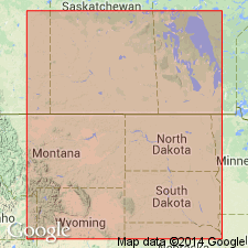
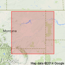
- Powder River basin
- Williston basin
Summary:
In the northern Black Hills and vicinity, Williston and Powder River basins, the upper part of the Deadwood formation is assigned an Early Ordovician age. Age assignment based on an Early Ordovician trilobite fauna collected from top of formation in Spearfish Canyon in the Black Hills, Lawrence County, South Dakota, in the Williston basin, and from Union Oil Co.-Ohio Oil Co. Government No. 1 drill core, at depth of 4,238 feet, in sec. 3, T. 57 N., R. 62 W., Crook County, Wyoming, in the Powder River basin.
Source: GNU records (USGS DDS-6; Denver GNULEX).
- Usage in publication:
-
- Deadwood formation
- Modifications:
-
- Revised
- AAPG geologic province:
-
- Williston basin
Summary:
Pg. 45 (chart), 46, 47. Deadwood formation. [Excludes SCOLITHUS sandstone of Furnish and others, 1936.] Consists of reddish-brown sandstones interbedded with shales and carbonates 350+ feet thick. Conformably underlies Ordovician Aladdin sandstone (new, = SKOLITHOS (SCOLITHUS) sandstone of previous geologists). Age is considered Late Cambrian.
Source: Publication; US geologic names lexicon (USGS Bull. 1200, p. 1057).
- Usage in publication:
-
- Deadwood formation
- Modifications:
-
- Revised
- AAPG geologic province:
-
- Williston basin
Summary:
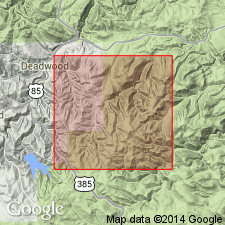
Deadwood formation. At type locality in Whitewood Canyon, just outside of town of Deadwood, in secs. 13 and 14, T. 5 N., R. 3 E., [Deadwood North 7.5-min quadrangle], Lawrence County, western South Dakota, consists of (descending): unit C, red brown, very glauconitic, thin-bedded, quartz sandstone with green shale partings and SCOLITHUS [SKOLITHOS] borings, 130 feet; unit B, gray green, thin-bedded shale alternating with gray buff, coarse to fine limestone with a green thicker shale about 30 feet from base, 260 feet; and unit A, gray buff conglomerate with igneous and metamorphic pebbles overlain by a pale buff, course quartz sandstone, 30 feet. Total thickness 420 feet; thins to south. Darton's uppermost 20 feet of thin-bedded, glauconitic sandstone limestone, shale, imbricated conglomerate and calcareous sandstone is transferred to overlying Whitewood limestone. To the north underlies Winnipeg formation (partly = Whitewood). Overlies Algonkian schist. Age is Late Cambrian.
Source: Publication.
- Usage in publication:
-
- Deadwood formation*
- Modifications:
-
- Biostratigraphic dating
- AAPG geologic province:
-
- Powder River basin
- Williston basin
Summary:
Pg. 444, 445, 446 (fig. 68), 449-450, 464, 469, 470. Deadwood formation. Predominantly glauconitic, pyritiferous limestones containing much intraformational conglomerate with minor partings and thin layers of black silty shale. Fossils. Uppermost 350 feet of the Deadwood yielded trilobites of very Early Ordovician (BELLEFONTIA zone) to about middle Early Ordovician age. Lies beneath Winnipeg formation (Middle Ordovician). So-called SCOLITHUS [SKOLITHOS] sandstone = top of formation.
See also Lochman and Duncan, 1950, p. 351.
Source: Publication.
- Usage in publication:
-
- Deadwood formation
- Modifications:
-
- Areal extent
- AAPG geologic province:
-
- Williston basin
McCoy, M.R., 1958, Cambrian of the Powder River basin [Wyoming]: Wyoming Geological Association Field Conference Guidebook, no. 13, p. 21-24.
Summary:
Pg. 21, 22 (fig. 1). Deadwood formation. In eastern portion of Powder River basin, [notably Crook County, Wyoming], term Deadwood is used to include a series of sandstone, shale, and limestone-dolomites which are Upper Cambrian and Lower Ordovician. At type section in Black Hills, Deadwood is 350 to 400 feet thick. Sandstone or conglomerate, often auriferous, marks base of formation; this unit, which rests on beveled schists or quartzites, is erratic in thickness, varying from 2 to 95 feet. Above basal sandstone is series of interbedded blue-gray shales, with 2 or 3 horizons, 10 to 70 feet thick. In upper part, a massive sandstone unit is commonly present, often dolomitic, and sometimes ferruginous. Deadwood thins southward to zero edge.
Source: Publication; US geologic names lexicon (USGS Bull. 1200, p. 1057).
- Usage in publication:
-
- Deadwood formation
- Modifications:
-
- Revised
- AAPG geologic province:
-
- Williston basin
Summary:
Pg. 9 (fig. 2), 23-43; C.G. Carlson, 1958 (1959), Stratigraphy of Deadwood-Winnipeg interval in North Dakota and northwestern South Dakota, 2nd Intl. Williston Basin Symp., p. 20-26. Deadwood formation. Limestone, sandstone, and shale. In Black Hills area, South Dakota, = Deadwood formation of Furnish and others (1936); includes SKOLITHOS (SCOLITHUS)-bearing sandstone (=Aladdin sandstone of McCoy, 1952, unit B of Whitewood formation of Butler and others, 1955) and underlying limestone, limestone conglomerate, shale and sandstone (=unit A of Whitewood formation of Butler and others, 1955). Thickness up to about 1,000 feet in western North Dakota and eastern Montana, southwest of Nesson anticline. Unconformably underlies Black Island Member of Winnipeg formation, or where Black Island is absent, unconformably underlies Icebox Member of Winnipeg (=Icebox formation of McCoy, 1952, unit C of Whitewood formation of Butler and others, 1955). Overlies Precambrian rocks. Fossils. Age is Late Cambrian to Early Ordovician.
[Discussion is chiefly subsurface of North Dakota, northwestern South Dakota, and eastern Montana.]
Source: Publication.
- Usage in publication:
-
- Deadwood formation
- Modifications:
-
- Overview
- AAPG geologic province:
-
- Williston basin
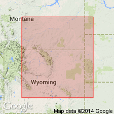
- Powder River basin
Summary:
Places SCOLITHUS [SKOLITHOS] sandstone [informal] (Aladdin sandstone of McCoy, 1952) at top of formation in outcrops in the northern Black Hills, SD and WY, in Williston and Powder River basins. Overlain unconformably by Icebox shale of Winnipeg group in outcrops in the Black Hills; overlain unconformably by Burgen sandstone of Winnipeg group in subsurface of Williston basin. Early Ordovician and Cambrian in age.
Source: GNU records (USGS DDS-6; Denver GNULEX).
- Usage in publication:
-
- Deadwood Formation
- Modifications:
-
- Age modified
- Biostratigraphic dating
- AAPG geologic province:
-
- Williston basin
Summary:
Discusses trilobite and brachiopod faunas of Late Cambrian and Early Ordovician age collected from the Deadwood Formation in 7 wells in the Williston basin, Montana and North Dakota. Correlation diagram shows stratigraphic relations within the Deadwood Formation from outcrops in the northern Black Hills, South Dakota, generally northward along the Cedar Creek anticline to Richey, Montana, and from there westward to the Little Rocky Mountains, Blaine County, Montana, where partly equivalent strata are in the Zortman Member of the Emerson Formation. Also correlates outcrops of Cambrian and Early Ordovician rocks in the Big Snowy Mountains, Fergus County, Montana, on the Central Montana uplift. Correlates Deadwood Formation with formations in the Canadian Rockies, Montana, Wyoming, Nevada, Colorado, New Mexico, Texas, and Missouri, on basis of the faunas. Reconstructs paleogeographic conditions in the Williston basin and adjacent regions in series of nine maps. Age of Deadwood Formation is Late Cambrian and Early Ordovician.
Source: Modified from GNU records (USGS DDS-6; Denver GNULEX).
- Usage in publication:
-
- Deadwood Formation*
- Modifications:
-
- Not used
Summary:
Not used in area of Hartville uplift, WY, Denver basin. Deadwood was assigned to lower 5 ft of what had been part of Guernsey Formation by Condra, Reed, Scherer (1940); rocks reassigned to Fremont Canyon Sandstone (abandoned) by Sando, Sandberg (1987). These basal clastic rocks are not correlative to the Deadwood and are assigned to Mississippian clastic unit of stratigraphic sequence 5.
Source: GNU records (USGS DDS-6; Denver GNULEX).
For more information, please contact Nancy Stamm, Geologic Names Committee Secretary.
Asterisk (*) indicates published by U.S. Geological Survey authors.
"No current usage" (†) implies that a name has been abandoned or has fallen into disuse. Former usage and, if known, replacement name given in parentheses ( ).
Slash (/) indicates name conflicts with nomenclatural guidelines (CSN, 1933; ACSN, 1961, 1970; NACSN, 1983, 2005, 2021). May be explained within brackets ([ ]).