- Usage in publication:
-
- Dead River Formation*
- Modifications:
-
- Revised
- Areal extent
- AAPG geologic province:
-
- New England province
Summary:
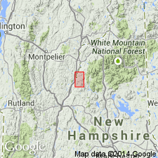
About 60 km northeast of area of fig. 2 (which includes Piermont allochthon and Bronson Hill sequence), Ammonoosuc Volcanics is underlain by interbedded schist and quartzite of Upper Cambrian(?) and Lower Ordovician Dead River Formation, which is remarkably similar to Perry Mountain Formation of Piermont allochthon. Previous reports (Moench and others, 1987; Moench, 1989) incorrectly assign rocks to Dead River Formation that actually belong to Perry Mountain. Report includes geologic map and correlation chart.
Source: GNU records (USGS DDS-6; Reston GNULEX).

- Usage in publication:
-
- Dead River Formation*
- Modifications:
-
- Age modified
- Revised
- AAPG geologic province:
-
- New England province
Summary:
Dead River Formation of Bronson Hill-Boundary Mountains anticlinorium was previously mapped as Albee Formation in Cupsuptic 15-min quad by Harwood (1973) and in Oquossoc 15-min quad by Guidotti (1977) in ME and in wide areas of northern NH by Billings (1956) and Green (1968). In Cupsuptic quad, consists of a main body of thinly interbedded greenish-gray slate and typically subordinate quartzite or feldspathic quartzite. Unit is also divided into three parts not shown on this map--a main body, a green slate and phyllite member, and a red, maroon, and purplish-gray slate member. A quartzite-rich member is separately mapped in Kennebago Lake 15-min quad, ME, and further east. An unnamed quartzite and phyllite member at Percy, in Percy, NH, 15-min quad, is separately mapped and consists of quartzite and grit interbedded with phyllite; possibly a volcaniclastic facies of Perry Mountain Formation. Dead River Formation is undated, but is assigned a Late Cambrian(?) and Ordovician (Whiterockian) age based on position below Ordovician (Whiterockian and Mohawkian) Ammonoosuc Volcanics and above Cambrian(?) Hurricane Mountain Formation.
Source: GNU records (USGS DDS-6; Reston GNULEX).

- Usage in publication:
-
- Dead River Formation*
- Modifications:
-
- Overview
- Age modified
- AAPG geologic province:
-
- New England province
Summary:
Used as Dead River Formation. Age changed from Late Cambrian(?) and Early Ordovician to Late Cambrian(?) and Early Ordovician(?). Consists of pinstriped gray, green, or tan, thinly laminated metapelite and quartzite. Includes separately mapped metapelite exhibiting graded bedding in Percy area, northern NH. Report includes geologic map, cross sections, correlation chart, and four 1:500,000-scale derivative maps.
Source: GNU records (USGS DDS-6; Reston GNULEX).
For more information, please contact Nancy Stamm, Geologic Names Committee Secretary.
Asterisk (*) indicates published by U.S. Geological Survey authors.
"No current usage" (†) implies that a name has been abandoned or has fallen into disuse. Former usage and, if known, replacement name given in parentheses ( ).
Slash (/) indicates name conflicts with nomenclatural guidelines (CSN, 1933; ACSN, 1961, 1970; NACSN, 1983, 2005, 2021). May be explained within brackets ([ ]).

