The National Geologic Map Database is migrating to a new infrastructure. We apologize for any service disruptions during this process.
|
|---|


- Usage in publication:
-
- Dead Horse conglomerate member*
- Modifications:
-
- Named
- Dominant lithology:
-
- Conglomerate
- AAPG geologic province:
-
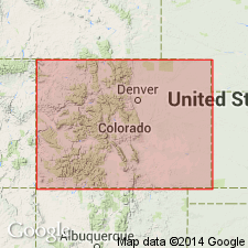
- Piceance basin
Summary:
Named as the basal member of the Manitou formation for exposures near Dead Horse Creek, which enters Glenwood Canyon in sec. 30, T. 5 S., R. 87 W., Garfield Co, CO in the Piceance basin. Exposures in the cliffs along Dead Horse Creek designated the type section. Consists largely of thin beds of gray, flat-pebble limestone conglomerate. The flat pebbles range from 1/4 in or less to 5 in and rarely 8 in length. Some of the pebbles are oriented at steep angles to bedding planes. Beds of conglomerate range from 3 in to a ft or more. A few thin beds of shale present, too. Is 107.9 ft thick in Glenwood Canyon where it overlies Clinetop algal limestone member (new) of Dotsero formation and underlies Tie Gulch dolomite member (new) of Manitou formation. Assigned to the Early Ordovician. Has a brachiopod and conodont fauna (listed). Cross section. Measured section.
Source: GNU records (USGS DDS-6; Denver GNULEX).
- Usage in publication:
-
- Deadhorse Member
- Modifications:
-
- Revised
- AAPG geologic province:
-
- Piceance basin
Summary:
Name Horseshoe Mountain Group applied to rocks of the Sauk sequence in central CO of Late Cambrian and Early Ordovician age. In its northwest province near Glenwood Springs, Garfield Co in the Piceance basin, the group is divided into the Sawatch Sandstone, Dotsero Formation (and its Glenwood Canyon and Clinetop Members), and Manitou Limestone (and its Deadhorse and Tie Gulch Members). In its southeast province--near Salida, Gunnison Co in the Piceance basin, Colorado Springs, El Paso CO in the Denver basin, and Fairplay, Park Co in the South Park basin--the group is divided into the Sawatch Sandstone, Peerless Formation, and Manitou Limestone (and its Helena Canyon, Ptarmigan (provisional), and Fairplay (provisional) Members). The group is named for exposures on Horseshoe Mountain (the type section) near Fairplay in Park Co. Rocks of the group include conglomerate, sandstone, shale, limestone, and dolomite. Correlation chart. Thickness of group at type (southeast facies--sec. 12, T. 10 S., R. 79 W.) is 352 ft: Manitou, 167 ft; Peerless, 35 ft; and Sawatch, 150 ft. Thickness of group in northwest facies (sec. 15, T. 5 S., R. 87 W.) is 772 ft: Manitou, 156 ft; Dotsero, 96 ft; and Sawatch, 520 ft.
Source: GNU records (USGS DDS-6; Denver GNULEX).
For more information, please contact Nancy Stamm, Geologic Names Committee Secretary.
Asterisk (*) indicates published by U.S. Geological Survey authors.
"No current usage" (†) implies that a name has been abandoned or has fallen into disuse. Former usage and, if known, replacement name given in parentheses ( ).
Slash (/) indicates name conflicts with nomenclatural guidelines (CSN, 1933; ACSN, 1961, 1970; NACSN, 1983, 2005, 2021). May be explained within brackets ([ ]).