

- Usage in publication:
-
- Dayton stone
- Modifications:
-
- Named
- Dominant lithology:
-
- Limestone
- Marl
- AAPG geologic province:
-
- Cincinnati arch
Summary:
Named Dayton stone, the commercial name for rock quarried in vicinity of Dayton, Ohio. Also called Niagara formation. Consists of even-bedded limestone and marl. Thickness ranges from 5 to 50 ft. Underlain by Clinton formation; overlain by glacial drift.
Source: GNU records (USGS DDS-6; Reston GNULEX).
- Usage in publication:
-
- Dayton formation
- Modifications:
-
- Overview
- AAPG geologic province:
-
- Cincinnati arch
Summary:
Designated Dayton formation of Niagara group. "The deposits are thin, varying from 7 to 13 feet and averaging only about 8 feet. Under normal development, made up of a number of even-bedded layers from 3 in. to 2 ft in thickness. The stone is compact, tough, and crystalline, little affected by weathering." Used extensively for masonry purposes. Underlain by Brassfield member. [formation affiliation uncertain]; overlain by Alger formation of Niagara group.
Source: GNU records (USGS DDS-6; Reston GNULEX).
- Usage in publication:
-
- Dayton limestone
- Modifications:
-
- Revised
- AAPG geologic province:
-
- Cincinnati arch
Summary:
Designated Dayton limestone of Niagara group. "The Dayton is a hard white limestone stratum about 8 ft thick and occurs in thin, well-defined beds." Underlain by Brassfield limestone; overlain by Osgood shale of Niagara group.
Source: GNU records (USGS DDS-6; Reston GNULEX).
- Usage in publication:
-
- Dayton Limestone Member
- Modifications:
-
- Revised
- AAPG geologic province:
-
- Cincinnati arch
Summary:
Reduced in rank to Dayton Limestone Member (uppermost member) of Noland Formation (new). Underlain by undifferentiated Noland Formation; overlain by glacial drift.
Source: GNU records (USGS DDS-6; Reston GNULEX).
- Usage in publication:
-
- Dayton Dolomite Member*
- Modifications:
-
- Revised
- AAPG geologic province:
-
- Cincinnati arch
Summary:
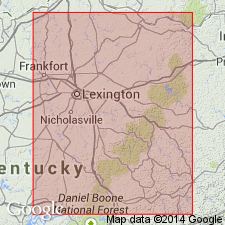
Designated Dayton Dolomite Member of Drowning Creek Formation (new) and of Alger Shale. "The Dayton is a light- to medium-gray, fine- to medium-grained calcareous dolomite that occurs in three or four beds totaling 1 to 3 ft in thickness. The dolomite is mostly dense and hard but locally porous or vuggy and is generally devoid of fossils." Underlain by undifferentiated Drowning Creek Formation and overlain by Estill Shale in most of area of report. Underlain by Lulbegrud Shale Member and overlain by Estill Shale Member of Alger Shale in small area near Colfax, Fleming Co. KY. Crops out in eastern KY, in Fleming Co. and northward, and in southern OH.
Source: GNU records (USGS DDS-6; Reston GNULEX).
- Usage in publication:
-
- Dayton Limestone*, Dolomite Member*
- Modifications:
-
- Areal extent
- AAPG geologic province:
-
- Appalachian basin
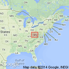
Summary:
Geographically extended to Dayton into the subsurface of WV (OH-WV hinge zone) in section F-F' as the Dayton Dolomite Member of the Drowning Creek Formation. In OH (Waverly arch), it is called the Dayton Limestone.
Source: GNU records (USGS DDS-6; Reston GNULEX).
For more information, please contact Nancy Stamm, Geologic Names Committee Secretary.
Asterisk (*) indicates published by U.S. Geological Survey authors.
"No current usage" (†) implies that a name has been abandoned or has fallen into disuse. Former usage and, if known, replacement name given in parentheses ( ).
Slash (/) indicates name conflicts with nomenclatural guidelines (CSN, 1933; ACSN, 1961, 1970; NACSN, 1983, 2005, 2021). May be explained within brackets ([ ]).