

- Usage in publication:
-
- Datil formation*
- Modifications:
-
- Original reference
- Dominant lithology:
-
- Tuff
- Rhyolite
- Sandstone
- Conglomerate
- Andesite
- AAPG geologic province:
-
- Basin-and-Range province
- Orogrande basin
Summary:
Datil formation. Well-indurated tuffs, rhyolites, cross-bedded sandstones, and conglomerates. Members very variable. Thickness 2,000+/- feet. Underlies Quaternary gravels and unconformably overlies Chamiso (Upper Cretaceous) and older formations. No fossils. Regarded as possibly late Tertiary.
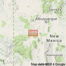
Named for fact it is the mountain-forming series of Datil Mountains, Alamosa Creek Valley [now Alamocita Creek], [Catron and] Socorro Cos., southwestern NM. [Datil Mountains and Alamocita Creek are in Catron County (est. Feb. 1921) and Socorro County, Magdalena quadrangle, scale 1:100,000.]
[Winchester's section measured at the north end of Bear Mountains, in secs. 4, 5, 8, and 9, T. 1 N., R. 4 W., Socorro Co., southwestern NM.]
Source: US geologic names lexicons (USGS Bull. 896, p. 573; USGS Bull. 1200, p. 1046-1047).
- Usage in publication:
-
- Datil formation*
- Modifications:
-
- Revised
- AAPG geologic province:
-
- Orogrande basin
Summary:
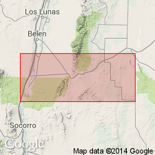
Stratigraphically restricted to the upper 1,140 ft of Winchell's (1920) measured section north of Bear Mountain, Socorro Co, NM in the Orogrande basin. The lower 694 ft of Winchell's section is assigned to the newly named Baca formation of Eocene age. Mapped (geologic map) in the Joyita Hills, Socorro Co. Estimated to be 2,000 ft thick. Restricted Datil consists of dominantly purple, some red and gray, latite, rhyolite, andesite flows, agglomerate, tuff, conglomerate, and sandstone. Rests on eroded edges of Sandia formation, Madera limestone, and Abo formation. Is older than Santa Fe formation which is assigned to the Pliocene. Assigned a Miocene? age, though the age of the Baca is in doubt and could be Eocene or younger.
Source: GNU records (USGS DDS-6; Denver GNULEX).
- Usage in publication:
-
- Datil Formation
- Modifications:
-
- Overview
- AAPG geologic province:
-
- Basin-and-Range province
Summary:
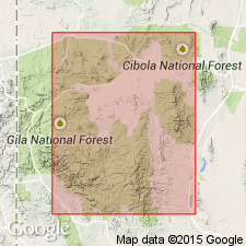
Most of the ash-flows are considered part of the Datil Formation. Name refers to the Datil Mountains, Socorro Co, NM but the type section 1,824 feet thick is located 30 mi east in the Bear Mountains. Type has been modified three times. Term was used for rhyolites and quartz latites characterized by thick ash-flow cooling units that separated older andesite from younger basalt. Previously believed that all rhyolitic rocks were contemporaneous, probably Miocene. Is unconformably above Laramide rocks. Is cut by basin-and-range faults. No fossils found. Used for rocks bracketed from 38 to 29 m.y. or Oligocene and that represent three cycles of eruptions. Use in restricted sense for rocks of 38-29 m.y. Use in broad sense includes younger, undated rocks.
Source: GNU records (USGS DDS-6; Denver GNULEX).
- Usage in publication:
-
- Datil Group
- Modifications:
-
- Not used
Summary:
Terms Datil Group and Datil Formation are ambiguous and need revision. Term Datil not used in report on Basin-and-Range province, NM.
Source: GNU records (USGS DDS-6; Denver GNULEX).
- Usage in publication:
-
- Datil Group
- Modifications:
-
- Revised
- AAPG geologic province:
-
- Orogrande basin
- Basin-and-Range province
Summary:
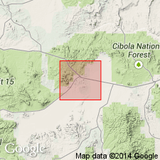
Present throughout northeast Mogollon-Datil volcanic field, Catron and Socorro Cos, Basin-and-Range province and Orogrande basin. Term has been applied to several combinations of rocks. Efforts to not use or to abandon term have not worked. Term is so deeply entrenched that it is impossible to abandon it. Therefore, term "redefined" [revised] and applied to rocks above Baca Formation and below Hells Mesa Tuff. Represents the early volcaniclastic apron of the northeast Mogollon-Datil volcanic field. Datil rocks range from andesite to low-silica rhyolite in composition and generally lack phenocrystic quartz. Includes Spears Formation, Datil Well, Rock House Canyon, and Blue Canyon Tuffs, as well as several unnamed units. Assigned to Oligocene. Is about 39-33 m.y. from units within group, and from age obtained from overlying Hells Mesa. Source unknown.
Source: GNU records (USGS DDS-6; Denver GNULEX).
- Usage in publication:
-
- Datil Group*
- Modifications:
-
- Revised
- AAPG geologic province:
-
- Basin-and-Range province
Summary:
Includes all rocks beneath the erosional unconformity at the base of the Oligocene Davis Canyon Tuff in this quad, Catron Co, NM in the Basin-and-Range province. Datil divided into (ascending): 1) tuff of Bishop Peak?; 2) unnamed tuffs, one of which is equivalent to the Hells Mesa Tuff; and 3) Pueblo Creek Formation (newly named), all of Oligocene age. Tuff of Bishop Peak? tongues into the "volcaniclastic rocks" map unit, the basal unit of the Pueblo Creek. The unnamed tuffs numbered t1 to t4 are discontinuous and are interlayered with the "alluvial facies" and "volcaniclastic rocks" map units of the Pueblo Creek.
Source: GNU records (USGS DDS-6; Denver GNULEX).
- Usage in publication:
-
- Datil Group*
- Modifications:
-
- Geochronologic dating
- Paleomagnetics
- Revised
- AAPG geologic province:
-
- Basin-and-Range province
Summary:
Consists of several outflow sheets of rhyolitic ash-flow tuffs and minor other volcanic rocks interlayered with volcaniclastic sedimentary rocks of the Spears Formation (Osburn and Chapin, 1983). Is revised to specifically include the Kneeling Nun Tuff, which was not specifically included in the Datil by Osburn and Chapin (1983). Mapped volcanic units of the Datil in the Horse Mountain West quadrangle, Catron Co, NM, in the eastern part of the Basin-and-Range province include (descending): pumice breccia of Old Horse Springs (about 33 Ma; reversed polarity); Blue Canyon Tuff (33.75 Ma; reversed polarity); Rock House Canyon Tuff (34.81 Ma; reversed polarity); tuff of Lebya Well (reversed polarity); Kneeling Nun Tuff (35.28 Ma; reversed polarity); tuff of Farr Ranch (35.50 Ma; normal polarity); Datil Well Tuff (35.41 Ma; normal polarity); and basaltic flow of Alamocito Canyon. Isotopic ages (40Ar/39Ar), natural remanent magnetism, and chemical analyses data are presented in tables. Age is Oligocene.
Source: GNU records (USGS DDS-6; Denver GNULEX).
For more information, please contact Nancy Stamm, Geologic Names Committee Secretary.
Asterisk (*) indicates published by U.S. Geological Survey authors.
"No current usage" (†) implies that a name has been abandoned or has fallen into disuse. Former usage and, if known, replacement name given in parentheses ( ).
Slash (/) indicates name conflicts with nomenclatural guidelines (CSN, 1933; ACSN, 1961, 1970; NACSN, 1983, 2005, 2021). May be explained within brackets ([ ]).