The National Geologic Map Database is migrating to a new infrastructure. We apologize for any service disruptions during this process.
|
|---|


- Usage in publication:
-
- Darby formation*
- Modifications:
-
- Original reference
- Dominant lithology:
-
- Dolomite
- Shale
- AAPG geologic province:
-
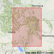
- Yellowstone province
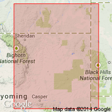
- Bighorn basin
- Green River basin
Summary:
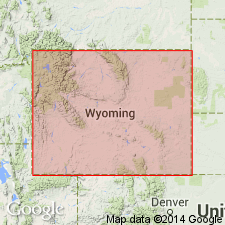
Pg. 420. Darby formation. Introduction of this new name is made necessary because none in present use fits stratigraphy of western Wyoming. The Darby is apparently = Peale's Three Forks shale plus upper part of his Jefferson limestone. It rests disconformably on Leigh dolomite member of the Bighorn dolomite, and in some places on underlying massive member of the Bighorn. It is separated from overlying Madison limestone locally, if not generally, by eroded surface. Consists of a varied sequence of shales and dolomites, of white, gray, green, lavender, buff, red, brown, and black colors; but somber colors predominate. Some beds are massive, others thin and brittle. Fossils rare. Age is Late and Middle Devonian.
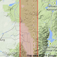
Named from canyon of Darby Creek, on west slope of Teton Range, where well exposed, Teton Co., northwestern WY. Extends over most of northwestern WY. [Gives detailed section (footing 428.5 ft) on east slope of Sheep Mountain near head of Green River.]
Source: US geologic names lexicon (USGS Bull. 896, p. 572).
- Usage in publication:
-
- Darby formation*
- Modifications:
-
- Areal extent
- AAPG geologic province:
-
- Snake River basin
Summary:
Recognized in a measured section in Hell Creek Canyon, sec 31, T1N, R46E and sec 2, T1S, R46E, Bonneville Co, ID in the Snake River basin where it overlies Bighorn dolomite and underlies Brazer and Madison limestones [undivided]. Is 570 ft thick in section. Composed of a lower dark gray to black limestone and dolomite and an upper yellow, purple-red and brown calcareous shale, siltstone, and sandstone. Has a discontinuous 5 ft yellow pebbly quartzite at base. Devonian age.
Source: GNU records (USGS DDS-6; Denver GNULEX).
- Usage in publication:
-
- Darby Formation*
- Modifications:
-
- Areal extent
- AAPG geologic province:
-
- Snake River basin
Summary:
Areally extended to Bonneville and Teton Cos, ID in the Snake River basin where it overlies Bighorn Dolomite and underlies Lodgepole Limestone. Is 700 to 800 ft thick. Divisible into a lower part composed of dark brownish-gray to sooty-gray, fine- to medium-grained limestone and an upper part (rarely exposed) of yellow to reddish-brown calcareous shale, siltstone, and sandstone. Top of lower part is a brown limestone breccia. Assigned a Middle and Late Devonian age.
Source: GNU records (USGS DDS-6; Denver GNULEX).
- Usage in publication:
-
- Darby Formation*
- Modifications:
-
- Overview
- Dominant lithology:
-
- Limestone
- Dolomite
- Sandstone
- Siltstone
- Conglomerate
- AAPG geologic province:
-
- Yellowstone province
Summary:
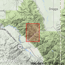
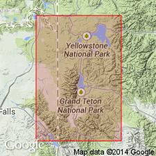
Type section designated 3 1/2 mi north of Darby Canyon on south side of Teton Canyon above cirque immediately south of Boy Scout Camp, Teton Co, WY in the Yellowstone province where formation is well exposed. Blackwelder's type [should read "typical"] section is at least 80 mi away from Teton area. Consists of interbedded buff, brown, gray, fine-grained to sugary dolomite, brown to gray, coarse, fine- to medium-grained limestone, dark brown to red-brown, fine-grained sandstone, buff to gray dolomitic siltstone at type. Two gray to dark gray conglomerates near base, both of which contain fragments of the underlying Leigh Member. The dolomite may be petroliferous and very thin bedded. The limestone ranges from very thin to thin bedded. Individual beds may be arenaceous, vugular, and friable. Siltstone is interbedded with dolomite. Is 218 ft thick at type. Is 335 ft thick at Glory Mountain [location not given]. Unconformably overlies Leigh Member of Bighorn Dolomite. Disconformably underlies Englewood Formation?. Has a few poorly preserved fossils (brachiopods, bryozoans, corals). Of Devonian age.
Source: GNU records (USGS DDS-6; Denver GNULEX).
- Usage in publication:
-
- Darby Formation
- Modifications:
-
- Areal extent
- AAPG geologic province:
-
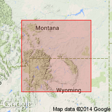
- Powder River basin
Summary:
Included in "Rock Unit III," a sequence of the Devonian Darby, Englewood, and lower [part of] Guernsey Formations, and Mississippian Madison, Pahasapa, and upper [part of] Guernsey Formations. Isopach map and cross section of "Rock Unit III" of the Powder River and adjoining Williston basin. [Precise areal limits of Darby not shown.] Darby on cross section shown as possibly pinching out under the Powder River basin.
Source: GNU records (USGS DDS-6; Denver GNULEX).
- Usage in publication:
-
- Darby Formation
- Modifications:
-
- Areal extent
- AAPG geologic province:
-
- Wind River basin
- Bighorn basin
- Green River basin
Summary:
Term has long been useful mapping unit form rocks between Bighorn Dolomite and Madison Limestone; however, in most places a dark shale unit of Devonian and Mississippian age occurs between Darby and Madison. Dark shale unit should not be considered part of Darby although it usually is mapped with Darby in the generally covered interval between Madison and Bighorn. In western WY and southwest MT, where Birdbear Member of Jefferson Formation is removed by erosion (fig. 4), lower member of Jefferson is referred to as Darby; thus western limit of Darby is restricted to Wind River and Owl Creek Mountains, Washakie Range, and associated basins (Wind River, Bighorn, and Greater Green River basins). Isopach map; correlation chart; cross sections; list of measured sections. In west-central WY, unconformably overlies Beartooth Butte Formation. Late Devonian age.
Source: GNU records (USGS DDS-6; Denver GNULEX).
- Usage in publication:
-
- Darby Formation*
- Modifications:
-
- Areal extent
- AAPG geologic province:
-
- Wind River basin
- Yellowstone province
- Green River basin
Summary:
Includes all strata between Bighorn Dolomite and Madison Limestone. Lower contact with Bighorn is an unconformity. Occurs in the western third of Wind River basin, and on flanks of northern and central Wind River Range, Washakie Range, western half of Owl Creek Mountains, or the Wind River and Greater Green River basins, and Bighorn basin. Is 193 ft thick at northwest end of Wind River Range. Thins progressively southeast to wedge edge near Sinks Canyon, sec 18, T32N, R100W, Sweetwater Co, WY. Isopach map shows zero line extending from Thermopolis south to point just west of Lander. Channel sandstone deposits locally at base. Divisible into a resistant buff, gray, brown, thin- to thick-bedded, ledgy dolomite in lower part and a greenish-gray and red soft siltstone, shale, and sandstone interbedded with white, pink, and brown limestone and dolomite in upper part. Includes at top a thin unit that unconformably overlies upper part that is composed of siltstone, shale, and silty dolomite equivalent to the dark shale unit and is transitional with the Madison. Fish remains (listed) of Early Devonian age in channel deposits at base. Brown dolomite has a fetid odor. Conodonts from dark shale unit are latest Devonian to earliest Mississippian. Deposited close to shore. Dark shale unit deposited during readvance of the sea.
Source: GNU records (USGS DDS-6; Denver GNULEX).
- Usage in publication:
-
- Darby Formation*
- Modifications:
-
- Areal extent
- AAPG geologic province:
-
- Green River basin
- Wind River basin
Summary:
Shown on figure 2 as the Devonian unit beneath the newly named Cottonwood Canyon Member of the Madison Limestone in the Wind River Range, Sublette Co, WY in the Greater Green River basin and in the adjoining Wind River basin. Name not used, however, in the Teton Range, Teton Co, WY in the Yellowstone province where Darby Creek, the locality for which the Darby was named (see Blackwelder, 1918) occurs. Name Logan Gulch Member of Three Forks Formation used instead (figs 2, 3, 4) in Teton area where Darby defined. [Term Darby cannot be restricted from the area where it was named without abandoning it.]
Source: GNU records (USGS DDS-6; Denver GNULEX).
- Usage in publication:
-
- Darby Formation*
- Modifications:
-
- Areal extent
- AAPG geologic province:
-
- Yellowstone province
- Green River basin
- Wind River basin
Summary:
Misconceptions concerning location of type locality discussed. Blackwelder (1918) designated a "typical" locality on east slope of Sheep Mountain, sec 6, T38N, R108W, Wind River Range, Sublette Co, WY in the Greater Green River basin. The name Darby, however, was derived 60 mi southeast of canyon of Darby Creek, west slope of Teton Range, Teton Co, WY in the Yellowstone province. No type section ever designated. Darby as defined by Blackwelder has been used by mappers for 50 years throughout the Washakie Range and Owl Creek Mountains, Gros Ventre and Wind River Ranges, and overthrust belt, Greater Green River basin, and Teton Range. Includes all rocks between Bighorn Dolomite (below) and Madison Limestone (above). Forms a natural cartographic unit comparatively nonresistant and poorly exposed. Contains equivalents (ascending) of: Jefferson Formation, Three Forks Formation, and a 7 ft thick dark shale (= to Cottonwood Canyon Member of Madison). Is Devonian age at some localities. Is also Early Mississippian age at some localities.
Source: GNU records (USGS DDS-6; Denver GNULEX).
- Usage in publication:
-
- Darby Formation*
- Modifications:
-
- Age modified
- AAPG geologic province:
-
- Green River basin
Summary:
Shown as Late Devonian and Early Mississippian age on geologic map. Name assigned to 500 ft of rocks between Bighorn Dolomite and Madison Limestone. A lower unit (= to Duperow Formation) recognized that consists of dark-brown gray fetid dolomite and limestone, light-gray to white sandstone and siltstone, green and red claystone and mudstone, a lower middle unit of massive, ledge-forming brown-dark gray dolomite (= Birdbear or upper member of Jefferson Formation), an upper middle unit of green-gray, gray, and brown dolomitic and partly sandy claystone, mudstone and siltstone (= Three Forks Formation), and a top unit of dark-gray, purple-weathering carbonaceous claystone, mudstone, and silty crinoidal dolomite (= dark shale unit). [No mention of a basal, local channel sandstone with Early Devonian fish remains. See Keefer and Van Lieu, 1966.] Regarded as Upper Devonian (lower three units) and Upper Devonian and Lower Mississippian (top unit).
Source: GNU records (USGS DDS-6; Denver GNULEX).
- Usage in publication:
-
- Darby Formation*
- Modifications:
-
- Overview
- AAPG geologic province:
-
- Green River basin
Summary:
Map unit shown as Devonian and Mississippian age because it includes beds assigned to the Cottonwood Canyon Member of the Mississippian Madison Limestone. Report area is in the Greater Green River basin.
Source: GNU records (USGS DDS-6; Denver GNULEX).
For more information, please contact Nancy Stamm, Geologic Names Committee Secretary.
Asterisk (*) indicates published by U.S. Geological Survey authors.
"No current usage" (†) implies that a name has been abandoned or has fallen into disuse. Former usage and, if known, replacement name given in parentheses ( ).
Slash (/) indicates name conflicts with nomenclatural guidelines (CSN, 1933; ACSN, 1961, 1970; NACSN, 1983, 2005, 2021). May be explained within brackets ([ ]).