

- Usage in publication:
-
- Damnation limestone
- Modifications:
-
- Original reference
- Dominant lithology:
-
- Limestone
- AAPG geologic province:
-
- Montana folded belt
Summary:
Pg. 35 and passim. Damnation limestone. Most distinguishing feature is bright buff color to which it weathers. At type locality conisists of play, dull-gray to tan-gray, fine-grained, fairly pure limestone in beds averaging 1 inch in thickness, with irregular bedding surfaces, and with a few flakes and nodules of buff clay irregularly distributed both between and within the limestones. Thickness averages 25 feet. Overlies Wolsey shale (Middle Cambrian) and underlies Nannie Basin limestone. Forms the steep slope at foot of the cliffs on southwestern side of Pagoda Mountain, in NE/4 sec. 9, T. 22 N., R. 13 W. This slope lies at head of Damnation Creek, which flows southwest. [Age is Middle(?) Cambrian.]
Source: US geologic names lexicon (USGS Bull. 896, p. 569).
- Usage in publication:
-
- Damnation limestone
- Modifications:
-
- Age modified
Summary:
Pg. 98. Damnation limestone. Assigned this formation to Middle Cambrian without a query.
Source: US geologic names lexicon (USGS Bull. 896, p. 569).

- Usage in publication:
-
- Damnation limestone
- Modifications:
-
- Revised
- Principal reference
- AAPG geologic province:
-
- Montana folded belt
Summary:
Pg. 1086-1087, 1089, 1090 (fig. 2). Damnation limestone. Redefined to include former Damnation and Nannie Basin limestones, and name Nannie Basin dropped. Thickness at type locality, herein stated, 149 feet; at Pentagon Mountain, 191 feet. Overlies Gordon shale; underlies Dearborn limestone. [Age is Middle Cambrian (Albertan).]
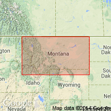
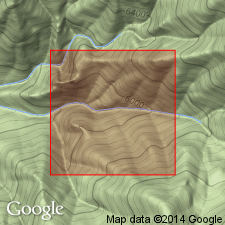
Type locality: west end of Scapegoat basin, in S/2 sec. 6, SW/4 sec. 5 and N/2 sec. 8, T. 18 N., R. 10 W., [Lewis and Clark Co.], northwestern MT.
Source: US geologic names lexicon (USGS Bull. 1200, p. 1039).
- Usage in publication:
-
- Damnation limestone*
- Modifications:
-
- Areal extent
- AAPG geologic province:
-
- Montana folded belt
Summary:
Pg. 213 (table 1), 220. Described in southwest Saypo quadrangle where it is 150 feet thick, overlies Gordon shale, and underlies Dearborn limestone.
Source: US geologic names lexicon (USGS Bull. 1200, p. 1039).

- Usage in publication:
-
- Damnation Limestone*
- Modifications:
-
- Areal extent
- AAPG geologic province:
-
- Montana folded belt
Summary:
Pg. A6-A7 (table 1), A22-A23. Damnation Limestone. Finely crystalline, medium- to dark-gray limestone; mottled light orange tan in lower part; includes some thin-bedded finely micaceous sandstone in irregularities between beds. Thickness 272 to 363 feet. Underlies Dearborn Limestone; overlies Gordon Shale. Correlates with middle part of Wolsey Shale of south-central Montana. Fossils; carries trilobites of the GLOSSOPLEURA-KOOTENIA faunal horizon (Deiss, 1939, p. 39). Age is Middle Cambrian.
Source: Publication.
For more information, please contact Nancy Stamm, Geologic Names Committee Secretary.
Asterisk (*) indicates published by U.S. Geological Survey authors.
"No current usage" (†) implies that a name has been abandoned or has fallen into disuse. Former usage and, if known, replacement name given in parentheses ( ).
Slash (/) indicates name conflicts with nomenclatural guidelines (CSN, 1933; ACSN, 1961, 1970; NACSN, 1983, 2005, 2021). May be explained within brackets ([ ]).