- Usage in publication:
-
- Dale Lake Volcanics*
- Modifications:
-
- Named
- Dominant lithology:
-
- Sandstone
- Breccia
- AAPG geologic province:
-
- Mojave basin
Summary:
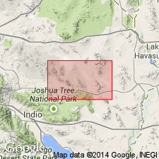
Unit is named the Dale Lake Volcanics for Dale Lake, San Bernardino Co., CA. Consists of porphyritic, aphanitic, and epiclastic rocks, including flows, polymict breccias, and tuffaceous sedimentary rocks. Locally vuggy or laminated. Phenocrysts include plagioclase, chloritized hornblende, pyroxene pseudomorphs, quartz, and alkali feldspar; the alkali feldspar phenocrysts are generally lavender and subspherical and resemble phenocrysts in the Virginia Dale Monzonite (new) and other units of the Bullion Mountains Intrusive Suite (new). In the type locality, upright, graded-bedded tuffaceous sandstone contains clastic lavender alkali-feldspar crystals and underlies a sill or thick flow of porphyritic granitoid, indistinguishable from the Virginia Dale Quartz Monzonite, that contains identical alkali feldspar crystals as phenocrysts. These relations are taken to indicate that crystal-bearing eruptive rocks of the Dale Lake Volcanics locally predated the Virginia Dale, but the magmas were so closely similar that the Dale Lake probably overlap in age with the Virginia Dale. Analyzed volcanic rocks contain 64 to 66 percent SiO2 and exhibit potassium enrichment indicative of potassium metasomatism in the groundmass. Age is Jurassic based on apparently coeval relations with the Virginia Dale.
Source: GNU records (USGS DDS-6; Menlo GNULEX).
For more information, please contact Nancy Stamm, Geologic Names Committee Secretary.
Asterisk (*) indicates published by U.S. Geological Survey authors.
"No current usage" (†) implies that a name has been abandoned or has fallen into disuse. Former usage and, if known, replacement name given in parentheses ( ).
Slash (/) indicates name conflicts with nomenclatural guidelines (CSN, 1933; ACSN, 1961, 1970; NACSN, 1983, 2005, 2021). May be explained within brackets ([ ]).

