

- Usage in publication:
-
- Cyrene Limestone
- Modifications:
-
- Overview
- AAPG geologic province:
-
- Cincinnati arch
Summary:
Pg. 241-247. Cyrene Limestone of Edgewood Group. Follows T.E. Savage, 1913, GSA Bull., v. 24, p. 351-376; T.L. Thompson and I.R. Satterfield, 1975, Missouri Dept. Nat. Res., Div. Research and Technical Info (Geol. Survey) Rept. Inv. 57, pt. 2, p. 61-108.
Original description: (Savage, 1913, p. 361) "(1) The Cyrene member, which will include the lower fossiliferous limestone phase of the [Edgewood] formation below the Bowling Green member, exposed 1 to 2 miles east of Cyrene and Edgewood, Pike County, Missouri…"
Thompson and Satterfield (1975, p. 96) added, "At the Bowling Green roadcut, the Cyrene is a 2-m-thick, gray to bluish-gray, fine- to medium-crystalline, fossiliferous, dolomitic limestone. Fossil distribution is not uniform, but fossils are numerous along bedding planes. Beds are 6- to 12-cm-thick in the upper part of this unit, and the top is marked by an irregular 8- to 12-cm-thick, coarse-grained limestone containing scattered oolites (unit 5A). Phosphatic debris and pyrite are common in acid residues from this limestone. A prominent shale parting separates unit 5A from the overlying Bowling Green Dolomite.
"The same lithic type is present at the type Cyrene of Sabage and is distinct from the limestone of the Bryant Knob Formation. We have not seen this dolomitic limestone east of these two exposures and have not found it where the Bryant Knob and Noix Limestone are present." Report includes history of nomenclature, type and reference locality maps, measured sections.
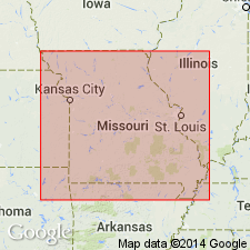
Type section: Savage (1913, p. 361) located the Cyrene only as "1 to 2 miles east of Cyrene and Edgewood, Pike County, Missouri." Rowley (1916 [full bibliographic citation not given], p. 319) stated that "the type locality for the member is generally known as the Wigginton place, and is at the foot of a hill locally known as Buffalo Knob." Thompson and Satterfield (1975, p. 82) stated, "We have located this section in the SW/4 NW/4 sec. 8, T. 52 N., R. 1 W. It is the only exposure in the vicinity designated by Savage (1913)." The section (fig. 157) is located in Pike County, northeastern Missouri, Cyrene 7.5-min quadrangle.
Reference section: an excellent exposure of the Cyrene Limestone, described in detail by Thompson and Satterfield (1975, p. 88) and Amsden (1986, Oklahoma Geol. Survey Bull. 139, p. 38), is in a roadcut on business route US Highway 54, 0.25 mile east of the junction with US Highway 61 bypass (figs. 158 and 159), north of the north edge of Bowling Green, NW/4 NW/4 sec. 24, T. 53 N., R. 3 W., Pike County, Missouri, Bowling Green 7.5-min quadrangle.
Source: Publication.
For more information, please contact Nancy Stamm, Geologic Names Committee Secretary.
Asterisk (*) indicates published by U.S. Geological Survey authors.
"No current usage" (†) implies that a name has been abandoned or has fallen into disuse. Former usage and, if known, replacement name given in parentheses ( ).
Slash (/) indicates name conflicts with nomenclatural guidelines (CSN, 1933; ACSN, 1961, 1970; NACSN, 1983, 2005, 2021). May be explained within brackets ([ ]).