

- Usage in publication:
-
- Cynthiana formation
- Modifications:
-
- Original reference
- Dominant lithology:
-
- Limestone
- Clay
- Shale
- AAPG geologic province:
-
- Cincinnati arch
Summary:
Pg. 10, 13, 14, 211-212. Cynthiana formation. Limestones, with interbedded clay and clay shale, 40 to 90 feet thick, divided into Greendale bed below and Point Pleasant bed above. Overlain by Utica shale; [overlies] Lexington limestone. Age is Middle Ordovician.
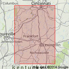
Named from Cynthiana, Harrison Co., KY.
Source: US geologic names lexicon (USGS Bull. 896, p. 563).
- Usage in publication:
-
- Cynthiana formation
- Modifications:
-
- Revised
- AAPG geologic province:
-
- Cincinnati arch
Summary:
Cynthiana divided into (descending): Nicholas limestone (35 feet), Greendale bed, and Perryville bed. Essentially equivalent of Catheys formation of Tennessee.
Source: GNU records (USGS DDS-6; Reston GNULEX).

- Usage in publication:
-
- Cynthiana formation
- Modifications:
-
- Revised
- AAPG geologic province:
-
- Cincinnati arch
Summary:
Cynthiana divided into Point Pleasant limestone above and Greendale limestone below. Rests disconformably on Cornishville limestone member of Perryville limestone. Minor disconformity at top of formation.
Source: GNU records (USGS DDS-6; Reston GNULEX).
- Usage in publication:
-
- Cynthiana formation
- Modifications:
-
- Revised
- AAPG geologic province:
-
- Cincinnati arch
Summary:
Cynthiana divided into (descending) Rogers Gap, Gratz, Bromley, and Greendale members. Overlies Cornishville member of Perryville formation and underlies Fulton shale.
Source: GNU records (USGS DDS-6; Reston GNULEX).
- Usage in publication:
-
- Cynthiana formation
- Modifications:
-
- Revised
- AAPG geologic province:
-
- Cincinnati arch
Summary:
Several names have been applied to different members of the Cynthiana. There is confusion in the literature in regard to the relationships, due both to regional variation in lithology and fauna, and to overlap. Formation as defined herein comprises the following members: Rogers Gap, Greendale, Millersburg, Nicholas limestone, Bromley, and Gratz. In southern and western Bluegrass are other pre-Greendale beds that are characterized by a fauna not known elsewhere in central Kentucky. Thickness ranges from 38 to 125 feet. Marked unconformity at base. Formation rests at different places on all formations from top of Perryville (Cornishville member) to Jessamine formation (in Lexington limestone). Underlies Eden formation.
Source: GNU records (USGS DDS-6; Reston GNULEX).

- Usage in publication:
-
- Cynthiana formation
- Modifications:
-
- Revised
- AAPG geologic province:
-
- Cincinnati arch
Summary:
Name Sulphur Well member proposed for beds below Greendale member of Cynthiana formation.
Source: GNU records (USGS DDS-6; Reston GNULEX).
- Usage in publication:
-
- Cynthiana formation
- Modifications:
-
- Overview
- AAPG geologic province:
-
- Cincinnati arch
Summary:
Lexington-Cynthiana-Eden is probably a conformable succession. Cynthiana consists of fossiliferous limestone and shale, 40 to 100 feet thick varying in character in different parts of area. Following divisions are discussed: Greendale, Millersburg, Nicholas limestone, Rogers Gap beds, Bromley shale, Gratz shale, and ALLONYCHIA zone. Facies of divisions change from place to place. Unit formerly termed Sulphur Well member is herein considered a facies of the upper Lexington. Age is pre-Cincinnatian.
Source: GNU records (USGS DDS-6; Reston GNULEX).
- Usage in publication:
-
- Cynthiana formation*
- Modifications:
-
- Revised
- AAPG geologic province:
-
- Cincinnati arch
Summary:
All subdivisions of interval between top of Benson limestone and base of Eden formation should be referred to as members of Cynthiana. This would include as members the lithologic and paleontologic units heretofore defined as Brannon, Woodburn, Greendale, Millersburg, Nicholas, Rogers Gap, Bromley, and Gratz.
Source: GNU records (USGS DDS-6; Reston GNULEX).
- Usage in publication:
-
- Cynthiana formation
- Modifications:
-
- Age modified
- AAPG geologic province:
-
- Cincinnati arch
Summary:
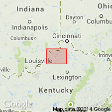
Rogers Gap [member of Cynthiana formation], uppermost member of the Mohawkian, and overlying Fulton shale, lowermost member of the Cincinnatian are faunally indistinguishable in area of this report [Ohio Valley around Cincinnati]. They appear to be lithologic facies of same time-rock unit. Evidence indicates advisability of extending Cincinnatian series downward to embrace Cynthiana formation, rather than including it in the Mohawkian as has been common practice.
Source: US geologic names lexicon (USGS Bull. 1200, p. 1025).
- Usage in publication:
-
- Cynthiana formation*
- Modifications:
-
- Revised
- AAPG geologic province:
-
- Cincinnati arch
Summary:
Generalized columnar section of rocks in study area shows Cynthiana formation, 80 to 173 feet thick, above Benson limestone member of Lexington and below Eden formation. Includes Woodburn limestone member at base, and Devils Hollow facies above; upper part of formation unnamed. Age is Middle Ordovician.
Source: GNU records (USGS DDS-6; Reston GNULEX).
- Usage in publication:
-
- Cynthiana†
- Modifications:
-
- Abandoned
- AAPG geologic province:
-
- Cincinnati arch
Summary:
Cynthiana Formation abandoned. Lexington Limestone stratigraphically extended to include overlying rocks formerly called Cynthiana Formation.
Source: GNU records (USGS DDS-6; Reston GNULEX).

- Usage in publication:
-
- Cynthiana Formation
- Modifications:
-
- Overview
- AAPG geologic province:
-
- Cincinnati arch
Summary:
Point Pleasant Member of Cynthiana Formation described in Road Log. Authors follow nomenclature of Weiss and others (1965) to maintain consistency with published literature, though they state that future study will determine appropriate stratigraphic placement of the Point Pleasant. Cynthiana underlies Kope Formation. Position is "sub-Cincinnatian."
Source: GNU records (USGS DDS-6; Reston GNULEX).
- Usage in publication:
-
- "Cynthiana"
- Modifications:
-
- Revised
- AAPG geologic province:
-
- Cincinnati arch
Summary:
"Cynthiana" still used as informal drillers' term in study area, though its rocks have been assigned formally to upper Lexington Limestone. Subsurface "Trenton" and "Cynthiana" are limestone and interbedded limestone and shale between Black River Group and Upper Ordovician shales. Underlies Kope Formation (Late Ordovician).
Source: GNU records (USGS DDS-6; Reston GNULEX).
For more information, please contact Nancy Stamm, Geologic Names Committee Secretary.
Asterisk (*) indicates published by U.S. Geological Survey authors.
"No current usage" (†) implies that a name has been abandoned or has fallen into disuse. Former usage and, if known, replacement name given in parentheses ( ).
Slash (/) indicates name conflicts with nomenclatural guidelines (CSN, 1933; ACSN, 1961, 1970; NACSN, 1983, 2005, 2021). May be explained within brackets ([ ]).