

- Usage in publication:
-
- Lower Cundiff limestone
- Upper Cundiff limestone
- Modifications:
-
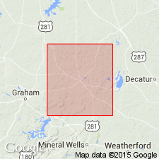
- Areal extent
- Dominant lithology:
-
- Limestone
- AAPG geologic province:
-
- Fort Worth syncline
Summary:
[Cundiff limestone in Caddo Creek formation.] Lower Cundiff limestone lies 50+/- feet above base of Caddo Creek formation and Upper Cundiff limestone lies 90+/- feet above Lower Cundiff limestone. [Age is Pennsylvanian.]
Source: US geologic names lexicon (USGS Bull. 896, p. 555).
- Usage in publication:
-
- Cundiff limestone
- Upper Cundiff limestone
- Lower [Middle] Cundiff limestone
- Modifications:
-
- Principal reference
- AAPG geologic province:
-
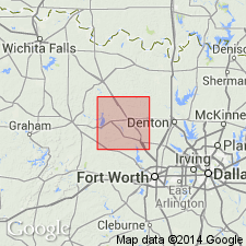
- Fort Worth syncline
Summary:
Pg. 40. Cundiff limestone. Three ledges of limestone outcropping in eastern part of Jack County, central northern Texas, near Cundiff, take their name from the village. The Upper Cundiff limestone consists of 3+/- feet of hard crystalline limestone apparently of algal origin; it is present in Wise County, central northern Texas. The Lower [Middle] Cundiff limestone consists of 3+/- feet of hard crystalline limestone apparently of algal origin; it is present in Wise County and is separated from Upper Cundiff limestone by 75+/- feet of shale. The lower of the 3 limestone ledges pinches out before Wise County is reached. The Cundiff limestone overlies Hog Creek shales, both of which are members of Caddo Creek formation. [Age is Pennsylvanian.]
Source: US geologic names lexicon (USGS Bull. 896, p. 555).

- Usage in publication:
-
- Cundiff Limestone
- Modifications:
-
- Mapped
- AAPG geologic province:
-
- Fort Worth syncline
Summary:
[See also adjacent Geol. Atlas Texas sheet Sherman (Barnes, 1967, revised 1991).]
Cundiff Limestone [unranked], in lower part of Colony Creek Shale of Canyon Group. Gray and brown, coarse-grained limestone. South of Cundiff, comprises two discontinuous beds 1 to 2 feet thick. Rocks included in Caddo Creek Formation by earlier workers. Fossiliferous (mostly algae and crinoid fragments). Age is Late Pennsylvanian (Missouri).
Source: Publication.

- Usage in publication:
-
- Cundiff Limestone [unranked]
- Modifications:
-
- Mapped 1:250k
- Dominant lithology:
-
- Limestone
- AAPG geologic province:
-
- Fort Worth syncline
Summary:
Pamphlet [p. 12]. Cundiff Limestone [unranked] in Colony Creek Shale of Canyon Group. Brown, coarse-grained, bioclastic with mostly algae and crinoid fragments, comprises two discontinuous beds 1 to 2 feet thick. Lies in basal part of Colony Creek Shale, below ss1 unit. Age is Late Pennsylvanian (Missourian).
[Mapped in Jack and Wise Cos., central northern TX; western edge of map sheet. Rocks previously (1967 ed. of map) included in "Graham and Caddo Creek Formations, undivided." See also adjacent Wichita Falls-Lawton sheet, Texas Geol. Atlas, 1987.]
Source: Publication.
For more information, please contact Nancy Stamm, Geologic Names Committee Secretary.
Asterisk (*) indicates published by U.S. Geological Survey authors.
"No current usage" (†) implies that a name has been abandoned or has fallen into disuse. Former usage and, if known, replacement name given in parentheses ( ).
Slash (/) indicates name conflicts with nomenclatural guidelines (CSN, 1933; ACSN, 1961, 1970; NACSN, 1983, 2005, 2021). May be explained within brackets ([ ]).