

- Usage in publication:
-
- Cuba sandstone
- Modifications:
-
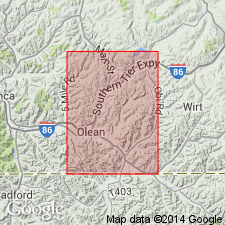
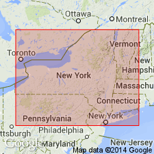
- Areal extent
- Dominant lithology:
-
- Sandstone
- AAPG geologic province:
-
- Appalachian basin
Summary:
Pg. 524-528. Cuba sandstone is separated from overlying Wolf Creek conglomerate by 600 feet of beds containing common Chemung species, and rests on recognized Chemung deposits. [Age is Late Devonian.]
Source: US geologic names lexicon (USGS Bull. 896, p. 551-552).

- Usage in publication:
-
- Cuba sandstone
- Modifications:
-
- Areal extent
- Dominant lithology:
-
- Sandstone
- AAPG geologic province:
-
- Appalachian basin
Summary:
Pg. 25. Cuba sandstone lies near middle of Chemung beds in Cattaraugus and Allegany Counties, [western New York]. [Age is Late Devonian.]
Source: US geologic names lexicon (USGS Bull. 896, p. 551-552).
- Usage in publication:
-
- Cuba sandstone lentil
- Modifications:
-
- Principal reference
- Dominant lithology:
-
- Sandstone
- AAPG geologic province:
-
- Appalachian basin
Summary:
Pg. 968. Cuba sandstone lentil. Medium- to coarse-grained, somewhat arkosic sandstone, usually light cream colored. Thickness 10 to 15 feet. Exposed in quarry a few rods east of Erie depot at Cuba, Allegany County, [western New York]. Included in Chemung beds, about 40 feet above their base in Olean and Salamanca quadrangles. [Age is Late Devonian.]
Source: US geologic names lexicon (USGS Bull. 896, p. 551-552).

- Usage in publication:
-
- Cuba sandstone
- Modifications:
-
- Areal extent
- Dominant lithology:
-
- Sandstone
- AAPG geologic province:
-
- Appalachian basin
Summary:
Pg. 69. Cuba sandstone lies stratigraphically below Girard shale and above Northeast shale. [Age is Late Devonian.]
Source: US geologic names lexicon (USGS Bull. 896, p. 551-552).

- Usage in publication:
-
- Cuba sandstone
- Modifications:
-
- Areal extent
- Dominant lithology:
-
- Sandstone
- AAPG geologic province:
-
- Appalachian basin
Summary:
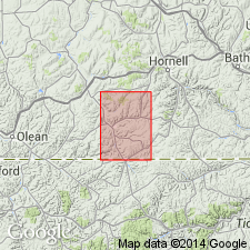
Pg. 152-153. Cuba sandstone is a most important horizon marker; easily traced up Ischua Creek to near Machias [Cattaraugus County, western New York], where name Ischua sandstone was early appropriated to it by Horseford. [Gives same stratigraphic position as in 1923, and repeated it in 1925 (GSA Bull., v. 36, p. 464).]
Source: US geologic names lexicon (USGS Bull. 896, p. 551-552).

- Usage in publication:
-
- Cuba sandstone
- Modifications:
-
- Biostratigraphic dating
- AAPG geologic province:
-
- Appalachian basin
Summary:
Pg. 369. Placed Cuba sandstone between Chadakoin (above) and Northeast shale (below) and included them all in Chemung. She stated: Cuba sandstone carries SPRIRIFER DISJUNTUS fauna and marks upper limit of SPIRIFER (DELTHYRIS) MESACOSTALIS in New York. Thickness 10 to 15 feet. [Age is Late Devonian.]
Source: US geologic names lexicon (USGS Bull. 896, p. 551-552).
- Usage in publication:
-
- Cuba sandstone
- Modifications:
-
- Areal extent
- Dominant lithology:
-
- Sandstone
- AAPG geologic province:
-
- Appalachian basin
Summary:
[Stratigraphic position and names of underlying and overlying formations changed.]
Pg. 71. Restudy of Upper Devonian correlation problems in southwestern New York indicates a discrepancy in thicknesses along Genessee River and at Lake Erie of beds formerly supposed to be identical, which may require some further examination in field before publication of map. Former revisions may not have gone far enough in their departure from old ideas. The beds involved are only those above Dunkirk black shale, whose continuity with Canaseraga sandstones above the Wiscoy shale has been amply corroborated. It now seems likely, however, that the Cuba sandstone, 835 feet above the Dunkirk along Genesee River, goes below, instead of above, Northeast shales at Lake Erie, whose base there is 526 feet above the Dunkirk, and their top, 1,001 feet. With the known westward thinning of all these Upper Devonian strata, generally to above 98.52 percent a mile northwest, which would bring the Cuba top down to 484 feet above the Dunkirk, the Cuba seems likely to connect with Shumla sandstone, and the Northeast to embrace all beds above it, perhaps including the Cattaraugus. Consequently it becomes desirable to introduce local names for two of these members on the Genesee-Olean meridian, namely, Cadis beds for the supposed "Volusia" between the Cuba and the Hinsdale sandstones, and Haymaker beds for those formerly taken for the Chadakoin, between HInsdale ("quarry") sandstone and Wolf Creek conglomerate. The succession thus becomes Cuba, Cadiz, Hinsdale, Haymaker. In any event, it grows increasingly clearer that there are no Mississippian strata in New York.
Source: US geologic names lexicon (USGS Bull. 896, p. 551-552, Northeast entry p. 1511-1512).
- Usage in publication:
-
- Cuba formation
- Modifications:
-
- Areal extent
- AAPG geologic province:
-
- Appalachian basin
Summary:
Pg. 14, 16-18, 23-27. Referred to as Cuba formation in Canadaway group. Thickness about 40 feet in Wellsville quadrangle. Overlies Machias formation; underlies Wellsville formation (new) of Conneaut group. [Age is Late Devonian.]
Source: US geologic names lexicon (USGS Bull. 1200, p. 1000).
- Usage in publication:
-
- Cuba member
- Modifications:
-
- Revised
- AAPG geologic province:
-
- Appalachian basin
Summary:
Pg. 10 (fig. 1), 12-14. Rank reduced to member status in Canadaway formation. [Age is Late Devonian.]
Source: US geologic names lexicon (USGS Bull. 1200, p. 1000).

- Usage in publication:
-
- "Cuba sandstone"
- Modifications:
-
- Revised
- AAPG geologic province:
-
- Appalachian basin
Summary:
Pl. 3. "Cuba sandstone." [Shown on correlation chart at/or near boundary between Canadaway Group and overlying Conneaut Group. At present (ca. 2010), some New York geologists consider Cuba Sandstone basal formation of Conneaut Group and others top formation of Canadaway Group. Age is Late Devonian (Famennian).]
Source: Publication; GNC notation.
For more information, please contact Nancy Stamm, Geologic Names Committee Secretary.
Asterisk (*) indicates published by U.S. Geological Survey authors.
"No current usage" (†) implies that a name has been abandoned or has fallen into disuse. Former usage and, if known, replacement name given in parentheses ( ).
Slash (/) indicates name conflicts with nomenclatural guidelines (CSN, 1933; ACSN, 1961, 1970; NACSN, 1983, 2005, 2021). May be explained within brackets ([ ]).