

- Usage in publication:
-
- Crooks Gap Conglomerate*
- Modifications:
-
- Named
- Dominant lithology:
-
- Conglomerate
- AAPG geologic province:
-
- Wind River basin
Summary:
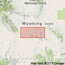
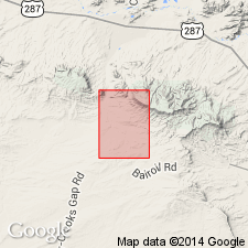
Named for exposures on both sides of Crooks Gap, T28N, Rs93 and 94W, Fremont Co, WY in Wind River basin which is the type locality. Consists largely of giant granite boulders embedded in pink to gray arkosic sandstone and siltstone. Pink color predominates, particularly in upper part. Size of boulders phenomenal (30x16x10 ft; 40x25x20 ft). Is present in Crooks Mountain-Green Mountain area, and along east margin of Great Divide basin. Estimated to be 1,500 ft thick on Green Mountain. Deposited as a fan in front of a Precambrian granite mass across truncated edges of the Wasatch and Battle Spring Formations, and rocks as old as Cody Shale on the west. Unfossiliferous. Maybe equivalent of Cathedral Bluffs Tongue of Wasatch Formation. Lower part may be equivalent of Lost Cabin Member of Wind River Formation. All correlations suggestive of latest early and perhaps early middle Eocene age. Geologic map. Cross sections.
Source: GNU records (USGS DDS-6; Denver GNULEX).
- Usage in publication:
-
- Crooks Gap Conglomerate*
- Modifications:
-
- Overview
- AAPG geologic province:
-
- Wind River basin
Summary:
Correlated with the upper part of the Battle Spring Formation. Divisible into: unit 1, at base, a 215 to 260 m thick yellow-gray arkose and conglomeratic arkose interbedded with giant (1+ m) boulder conglomerate (boulders are granite, gneissic granite, quartzo-feldspathic rock, quartzite of Flathead Sandstone, and Precambrian diabase); unit 2, a 185 m thick gray-white arkose, conglomeratic arkose, and conglomerate; unit 3, a 185 m thick green, gray conglomeratic arkose and giant boulder conglomerate (boulders are of granite, gneissic granite, quartzo-feldspathic rock, and diabase). Units 1 and 2 occur on flanks of Green Mountain in Ts27 and 28N, R92W; unit 1 is on Crooks Peak, sec 30, T28N, R92W, and unit 3 is on top of Green Mountain, Fremont Co, WY in the Wind River basin. Lies with angular unconformity on lower part of Battle Spring Formation. Of early and middle Eocene age.
Source: GNU records (USGS DDS-6; Denver GNULEX).
For more information, please contact Nancy Stamm, Geologic Names Committee Secretary.
Asterisk (*) indicates published by U.S. Geological Survey authors.
"No current usage" (†) implies that a name has been abandoned or has fallen into disuse. Former usage and, if known, replacement name given in parentheses ( ).
Slash (/) indicates name conflicts with nomenclatural guidelines (CSN, 1933; ACSN, 1961, 1970; NACSN, 1983, 2005, 2021). May be explained within brackets ([ ]).