

- Usage in publication:
-
- Crab Lake Member
- Modifications:
-
- Principal reference
- Dominant lithology:
-
- Till
- Sand
- Silt
- Clay
- AAPG geologic province:
-
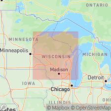
- Wisconsin arch
Summary:
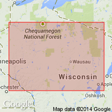
Pg. vi (chart), 53-56. Crab Lake Member of Copper Falls Formation. (Follows the informal usage of Attig and others, 1985, GSA Bull., v. 96, 1585-1593; Attig, 1985, Wisconsin Geol. Nat. Hist. Survey Inf. Circ., no. 50; Attig, 1984, Univ. Wisconsin PhD dissert.) Mostly till, with associated supraglacial debris-flow sediment and stream sediment. Is a reddish-brown, slightly gravelly sandy loam. Pebble fabric strongly developed; long axes oriented parallel to ice flow (north-south) and plunge upglacier (north). Maximum thickness 8.5 m; typically 1 to 3 m. Is the surface unit in and north of Winegar moraine, Vilas and Iron Counties, northern Wisconsin. Overlies Nashville Member of Copper Falls Formation in places. Equivalent to informal Morse till of Clayton, 1985 (Wisconsin Geol. Nat. Hist. Survey Inf. Circ., no. 46, 40 p.), and to sediment in Winegar moraine of Michigan, as described by Peterson, 1982 (USGS Open-File Rpt. 82-301, 18 p.). Interpreted as having been deposited by advance of Ontonagon Lobe in northern Wisconsin about 13,000 to 12,000 yr B.P. (Pleistocene; late Wisconsinan).
Type section: roadcut (fresh in 1981) on east side of Crab Lake Road, about 75 m south of County Trunk Highway B, [about 1 mi southeast of village of Presque Isle], in NW/4 NW/4 NW/4 sec. 2, T. 43 N., R. 6 E., [approx. Lat. 46 deg. 14 min. 27 sec. N., Long. 89 deg. 43 min. 15 sec. W.], Presque Isle quadrangle, Vilas Co., northern WI.
Named from Crab Lake, Vilas Co., northern WI; name credited to John W. Attig.
Reference section: in (fresh face, 1981) small gravel pit on west side of dirt road, 0.6 mi (1 km) northwest of intersection of Helen Creek and County Trunk Highway B, in NE/4 SE/4 NW/4 sec. 19, T. 43 N., R. 9 E., [approx. Lat. 46 deg. 11 min. 40 sec. N., Long. 89 deg. 25 min. 12 sec. W.], Thousand Island Lake 7.5-min quadrangle, Vilas Co., northern WI.
[Additional locality information from Syverson and others, 2011, Wisconsin lexicon of Pleistocene units, Wisconsin Geol. Nat. Hist. Survey Tech. Rpt., no. 1; supplemented from USGS historical topographic map collection TopoView and Wisconsin Highways, www.wisconsinhighways.org; accessed on June 9, 2018.]
Source: Publication.
- Usage in publication:
-
- Crab Lake Member
- Modifications:
-
- Overview
- AAPG geologic province:
-
- Wisconsin arch
Summary:
[Not synopsized to date. Lithology, thickness, distinguishing characteristics, contacts, sections, areal extent, age, correlations discussed.]
Pg. 4 (fig. 2), 7 (fig. 3), 8, 83-84. Crab Lake Member of Copper Falls Formation.
Source: NA
For more information, please contact Nancy Stamm, Geologic Names Committee Secretary.
Asterisk (*) indicates published by U.S. Geological Survey authors.
"No current usage" (†) implies that a name has been abandoned or has fallen into disuse. Former usage and, if known, replacement name given in parentheses ( ).
Slash (/) indicates name conflicts with nomenclatural guidelines (CSN, 1933; ACSN, 1961, 1970; NACSN, 1983, 2005, 2021). May be explained within brackets ([ ]).