The National Geologic Map Database is migrating to a new infrastructure. We apologize for any service disruptions during this process.
|
|---|


- Usage in publication:
-
- Cooper marl
- Modifications:
-
- Named
- Dominant lithology:
-
- Marl
- AAPG geologic province:
-
- Atlantic Coast basin
Summary:
Pg. 162-169, 190, 211. Ashley and Cooper beds, the newest Eocene beds of the State. The marl of these beds is characterized by its dark-gray color and granular texture, while the remains of fishes and Mammalia give its fossil remains a peculiar character and leave no doubt of the position assigned to it, at the top of the Eocene series. These, together with the Santee beds must amount, at least, to a thickness of 600 or 700 feet. Overlie Coralline marl (Eocene) and unconformably underlie Pliocene [Miocene]. Exposed along Ashley and Cooper Rivers, South Carolina. [In text of above report, the beds along Ashley River are called Ashley marl and Ashley beds (p. 162, 164) and the beds along Cooper River are called Ashley and Cooper beds and (p. 139) Cooper River marls. Page 165 states that many of the fossils of the Ashley are found on the Cooper.]
Source: US geologic names lexicon (USGS Bull. 896, p. 512).
- Usage in publication:
-
- Cooper marl*
- Modifications:
-
- Areal extent
- AAPG geologic province:
-
- South GA-North FL sedimentary province
Summary:
Cooper Marl geographically extended into GA where thickness is about 33 ft. Thickness in SC is 76 ft. Unconformably underlies Flint River formation; overlies Ocala formation with apparent conformity. Contact with Barnwell formation not observed, but presumably is younger than Sandersville member (new) and perhaps conformable with it.
Source: GNU records (USGS DDS-6; Reston GNULEX).
- Usage in publication:
-
- Cooper marl*
- Modifications:
-
- Age modified
- Biostratigraphic dating
- AAPG geologic province:
-
- Atlantic Coast basin
Summary:
Cooper marl, currently referred to late Eocene (Jacksonian), is reassigned to early Oligocene(?) on basis of its mollusks, foraminifers, and cetaceans. In some areas, unconformably overlies Castle Hayne limestone.
Source: GNU records (USGS DDS-6; Reston GNULEX).
- Usage in publication:
-
- Cooper marl*
- Modifications:
-
- Overview
- AAPG geologic province:
-
- Atlantic Coast basin
Summary:
Cooper marl, oldest exposed formation in Charleston phosphate area, SC, is a soft, very fine grained, impure carbonate deposit. Dips southward from 8 to 14 ft per mi and overlies beds of Eocene age upturned on the north. Thickness 200 ft near Charleston. Thins and pinches out 20 mi north. Thickens southwestward to at least 280 ft. Unconformably underlies Ladson formation (new). In others areas, underlies Duplin marl, unnamed lower Miocene(?) sandy limestone, or Hawthorn(?) formation. Paleontologic evidence indicates that Cooper marl is of Oligocene age, basal beds exposed inland at Harleyville being early Oligocene and higher beds nearer the coast late Oligocene.
Source: GNU records (USGS DDS-6; Reston GNULEX).
- Usage in publication:
-
- Cooper Group*
- Modifications:
-
- Revised
- AAPG geologic province:
-
- Atlantic Coast basin
Summary:
Cooper Formation raised to Group rank and its Harleyville, Parkers Ferry, and Ashley Members raised to Formations. Only the Ashley forms natural outcrops in this quadrangle. The Parkers Ferry is only in the subsurface, and the Harleyville is absent in this quad.
Source: GNU records (USGS DDS-6; Reston GNULEX).
- Usage in publication:
-
- Cooper Formation*
- Modifications:
-
- Revised
- AAPG geologic province:
-
- Atlantic Coast basin
Summary:
In this discussion of the Clubhouse Crossroads Corehole #1, Cooper Formation and its Harleyville, Parkers Ferry, and Ashley Members are used to conform with previous usage. Lower Oligocene (Rupelian) age strata are missing at the CCC # 1 because it lies in the Gulf Trough channel, an area swept by strong currents that inhibited deposition during the Rupelian. Rupelian age deposits are present in the Cooper nearby at Bohicket Creek.
Source: GNU records (USGS DDS-6; Reston GNULEX).
- Usage in publication:
-
- Cooper Formation
- Modifications:
-
- Areal extent
- AAPG geologic province:
-
- Atlantic Coast basin
Summary:
Cooper Formation is here restricted in GA to the continental shelf area. Unit extends from the Holly Hill and Charleston area of SC, southward on the continental shelf to offshore southeastern GA. Age ranges from late Eocene (late Jacksonian) to early Miocene (Aquitanian). The upper part of the Cooper grades laterally westward into the lower part of the Parachucla Formation (Hawthorne Group), specifically the Tiger Leap Member (new name); the early Oligocene portion in the northern coastal area grades laterally into the Lazaretto Creek Formation or the Suwanee Limestone while elsewhere all of the Oligocene appears to thin westward and pinch out; the lower (late Eocene) portion grades laterally into the Crystal River Formation of the Ocala Group. The Cooper underlies the Berryville Clay Member (new name) of the Coosawatchee Formation.
Source: GNU records (USGS DDS-6; Reston GNULEX).
- Usage in publication:
-
- Cooper Formation
- Modifications:
-
- Areal extent
- AAPG geologic province:
-
- South Georgia sedimentary province
Summary:
Cooper Formation is restricted to the continental shelf in the GA area and consists of massive and structureless generally unconsolidated, finely to very finely granular and even-textured, microfossiliferous, variably argillaceous limestone. In GA, the Cooper is present only under the continental shelf and ranges in age from late Eocene (late Jacksonian) to early Miocene (Aquitanian). Only the Oligocene portion of the formation is described in this report. The Oligocene component occurs in the interval from approximately 289 ft to 508 ft in the core AMCOR 6002 and can be divided into three parts: a lower Vicksburgian component, an uppermost Vicksburgian component, and a Chickasawhayan component. The lower Vicksburgian part is slightly phosphatic and glauconitic and is largely a foraminiferal coquina to foraminiferal coquinoid "marl" with conspicuous bioclastics. The upper-most Vicksburgian is equivalent to the Bucatunna Clay and Okapilco Limestone (new) interval. This portion consists of an argillaceous phosphatic limestone or "marl" with gypsum bloom and scattered fine to very fine quartz sand. The Chickasawhayan portion consists for the most part of typical Cooper "marl" though one sample consists of light olive gray silty, calcareous, phosphatic foraminiferal clay and another of olive gray calcareous, phosphatic clayey sand with phosphate pebbles. Stratigraphic relationships with the GA onshore Oligocene section are uncertain, but the lower Vicksburgian component appears to grade laterally westward into the Lazaretto Creek Formation (new).
Source: GNU records (USGS DDS-6; Reston GNULEX).
- Usage in publication:
-
- Cooper Group*
- Modifications:
-
- Mapped 1:100k
- Dominant lithology:
-
- Not stated
- AAPG geologic province:
-
- Atlantic Coast basin
Summary:
Pg. 9-10, 14, 21, geol. map. Cooper Group (of Weems and Lemon, 1984), undivided. Confined to subsurface of eastern part of Barnwell sheet. One exposure in small strip mine (Kirkland pit) near Clear Pond, South Carolina, where group is 11.5 m (38 feet) thick. Strata probably correlates with Parkers Ferry Formation, based on paleontological data (Hazel and others, 1977, USGS Prof. Paper 1028) from eastern South Carolina, and lithologic descriptions of Weems and Lemon (1984). Age is late Eocene, based on fossils (dinoflagellates identified by L.E. Edwards, USGS, written commun., 1985).
Strip mine (Kirkland pit) located just north of junction of SC Route S-5-41 and Little Salkehatchie River west of Clear Pond, SC, Lat. 33 deg. 11 min. 41 sec. N., Long. 81 deg. 06 min. 36 sec. W.
Source: Publication.
- Usage in publication:
-
- Cooper Group
- Modifications:
-
- Revised
- Age modified locally
- Dominant lithology:
-
- Calcarenite
- Calcisiltite
- Calcilutite
- AAPG geologic province:
-
- Atlantic Coast basin
Weems, R.E., Albright, L.B., III, Bybell, L.M., Cicimurri, D.J., Edwards, L.E., Harris, W.B., Lewis, W.C., Osborne, J.E., Sanders, A.E., and Self-Trail, J.M., 2016, Stratigraphic revision of the Cooper Group and the Chandler Bridge and Edisto Formations in the Coastal Plain of South Carolina: South Carolina Geology, v. 49, p. 1-24.
Summary:
Pg. 3 (fig. 2), 4, 5-6, 7 (fig. 4), 21 (tbl. 6, fig. 13). Cooper Group. Consists of (descending): Ashley, Harleyville, and Parkers Ferry Formations; separated by unconformities. Ashley Formation restricted to beds of early Oligocene (late Rupelian) age locally; uppermost 20+ feet (upper Oligocene) reallocated to unconformably overlying Edisto Formation [intervening Chandler Bridge Formation is absent]. Subdivided into (descending): Givhans Ferry, Runnymede, and Gettysville Members (all new). Harleyville Formation is considered younger than Parkers Ferry Formation, not older, as previously thought. In subsurface, the Harleyville is assigned to beds previously informally called Drayton limestone (Weems and others, 1987, USGS Open-file Rpt. 87-661) and Drayton limestone beds (Weems and Lemon, 1996, USGS Misc. Inv. Ser. Map I-2491). Subdivided into (descending): /Drayton and Osborn Members (both new). Parkers Ferry is basal formation of Cooper Group. Beds below the Parkers Ferry, previously assigned to the Harleyville Formation or to Crow Member of Santee Limestone, are reallocated to /Pregnall Member of Tupelo Bay Formation. Fossils. In study area, age of Cooper Group is late Eocene and early Oligcoene (middle and late Priabonian, and late Rupelian) based on microfossil determinations.
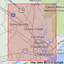
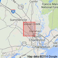
Study area: Clubhouse Crossroads and Osborn 7.5-min quadrangles, Dorchester and Charleston Cos., southern SC.
Source: Publication.
For more information, please contact Nancy Stamm, Geologic Names Committee Secretary.
Asterisk (*) indicates published by U.S. Geological Survey authors.
"No current usage" (†) implies that a name has been abandoned or has fallen into disuse. Former usage and, if known, replacement name given in parentheses ( ).
Slash (/) indicates name conflicts with nomenclatural guidelines (CSN, 1933; ACSN, 1961, 1970; NACSN, 1983, 2005, 2021). May be explained within brackets ([ ]).