- Usage in publication:
-
- Cooper Arroyo Sandstone Member*
- Modifications:
-
- Named
- Dominant lithology:
-
- Sandstone
- AAPG geologic province:
-
- San Juan basin
Summary:
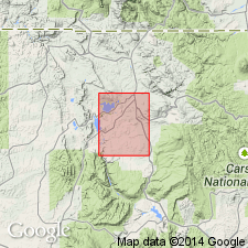
Named as a member of Mancos Shale. Type section designated as outcrops beginning about 650 ft south of Cooper Arroyo and 1400 ft west of east boundary of quadrangle, Rio Arriba Co, NM in the San Juan basin. These outcrops extend as a low cuesta ridge southwest from type for about 2 mi. Made a formal term because of its distinctive lithologic character. Type section is on Tierra Amarilla Grant, 3000 ft S 10 deg W of road intersection at BM 6966 which is 3600 ft south of NM Hwy 112, and 500 ft west of east border of Boulder Lake quad. Is 2 ft 8 1/2 in at type where it overlies lower part of middle shale unit of Mancos and underlies upper part of middle shale unit of Mancos. Composed of medium-grained, glauconitic sandstone at base and coarse-grained, glauconitic sandstone at top. Upper and lower surfaces of some of the beds are ripple bedded. Some small, black dense siliceous pebbles up to 1/2 in diameter. Has a fauna of early Niobrara age (INOCERAMUS ERECTUS, PLACENTICERAS sp., OSTREA CONGESTA, fish teeth). Of Late Cretaceous age. Measured section.
Source: GNU records (USGS DDS-6; Denver GNULEX).
For more information, please contact Nancy Stamm, Geologic Names Committee Secretary.
Asterisk (*) indicates published by U.S. Geological Survey authors.
"No current usage" (†) implies that a name has been abandoned or has fallen into disuse. Former usage and, if known, replacement name given in parentheses ( ).
Slash (/) indicates name conflicts with nomenclatural guidelines (CSN, 1933; ACSN, 1961, 1970; NACSN, 1983, 2005, 2021). May be explained within brackets ([ ]).

