The National Geologic Map Database is migrating to a new infrastructure. We apologize for any service disruptions during this process.
|
|---|


- Usage in publication:
-
- Cook's Mountain series
- Modifications:
-
- Original reference
- Dominant lithology:
-
- Greensand
- AAPG geologic province:
-
- East Texas basin
Summary:
Pg. 54-57. Cook's Mountain series. Extensive series of marine beds, prevailingly greensands, but including greensand marls, altered greensand with thin strata of carbonate of iron, indurated altered fossiliferous greensand, green fossiliferous clays, glauconitic sandstones and clays, stratified black and gray sandy clays, brown fossiliferous sands, black or yellow clays with limy concretions, and occasionally local deposits of black sand with gypsum crystals. Thickness 390 feet. Underlies Yegua division and overlies Mount Selman division. [Age is middle Eocene.]
[Named from Cook Mountain, Houston Co., eastern TX.]
Source: US geologic names lexicon (USGS Bull. 896, p. 510).

- Usage in publication:
-
- Cook Mountain formation*
- Modifications:
-
- Overview
- AAPG geologic province:
-
- Arkla basin
- East Texas basin
- Gulf Coast basin
- Mid-Gulf Coast basin
Summary:
Cook Mountain formation of Claiborne group. Recognized in southern and eastern Texas and northwestern Louisiana. Age is middle Eocene.
Sparta sand was for many years treated as basal member of Cook Mountain formation, but it is now treated as a distinct formation.
Named from Cook Mountain, Houston Co., eastern TX.
Source: US geologic names lexicon (USGS Bull. 896, p. 510).
- Usage in publication:
-
- Cook Mountain formation
- Modifications:
-
- Revised
- AAPG geologic province:
-
- Arkla basin
Summary:
Pg. 84-110. Cook Mountain formation of Claiborne group. In Caldwell and Winn Parishes, northwestern Louisiana, divided into (ascending) Dodson (new), Milams, Saline Bayou, and Little Natches (new) members. Thickness 99 to 185 feet. Overlies Sparta sand; underlies Cockfield formation. [Age is middle Eocene.]
Source: US geologic names lexicon (USGS Bull. 1200, p. 924-925).
- Usage in publication:
-
- Cook Mountain formation
- Modifications:
-
- Revised
- AAPG geologic province:
-
- East Texas basin
Summary:
Pg. 1663-1676. Cook Mountain formation replaces term Crockett formation. Name Cook Mountain believed to be preferable because of more extensive usage in Texas and Louisiana. Wheelock marl, Landrum shale, Spiller sand, and Mount Tabor shale, previously defined as members of Crockett, are here reallocated to Cook Mountain formation. [Age is middle Eocene.]
Source: US geologic names lexicon (USGS Bull. 1200, p. 924-925).
- Usage in publication:
-
- Cook Mountain formation
- Modifications:
-
- Revised
Summary:
Pg. 259 (fig. 2), 261-263. Cook Mountain formation. In south Texas, divided into (ascending) Garceno sandstone, Veleno, and Falcon sandstone members (all new). Thickness 1,700 feet. Overlies Mount Selman formation; underlies La Perla shale member (new) of Yegua formation. [Age is middle Eocene.]
Source: US geologic names lexicon (USGS Bull. 1200, p. 924-925).
- Usage in publication:
-
- Cook Mountain Formation
- Modifications:
-
- Mapped
Summary:
Cook Mountain formation of Claiborne group. As mapped, overlies Sparta sand and underlies Cockfield formation. [Age is middle Eocene.]
Source: US geologic names lexicon (USGS Bull. 1200, p. 924-925).
- Usage in publication:
-
- Cook Mountain formation*
- Modifications:
-
- Revised
- AAPG geologic province:
-
- Mid-Gulf Coast basin
Summary:
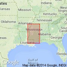
Cook Mountain formation of Claiborne group. Correlation chart shows that Cook Mountain in Mississippi includes (ascending) Archusa marl, Potterchitto sand, and Gordon Creek shale members. Overlies Sparta sand; underlies Cockfield formation. Mississippi Geological Survey uses Wautubbee formation instead of Cook Mountain and Kosciusko sand instead of Sparta sand. [Age is middle Eocene.]
Source: US geologic names lexicon (USGS Bull. 1200, p. 924-925).
- Usage in publication:
-
- Cook Mountain Formation*
- Modifications:
-
- Areal extent
- AAPG geologic province:
-
- Gulf Coast basin
Summary:
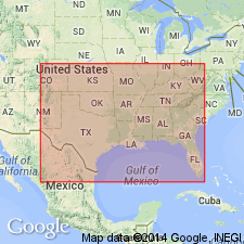
Pg. D2, D4 (table 1), D20-D21. Cook Mountain Formation of Claiborne Group. Geographically restricted to Texas Coastal Plain north of Frio River. Consists chiefly of marine clays with a few beds of fine sand. Thickness 125 to 450 feet. Overlies Sparta Sand and underlies Yegua Formation, both of Claiborne. South of the Frio River, in the Rio Grande embayment, beds previously called Cook Mountain are assigned to Laredo Formation of Claiborne. Age is middle Eocene.
Source: Publication; Changes in stratigraphic nomenclature, 1968 (USGS Bull. 1294-A, p. A6).

- Usage in publication:
-
- Cook Mountain Formation
- Modifications:
-
- Mapped 1:250k
- Dominant lithology:
-
- Clay
- Sand
- Marl
- Limestone
- AAPG geologic province:
-
- Gulf Coast basin
- East Texas basin
Summary:
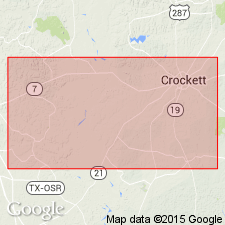
Cook Mountain Formation. From top down includes Mount Tabor, Spiller, Landrum, and Wheelock Members (not separately mapped). Thickness about 300 feet. Lies above Stone City Formation and below Yegua Formation. Age is Eocene.
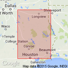
Mapped in southeastern corner of map sheet in Madison and Leon Cos., eastern TX.
Source: Publication.

- Usage in publication:
-
- Cook Mountain Formation
- Modifications:
-
- Mapped 1:250k
- Dominant lithology:
-
- Clay
- Sandstone
- AAPG geologic province:
-
- Gulf Coast basin
Summary:
Cook Mountain Formation. Clay and sandstone; clay, gypsiferous, slightly silty and lignitic, minor glauconite, brown to brownish gray, weathers brownish gray to yellowish gray; sandstone, very fine-grained, calcareous, glauconitic, gray to yellowish brown; marine megafossils and microfossils abundant. Thickness 200 to 230 feet. Overlies Sparta Sand (Eocene); underlies Yegua Formation (Eocene). Age is Eocene.
Mapped in Wilson, Gonzales, Fayette, and Bastrop Cos., southeastern TX.
Source: Modified from GNU records (USGS DDS-6; Denver GNULEX).

- Usage in publication:
-
- Cook Mountain Formation
- Modifications:
-
- Mapped 1:250k
- Dominant lithology:
-
- Clay
- Sandstone
- AAPG geologic province:
-
- Gulf Coast basin
Summary:
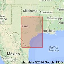
Cook Mountain Formation. Clay and sandstone; clay, gypsiferous, slightly silty and lignitic, minor glauconite, brown to brownish gray, weathers brownish gray to yellowish gray; sandstone, near top and at base, very fine-grained, calcareous, glauconitic, gray to yellowish brown; marine megafossils and microfossils abundant. Thickness about 200 to 350 feet. Correlative with upper part of Laredo Formation mapped southwest of Frio River. Lies above Sparta Sand and below Yegua Formation. Age is Eocene.
[Mapped northeast of Frio River, in Frio and Atascosa Cos., southern TX.]
Source: Publication.

- Usage in publication:
-
- Cook Mountain Formation
- Modifications:
-
- Mapped 1:250k
- Dominant lithology:
-
- Clay
- Sandstone
- AAPG geologic province:
-
- Gulf Coast basin
Summary:
Pamphlet [p. 2]. Cook Mountain Formation. Clay and sandstone; clay, gypsiferous, slightly silty and lignitic, minor glauconite, brown to brownish-gray, weathers brownish-gray to yellowish-gray; sandstone near top and at base, very fine-grained, calcareous, glauconitic, gray to yellowish-brown, marine megafossils and microfossils abundant. Thickness about 230 feet. Overlies Sparta Sand; underlies Yegua Formation. Age is Eocene.
[Mapped in southeasternmost corner of map sheet, in Atascosa and Wilson Cos., southern TX.]
Source: Publication.
- Usage in publication:
-
- Cook Mountain Formation
- Modifications:
-
- Areal extent
- AAPG geologic province:
-
- Mid-Gulf Coast basin
Summary:
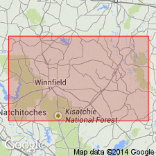
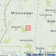
The Cook Mountain Formation is best exposed in Newton Co., MS, on the south side of I-20 at the Newton exit, in NW1/4NE1/4 sec. 26, T6N, R11E. Varies in thickness in the subsurface, from 47 ft to 135 ft. Thickens downdip. Mapped as a single unit, but two members discussed in text: Potterchitto and Gordon Creek Shale. Basal Archusa Marl Member is not recognized in Newton Co., either at the surface or in the subsurface. Disconformably overlies the Kosciusko Formation and conformably underlies the Cockfield Formation. Age is middle Eocene. Geologic map. Measured section. Stratigraphic column.
Source: GNU records (USGS DDS-6; Reston GNULEX).
For more information, please contact Nancy Stamm, Geologic Names Committee Secretary.
Asterisk (*) indicates published by U.S. Geological Survey authors.
"No current usage" (†) implies that a name has been abandoned or has fallen into disuse. Former usage and, if known, replacement name given in parentheses ( ).
Slash (/) indicates name conflicts with nomenclatural guidelines (CSN, 1933; ACSN, 1961, 1970; NACSN, 1983, 2005, 2021). May be explained within brackets ([ ]).