

- Usage in publication:
-
- Conover Ranch Formation*
- Modifications:
-
- Overview
- AAPG geologic province:
-
- Montana folded belt
Summary:
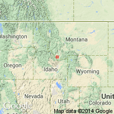
Is a new name for Upper Mississippian and Lower Pennsylvanian rocks in Snowcrest Range Group in Beaverhead Co, MT, Montana folded belt province, previously assigned to Amsden Formation in southwest MT. Represents increased terrigenous deposition at the craton margin. Composite section. Correlation chart.
Source: GNU records (USGS DDS-6; Denver GNULEX).
- Usage in publication:
-
- Conover Ranch Formation*
- Modifications:
-
- Original reference
- Dominant lithology:
-
- Sandstone
- Siltstone
- Conglomerate
- Claystone
- Mudstone
- AAPG geologic province:
-
- Montana folded belt
Summary:
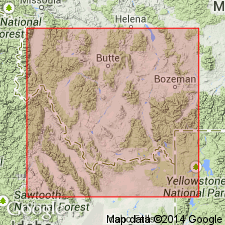
Conover Ranch Formation of Snowcrest Range Group. Rocks previously assigned to the Amsden Formation in southwest Montana are here named the Conover Ranch Formation, the upper formation of the Snowcrest Range Group (new name), in the Tendoy Mountains, Blacktail Mountains, Snowcrest Range, Elkhorn-Boulder Mountains, Tobacco Root Range, and parts of the Gravelly Range and Pioneer Mountains, Montana. Consists of pale-reddish-brown to pale-reddish-purple mudstone containing thin-bedded marine limestone, calcareous sandstone and siltstone, and, locally, carbonate conglomerate, phosphatic claystone, mottled or nodular calcareous mudstone, and recrystallized grainstone. Overlies the Lombard Limestone (new name) of the Snowcrest Range Group; underlies and intertongues with the Quadrant Sandstone. Is equivalent to part of the Tyler Formation, part of the Alaska Bench Limestone of the Amsden Group in central Montana, and part of the Bluebird Mountain Formation in east-central Idaho. Is laterally equivalent to the uppermost part of the Lombard and the lowermost part of the Quadrant. Thickness at the type section is 30.6 m and ranges from 0 to 33 m. Age is commonly Late Mississippian (late Chesterian) (Mamet Foraminifer Zone 19, Sando and Bamber Coral Zone VI), but is Early Pennsylvanian (early Morrowan) along the Jefferson River, where it includes the Mississippian-Pennsylvanian boundary.
Type section: exposure 122 m uphill from the northwest bank of Sheep Creek, Conover Ranch, Blacktail Mountains, in NE/4 NW/4 sec. 18, T. 9 S., R. 8 W., Gallagher Mountain 7.5-min quadrangle, Beaverhead Co., MT.
Source: US geologic names lexicon (USGS Bull. 1565, p. 71-72).
- Usage in publication:
-
- Conover Ranch Formation*
- Modifications:
-
- Areal extent
- AAPG geologic province:
-
- Montana folded belt
Summary:
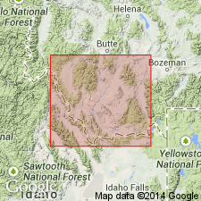
Extended into Badger Pass area of Badger Ridge in Pioneer Mountains, Beaverhead Co, MT, Montana folded belt province. Replaces Amsden Formation which is not used in this area. Thickness is at least 100 ft; base is not exposed. Grades upward into overlying Quadrant Quartzite; overlies Lombard Limestone. Stratigraphic column. Late Mississippian and Early Pennsylvanian age.
Source: GNU records (USGS DDS-6; Denver GNULEX).
For more information, please contact Nancy Stamm, Geologic Names Committee Secretary.
Asterisk (*) indicates published by U.S. Geological Survey authors.
"No current usage" (†) implies that a name has been abandoned or has fallen into disuse. Former usage and, if known, replacement name given in parentheses ( ).
Slash (/) indicates name conflicts with nomenclatural guidelines (CSN, 1933; ACSN, 1961, 1970; NACSN, 1983, 2005, 2021). May be explained within brackets ([ ]).