The National Geologic Map Database is migrating to a new infrastructure. We apologize for any service disruptions during this process.
|
|---|


- Usage in publication:
-
- Conococheague limestone*
- Modifications:
-
- Original reference
- Dominant lithology:
-
- Limestone
- Sandstone
- AAPG geologic province:
-
- Appalachian basin
Summary:
Pg. 701-703; USGS Geol. Atlas of the US, Mercersburg-Chambersburg folio, no. 170, p. 6, 1909. Conococheague limestone. Closely banded dark-blue limestone, characterized by beds containing thin sandy laminae and quartz grains that weather into hard shale fragments and thin slabby sandstones. Base marked by siliceous beds and conglomerates of two kinds. Thickness is 1,635+/- feet. Underlies Beekmantown limestone and overlies Elbrook formation. Fossils (trilobites, brachiopods). Age is Late Cambrian (Saratogan).
Named from Conococheague Creek in Scotland, Franklin Co., central southern PA.
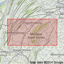
[Type section: along banks of Conococheague Creek in town of Scotland, Scotland 7.5-min quadrangle, Franklin Co., central southern PA. Extends into western MD, and northwestern VA.]
Source: Publication; US geologic names lexicon (USGS Bull. 896, p. 508).
- Usage in publication:
-
- Conococheague limestone*
- Modifications:
-
- Areal extent
- AAPG geologic province:
-
- Appalachian basin
Summary:
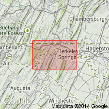
Geographically extended into MD and WV (actually, only shows up in Hancock quadrangle, WV, but must be extended through MD by default). Listed as Upper Cambrian in stratigraphic column. Thickness approximately 1250 feet.
Source: GNU records (USGS DDS-6; Reston GNULEX).
- Usage in publication:
-
- Conococheague limestone*
- Modifications:
-
- Areal extent
- AAPG geologic province:
-
- Appalachian basin
Summary:
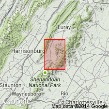
Geographically extended to VA. Overlies Elbrook dolomite; underlies Beekmantown dolomite. Same lithologic features as in type area.
Source: GNU records (USGS DDS-6; Reston GNULEX).
- Usage in publication:
-
- Conococheague limestone
- Modifications:
-
- Revised
- AAPG geologic province:
-
- Appalachian basin
Summary:
Revised lower part of formation (dolomite-orthoquartzite) as Big Spring Station Member of Conococheague Limestone.
Source: GNU records (USGS DDS-6; Reston GNULEX).
- Usage in publication:
-
- Conococheague formation*
- Modifications:
-
- Revised
- AAPG geologic province:
-
- Appalachian basin
Summary:
Placed upper 200 feet of Conococheague into a lower member of the Stonehenge limestone in type area. He believes by doing this that the contact between these formations is closer to the Cambrian-Ordovician boundary (used several fossil taxa to reach this conclusion).
Source: GNU records (USGS DDS-6; Reston GNULEX).
- Usage in publication:
-
- Conococheague limestone*
- Modifications:
-
- Areal extent
- AAPG geologic province:
-
- Appalachian basin
Summary:
Geographically extended to northeastern TN as Conococheague limestone of Knox group. Lower part coarsely crystalline black fetid dolomite that forms ledges, upper part contains four or more 1 to 2 feet thick sandstone beds associated with limestone containing crinkled argillaceous laminae or ribbons. Resembles Conococheague of Virginia. Thickness probably less than 1000 feet.
Source: GNU records (USGS DDS-6; Reston GNULEX).
- Usage in publication:
-
- Conococheague Group
- Modifications:
-
- Revised
- AAPG geologic province:
-
- Appalachian basin
Summary:
Raised Conococheague to Group rank with 3 formations: Snitz Creek Formation, Millbach Formation, and Richland Formation (lowest to highest). Snitz Creek is predominantly dolomite, Millbach is interbedded limestone and dolomite, and Richland is predominantly dolomite. Conococheague Group is shown as Upper Cambrian. Overlies the Buffalo Springs Formation; underlies Stonehenge Formation of Beekmantown Group.
Source: GNU records (USGS DDS-6; Reston GNULEX).
- Usage in publication:
-
- Conococheague Group
- Modifications:
-
- Revised
- AAPG geologic province:
-
- Appalachian basin
Summary:
Conococheague Group.
Raised to group status for eastern valley. Divided into Zullinger Formation and Shadygrove Formation (lowest to highest). Does not recognize Big Spring Station Member of previous Conococheague Formation, equivalents are in lower part of Zullinger Formation. Conococheague Group is Middle and Upper Cambrian is stratigraphic column. Overlies Elbrook Formation; underlies Stoufferstown Formation of Beekmantown Group.
Source: GNU records (USGS DDS-6; Reston GNULEX).
- Usage in publication:
-
- Conococheague Limestone*
- Modifications:
-
- Age modified
- Biostratigraphic dating
- AAPG geologic province:
-
- Appalachian basin
Summary:
Cambrian-Ordovician boundary, as approximated near the base of the conodont CORDYLODUS PROAVUS Zone (base of trilobite MISSISQUOIA Zone), is 43 meters below contact with overlying Stonehenge Limestone in northwestern Virginia. This contact may be diachronous along and across strike in the Appalachians.
Source: GNU records (USGS DDS-6; Reston GNULEX).

- Usage in publication:
-
- Conococheague Limestone*
- Modifications:
-
- Biostratigraphic dating
- AAPG geologic province:
-
- Appalachian basin
Summary:
Conodonts recovered from near the top of the Conococheague Limestone in the Winchester 30 X 60 minute quadrangle indicate that the contact between the Conococheague and the overlying Stonehenge Formation is probably within the CORDYLODUS LINDSTROMI zone. Depending on the placement of the Cambrian-Ordovician boundary, this boundary is very close to the formational contact.
Source: GNU records (USGS DDS-6; Reston GNULEX).
For more information, please contact Nancy Stamm, Geologic Names Committee Secretary.
Asterisk (*) indicates published by U.S. Geological Survey authors.
"No current usage" (†) implies that a name has been abandoned or has fallen into disuse. Former usage and, if known, replacement name given in parentheses ( ).
Slash (/) indicates name conflicts with nomenclatural guidelines (CSN, 1933; ACSN, 1961, 1970; NACSN, 1983, 2005, 2021). May be explained within brackets ([ ]).