

- Usage in publication:
-
- Conejo volcanics
- Modifications:
-
- Named
- Dominant lithology:
-
- Volcanics
- AAPG geologic province:
-
- Transverse Ranges province
Summary:
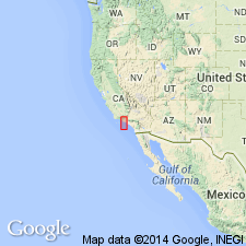
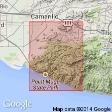
One of most important centers of Miocene volcanism in California lies in west end of Santa Monica Mountains, Ventura Co. This region often referred to as "Conejo Mountains". Name "Conejo volcanics" is here applied to all volcanic and intrusive rocks occurring in that region. These volcanic rocks and interbedded Miocene sedimentary deposits probably aggregate 15,000 ft in thickness.
Source: GNU records (USGS DDS-6; Menlo GNULEX).
- Usage in publication:
-
- Conejo volcanics
- Modifications:
-
- Overview
- AAPG geologic province:
-
- Transverse Ranges province
Summary:
Conejo volcanics is unique in that small oil field is located therein. Unit is composed of basalt flows and pyroclastics with minor basalt and andesite dikes. Overlies olivine basalt which in turn overlies Topanga formation.
Source: GNU records (USGS DDS-6; Menlo GNULEX).
- Usage in publication:
-
- Conejo volcanics
- Modifications:
-
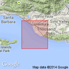
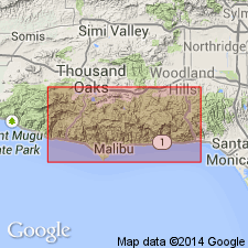
- Areal extent
- AAPG geologic province:
-
- Ventura basin
Summary:
On San Miguel Island described as 2500 ft of orange-brown to dark brown, moderately soft, massive to poorly bedded, basaltic tuffs, silts, sands, and fine breccia, andesitic flows and agglomerate in upper part in Cuyler Harbor area. On Santa Rosa Island described as 2900 ft of basaltic pyroclastics as on San Miguel Island with occasional basalt dikes, silts and flows. Near top surface are thin zones of buff, siliceous and tuffaceous shales with fossiliferous sandstones containing foraminifers. "Lower part of this formation may be Saucesian and therefore these volcanics may represent a part of Rincon" (L.E. Redwine). Overlies Rincon formation. Disconformably underlies Monterey formation.
Source: GNU records (USGS DDS-6; Menlo GNULEX).
- Usage in publication:
-
- Conejo Volcanics
- Modifications:
-
- Revised
- AAPG geologic province:
-
- Transverse Ranges province
Summary:
Mapping of Conejo Volcanics in Boney Mountains and Santa Monica Mountains may be facilitated by recognition of few characteristic members such as Boney member (of Sonnemann, 1956) and corresponding Malibu Junction member in Malibu Lake area.
Source: GNU records (USGS DDS-6; Menlo GNULEX).
- Usage in publication:
-
- Conejo Volcanics*
- Modifications:
-
- Adopted
- Age modified
- AAPG geologic province:
-
- Ventura basin
Summary:
In Ventura basin offshore area, middle Miocene Conejo Volcanics form an acoustic marker. In middle Miocene(?) time erosional surface appears to have developed on surface of Conejo Volcanics in eastern Santa Barbara basin, especially along Anacapa ridge. It appears as an irregular surface unconformably in contact with overlying Monterey Shale. However, on Santa Cruz Island, where top surface of unit is exposed, it is an irregular nonconformable surface with no evidence of erosional truncation. In Oxnard Plain area overlies Topanga (Temblor?) Formation.
Source: GNU records (USGS DDS-6; Menlo GNULEX).
- Usage in publication:
-
- Conejo Volcanics*
- Modifications:
-
- Revised
- AAPG geologic province:
-
- Transverse Ranges province
Summary:
Assigned as middle of three formations to Topanga Group. In upper plate of Malibu fault, unit is divided into three tongues which are complexly interbedded with members of Calabasas Formation. Tongues are (ascending): Ramera Canyon, Soltice Canyon, and Malibu Bowl (all new). Conejo Volcanics rests accordantly on Topanga Formation and locally on Vaqueros Formation. Age is middle Miocene on basis of stratigraphic relations, radiometric age (Turner, 1970), and sparse fauna.
Source: GNU records (USGS DDS-6; Menlo GNULEX).
For more information, please contact Nancy Stamm, Geologic Names Committee Secretary.
Asterisk (*) indicates published by U.S. Geological Survey authors.
"No current usage" (†) implies that a name has been abandoned or has fallen into disuse. Former usage and, if known, replacement name given in parentheses ( ).
Slash (/) indicates name conflicts with nomenclatural guidelines (CSN, 1933; ACSN, 1961, 1970; NACSN, 1983, 2005, 2021). May be explained within brackets ([ ]).