

- Usage in publication:
-
- Comanche Peak chalk bed
- Modifications:
-
- Original reference
- Dominant lithology:
-
- Limestone
- AAPG geologic province:
-
- Bend arch
Summary:
Pg. xiv, xvii-xix. Comanche Peak chalk bed. Persistent, fossiliferous, white chalky limestone, composing middle formation of Fredericksburg division [group]. Conformably underlies Caprina chalk and chalky limestone [Edwards limestone] and overlies EXOGYRA TEXANA beds [Walnut clay]. Age is Early Cretaceous (Comanche).
[Named from Comanche Peak, Hood Co., eastern TX. Comanche Peak limestone of Fredericksburg group adopted by the USGS, ca. 1938. See also under Fredericksburg group.]
Source: US geologic names lexicon (USGS Bull. 896, p. 498).
- Usage in publication:
-
- Comanche Peak limestone
- Modifications:
-
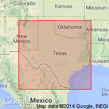
- Areal extent
Summary:
Pg. 14 (table 2), 22. Comanche Peak limestone of Fredericksburg group. Described in Comal County where it is composed chiefly of hard gray-white massive limestone; beds of marl containing EXOGYRA TEXANA Roemer present locally. Thickness 20 to 55 feet; average 40 feet. Conformably overlies Walnut Clay, similarity of beds to Walnut clay make it difficult to define lower limits of Comanche Peak. Conformably overlies Edwards limestone. [Age is Early Cretaceous (Comanche).]
Source: US geologic names lexicon (USGS Bull. 1200, p. 901).
- Usage in publication:
-
- Comanche Peak limestone
- Modifications:
-
- Areal extent
Summary:
Comanche Peak limestone of Fredericksburg group. Discussed in symposium on Edwards limestone. Hill (1891, GSA Bull., v. 2) emended Comanche Peak formation to exclude most of older strata (Walnut and Glen Rose) originally included in [†]Comanche Peak group by Shumard (1860). White chalky limestone of type section is 100 feet thick and is essentially same faceis represented by Goodland limestones from Tarrant County north. Comanche Peak thins to south as Edwards limestones thickens and, in Colorado Valley area, encroaches on underlying marly limestones of Walnut strata. [Is part of] Fredericksburg group. [Age is Early Cretaceous (Comanche).]
Source: US geologic names lexicon (USGS Bull. 1200, p. 901).
- Usage in publication:
-
- Comanche Peak Limestone*
- Modifications:
-
- Mapped 1:62.5k
- Dominant lithology:
-
- Limestone
- AAPG geologic province:
-
- Permian basin
Summary:
Is formation mapped in eastern Brewster County, Texas, along Rio Grande, in Permian basin. Mapped undivided with Walnut Clay. Map unit described as medium-gray, poorly bedded limestone and clayey limestone, very finely crystalline, in upper part medium- to coarse-grained clastic limestone; very fossiliferous; weathers nodular, light-gray with light yellowish-gray mottling. Exposed along Rio Grande. About 60 feet thick. Age is Early Cretaceous.
Source: GNU records (USGS DDS-6; Denver GNULEX).

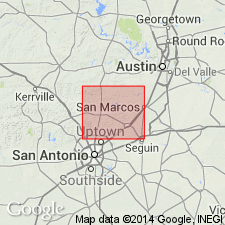
- Usage in publication:
-
- Comanche Peak Limestone
- Modifications:
-
- Areal extent
- AAPG geologic province:
-
- Bend arch
- Permian basin
Summary:
Pamphlet [p. 2]. Comanche Peak Limestone. Fine grained, argillaceous, nodular, light gray, burrowed, marine megafossils include echinoids and molds and shells of mollusks; thickness 15 to 20 feet. Age is Early Cretaceous.
Not separately mapped. Mapped undifferentiated with Edwards Limestone and Walnut Formation in western Callahan, Taylor, and Runnels Cos. Mapped undifferentiated with Walnut Formation in eastern Callahan and northern Brown Cos.
Source: Publication.
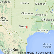
- Usage in publication:
-
- Comanche Peak Limestone
- Modifications:
-
- Mapped 1:250k
- Dominant lithology:
-
- Limestone
- Clay
- AAPG geologic province:
-
- Ouachita folded belt
- Strawn basin
Summary:
Comanche Peak Limestone. Limestone and some clay. Limestone mostly aphanitic, bioclastic to fossiliferous, soft, a few harder GRYPHAEA-bearing beds about 25 feet above base form benches, light- to medium-gray; weathers various shades of gray, locally mottled yellowish brown; marine megafossils are gastropods, ammonites, echinoids, PECTEN, LIMA, GRYPHAEA, and EXOGYRA TEXANA. Clay, calcareous, intergradational with nodular limestone, beds 1 to 5 feet thick, medium- to dark-gray, weathers yellowish brown, fossiliferous. Thickness 90+/- feet. Lies above Walnut Clay and below Edwards Limestone. Northward, at Hood-Parker County line, grades laterally into Goodland Limestone. Age is Early Cretaceous.
[Mapped in Bosque, Erath, Hill, Hood, Johnson, and Somervell Cos., eastern TX.]
Source: Publication.

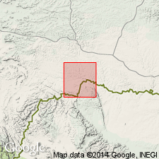
- Usage in publication:
-
- Comanche Peak Limestone
- Modifications:
-
- Mapped 1:250k
- Dominant lithology:
-
- Limestone
- Shale
- AAPG geologic province:
-
- Permian basin
Summary:
Is Lower Cretaceous formation mapped in several small scattered areas in this map sheet (northeastern Permian basin). Separately mapped in Yellow House Canyon, about 3.5 miles north of Posey, Lubbock County, Texas. Mapped undivided with overlying Edwards Limestone and underlying Walnut Formation, and Antlers Sand on east peak of Double Mountain in southwest Stonewall County, Texas; and on hill about 11.5 miles south-southwest of Clairemont, Kent County, Texas. Mapped undivided with underlying Walnut Formation and Antlers Sand northeast of Posey, Texas; southwest of Post, Texas, along upper reaches of Double Mountain Fork Brazos River; and on west peak of Double Mountain. Described as limestone, argillaceous, thin shale interbeds, irregularly bedded and nodular to thick-bedded, light-gray, grayish-yellow, yellowish-brown; marine megafossils; thickness 40+/- feet.
Source: GNU records (USGS DDS-6; Denver GNULEX).
For more information, please contact Nancy Stamm, Geologic Names Committee Secretary.
Asterisk (*) indicates published by U.S. Geological Survey authors.
"No current usage" (†) implies that a name has been abandoned or has fallen into disuse. Former usage and, if known, replacement name given in parentheses ( ).
Slash (/) indicates name conflicts with nomenclatural guidelines (CSN, 1933; ACSN, 1961, 1970; NACSN, 1983, 2005, 2021). May be explained within brackets ([ ]).