- Usage in publication:
-
- "Coldwater sandstone"
- Modifications:
-
- Original reference
- Dominant lithology:
-
- Sandstone
- AAPG geologic province:
-
- Ventura basin
- Los Angeles basin
Summary:
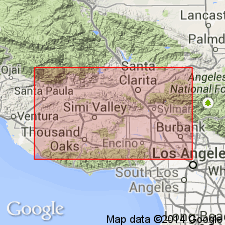
The top sandstone of Tejon formation in parts of Los Angeles County, southern California is locally known as "Coldwater sandstone."
Source: US geologic names lexicon (USGS Bull. 896, p. 486).
- Usage in publication:
-
- Coldwater member
- Modifications:
-
- Revised
- Areal extent
- AAPG geologic province:
-
- Ventura basin
- Los Angeles basin
Summary:
Pg. 789-802. Coldwater member of Tejon formation. West of Sespe Canyon, in heart of an anticline along Coldwater Creek, and again to north along south flank of Topatopa Mountains, there are 400 to 500 feet of hard white sandstones with intercalations of light-pink, pale-green, and grayish shales. The sandstones carry a dwarfed estuarine fauna of Eocene age. These beds have heretofore been included with the Sespe, but since they are fossiliferous, and also differ lithologically from typical Sespe, they should be included in Tejon as Coldwater member.
Source: US geologic names lexicon (USGS Bull. 896, p. 486).
- Usage in publication:
-
- Coldwater sandstone member
- Modifications:
-
- Areal extent
- AAPG geologic province:
-
- Santa Maria basin
- Ventura basin
- [Los Angeles basin(?)]
Summary:
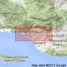
Pg. 1091. Coldwater sandstone, top member of Tejon formation, is about 2,500 feet thick near Matilija, Ventura County, southern California. Is characterized by white friable arkose sandstone interbedded with reddish gray shale and massive hard ledges composed of numerous shells of OSTREA IDRIAENSIS Gabb. Has been traced more than 40 miles along Santa Ynez Range westward from type locality in Coldwater Canyon. [Age is Eocene.]
Source: US geologic names lexicon (USGS Bull. 896, p. 486).
- Usage in publication:
-
- Coldwater sandstone member
- Modifications:
-
- Areal extent
- AAPG geologic province:
-
- Ventura basin
- Los Angeles basin
Summary:
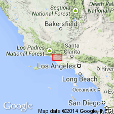
Pg. 697 (fig. 3). Coldwater sandstone member of Tejon formation. Shown on columar section of Ventura region as underlying Sespe formation and overlying Cozy Dell member. Thickness 1,500 to 2,000 feet. [Age is Eocene.]
Source: US geologic names lexicon (USGS Bull. 1200, p. 878).
- Usage in publication:
-
- Coldwater formation
- Modifications:
-
- Not used
- AAPG geologic province:
-
- Ventura basin
- Los Angeles basin
Summary:
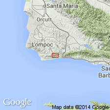
Pg. 6. Coldwater formation. Sediments locally known as Coldwater in Santa Barbara County, southern California, redefined as Sacate formation.
Source: US geologic names lexicon (USGS Bull. 1200, p. 878).
- Usage in publication:
-
- Coldwater Sandstone
- Modifications:
-
- Mapped
- AAPG geologic province:
-
- Ventura basin
- Los Angeles basin
Summary:
See also USGS Open-File Report OFR-82-75, 1982 (http://ngmdb.usgs.gov/Prodesc/proddesc_167.htm) and California Geol. Survey's digital adaptation, 2006 (ftp://ftp.consrv.ca.gov/pub/dmg/rgmp/Prelim_geo_pdf/Matilija_prelim.pdf).
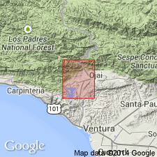
Coldwater Sandstone. Arkosic sandstone containing strata with oyster shells and a few beds of red claystone. In places, mostly siltstone (separately mapped). Age is late Eocene [late middle Eocene] (Narizian provincial molluscan stage).
Source: Publication.
- Usage in publication:
-
- Coldwater Sandstone
- Modifications:
-
- Revised
- Paleomagnetics
- Areal extent
- AAPG geologic province:
-
- Ventura basin
- Los Angeles basin
Summary:
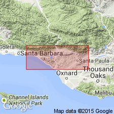
Coldwater Sandstone. Magnetically and biostratigraphically correlated to Chrons C19r-C18n (39.5 to 42.5 Ma), late Uintan to early Duchesnean.
Source: Publication.
For more information, please contact Nancy Stamm, Geologic Names Committee Secretary.
Asterisk (*) indicates published by U.S. Geological Survey authors.
"No current usage" (†) implies that a name has been abandoned or has fallen into disuse. Former usage and, if known, replacement name given in parentheses ( ).
Slash (/) indicates name conflicts with nomenclatural guidelines (CSN, 1933; ACSN, 1961, 1970; NACSN, 1983, 2005, 2021). May be explained within brackets ([ ]).

