


- Usage in publication:
-
- Codell sandstone bed*
- Modifications:
-
- Original reference
- Dominant lithology:
-
- Sandstone
- Shale
- AAPG geologic province:
-
- Central Kansas uplift
Summary:
Pg. 28, 64. Codell sandstone bed. A sandy zone forming topmost 20 to 25 feet of Blue Hill shale member of Carlile shale in western Kansas (Russell to Hamilton Counties). Age is Late Cretaceous. Report includes geologic map, stratigraphic chart.
Named from excellent exposures in bluffs along Saline Valley in Ellis Co., 5 mi south and a little west of town of Codell in Rooks Co., western KS.
Source: US geologic names lexicon (USGS Bull. 896, p. 480); supplemental information from GNU records (USGS DDS-6; Denver GNULEX).
- Usage in publication:
-
- Codell sandstone member*
- Modifications:
-
- Revised
- Areal extent
- AAPG geologic province:
-
- Denver basin
Summary:
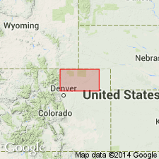
Applied Codell Sandstone Member to topmost 3 to 20 feet of Benton shale in eastern Larimer County, eastern Colorado, or to sandstone called "Niobenton sand" by drillers. Age is Late Cretaceous.
Source: US geologic names lexicon (USGS Bull. 896, p. 480).
- Usage in publication:
-
- Codell sandstone member*
- Modifications:
-
- Revised
Dane, C.H., and Pierce, W.G., 1933, [Geology and oil and gas prospects in part of eastern Colorado]: U.S. Geological Survey Press Notice, June 8, 1933
Summary:
Codell sandstone member of Carlile shale. Elevated Codell sandstone to rank of a member at top of Carlile shale and restricted Blue Hill shale member to underlying part of the Blue Hill shale of previous reports. Age is Late Cretaceous.
Source: US geologic names lexicon (USGS Bull. 896, p. 480).

- Usage in publication:
-
- Codell sandstone zone
- Modifications:
-
- Revised
Summary:
Pg. 24. Referred to as Codell sandstone zone in Blue Hill shale member of Carlile shale. Age is Late Cretaceous.
Source: US geologic names lexicon (USGS Bull. 1200, p. 867).
- Usage in publication:
-
- Codell sandstone member*
- Modifications:
-
- Areal extent
- AAPG geologic province:
-
- Denver basin
Summary:
Chart 10b (column 53). Shown on correlation chart as member at top of Benton shale, Morgan County, Colorado. Age is Late Cretaceous.
Source: US geologic names lexicon (USGS Bull. 1200, p. 867).
- Usage in publication:
-
- Codell member
- Modifications:
-
- Areal extent
- AAPG geologic province:
-
- Sioux uplift
Summary:
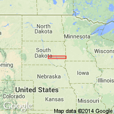
Pg. 17, 18. Codell member of Carlile formation. Thickness about 6 feet where exposed in Davison County, South Dakota. Occurs at top of Carlile. Age is Late Cretaceous.
Source: US geologic names lexicon (USGS Bull. 1200, p. 867).
- Usage in publication:
-
- Codell sandstone member*
- Modifications:
-
- Areal extent
- AAPG geologic province:
-
- Anadarko basin
Summary:
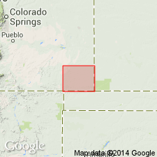
Pg. 16 (table 1), 121. Codell sandstone member of Carlile shale. Uppermost member of Carlile shale. In Baca County, Colorado, consists of 2.5 to 3 feet of light-tan to rusty-brown hard finely crystalline limestone containing a few sand grains. Overlies Blue Hill shale member; underlies Fort Hays limestone member of Niobrara formation. Age is Late Cretaceous.
Source: US geologic names lexicon (USGS Bull. 1200, p. 867).
- Usage in publication:
-
- Codell sandstone member*
- Modifications:
-
- Areal extent
- AAPG geologic province:
-
- North Park basin
Summary:
Pg. 53, pl. 1. Codell sandstone member of Benton formation. Upper member of Benton formation in Red Dirt Creek area, Grand County, Colorado. Thickness about 46 feet. Underlies Fort Hays member of Niobrara. Age is Late Cretaceous.
Source: US geologic names lexicon (USGS Bull. 1200, p. 867).

- Usage in publication:
-
- Codell sandstone member*
- Modifications:
-
- Overview
Summary:
Codell sandstone member of Carlile shale. Shown on correlation chart as uppermost member of Carlile shale. Overlies Blue Hill shale member; underlies Fort Hays limestone member of Niobrara chalk. Age is Late Cretaceous.
Source: US geologic names lexicon (USGS Bull. 1200, p. 867).

- Usage in publication:
-
- Codell sandstone member*
- Modifications:
-
- Areal extent
- AAPG geologic province:
-
- Denver basin
Summary:
Carlile shale mapped as a narrow band on southwest part of map in Jefferson Co, CO in the Denver basin, where it is in contact with the older Greenhorn limestone and with the younger Niobrara formation. Divisible into (ascending): Fairport chalky shale member about 25 ft thick, Blue Hill? shale member about 15 ft thick, and Codell sandstone member 2 ft thick. Ammonites identified in the Fairport and Codell. Of Late Cretaceous age. Geologic map.
Source: GNU records (USGS DDS-6; Denver GNULEX).
- Usage in publication:
-
- Codell Sandstone Member*
- Modifications:
-
- Areal extent
- AAPG geologic province:
-
- Sioux uplift
Summary:
Is present at Lake Traverse, Traverse Co, MN on the Sioux uplift where as a member (one of four members) of Carlile Shale, it overlies Blue Hill Member and underlies an unnamed member. Name applied to a noncalcareous siltstone and fine-grained sandstone about 6 m thick. The sandstone is in the lower half. The name Turner Sandy Member of Carlile considered to be equivalent to the Codell is used in the northern Black Hills area of SD. Turner not used in MN; it pinches out east of Black Hills. Deposited in a shallow marine environment on the east margin of the Cretaceous seaway.
Source: GNU records (USGS DDS-6; Denver GNULEX).
- Usage in publication:
-
- Codell Sandstone Member*
- Modifications:
-
- Overview
- AAPG geologic province:
-
- Denver basin
- Las Vegas-Raton basin
Summary:
Study area extends from Colorado Springs, El Paso Co, CO in Denver basin south to Walsenburg, Huerfano Co, CO in Las Vegas-Raton basin. As a member of Carlile Shale, Codell gradationally overlies Blue Hill Member of Carlile. Blue Hill is an olive-gray, noncalcareous shale. A limestone marker 15-30 cm thick is present at top of Blue Hill. The marker is pink-gray, medium-crystalline, has disseminated small crystals of pyrite, and has a flat bottom and hummocky upper surface. The overlying Codell is typically 12 m thick, consists of a succession of very fine to medium grained laminated sandstone, bioturbated sandstone, and at some localities silty shale. Codell extends south to Walsenburg; this is probably its southern limit. Codell becomes thicker (12 m) to north. Codell is a coastal deposit formed during upper part of regressive phase of the Greenhorn cyclothem in latest middle Turonian time. Codell rocks represent deposition in system of northeast-trending barrier island, lagoon fills, tidal deltas, offshore bars. Paleogeographic map. Cross sections. Disconformably overlain by Juana Lopez Member of Carlile.
Source: GNU records (USGS DDS-6; Denver GNULEX).
- Usage in publication:
-
- Codell Sandstone Member*
- Modifications:
-
- Biostratigraphic dating
- Areal extent
- AAPG geologic province:
-
- Palo Duro basin
Summary:
Is member of Carlile Shale. Upper part of member is assigned a middle Turonian (Late Cretaceous) age based on presence of the ammonite SPATHITES PUERCOENSIS in a sandstone concretion from USGS Mesozoic locality D10769 near old Sapello cemetery in northwest part of Lake Isabel 7 1/2 min quad, San Miguel Co, NM. Unit is thus areally extended into Palo Duro basin. Associated fauna includes PRIONOCYCLUS HYATTI and SPATHITES sp. (found as float).
Source: GNU records (USGS DDS-6; Denver GNULEX).
- Usage in publication:
-
- Codell Sandstone Member*
- Modifications:
-
- Biostratigraphic dating
- Areal extent
- AAPG geologic province:
-
- Las Vegas-Raton basin
Summary:
Is member of Carlile Shale. Overlies Blue Hill Member of Carlile in Canadian River Valley east of Springer, Colfax Co, NM. Basal part of member is assigned a middle Turonian (Late Cretaceous) age based on presence of the ammonite ROMANICERAS from limestone concretions from USGS Mesozoic locality D10740 in west bank of Canadian River 6.4 km east of Springer, NM. Unit is thus areally extended into Las Vegas-Raton basin. Associated fossils include PRIONOCYCLUS HYATTI (Stanton) and COILOPOCERAS SPRINGERI Hyatt.
Source: GNU records (USGS DDS-6; Denver GNULEX).
For more information, please contact Nancy Stamm, Geologic Names Committee Secretary.
Asterisk (*) indicates published by U.S. Geological Survey authors.
"No current usage" (†) implies that a name has been abandoned or has fallen into disuse. Former usage and, if known, replacement name given in parentheses ( ).
Slash (/) indicates name conflicts with nomenclatural guidelines (CSN, 1933; ACSN, 1961, 1970; NACSN, 1983, 2005, 2021). May be explained within brackets ([ ]).