- Usage in publication:
-
- Coal Creek member
- Modifications:
-
- First used
- Geochronologic dating
- Dominant lithology:
-
- Sandstone
- Siltstone
- Mudstone
- Marl
- Conglomerate
- AAPG geologic province:
-
- Montana folded belt
Summary:
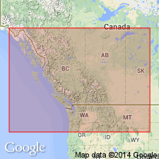
Kishenehn Formation mapped in Kishenehn basin, a half-graben 95 mi long and 1-8 mi wide extending from Flathead, BC, CN south to north end Flathead Lake, Flathead Co, MT, Montana folded belt province. Consists of 3,000 ft (basin edges) to 11,000+ ft (basin center) of synorogenic deposits. Divided into informal members (ascending): 1) basal member recognized primarily on limonitic-staining, pressure-marked conglomerate clasts (of well-rounded Proterozoic and Paleozoic quartzites), and stratigraphic position, only in North Fork region, dominantly sandy conglomerate interbedded with pebbly sandstone, carbonaceous mudstone and coal 460 to 3,900 ft thick; 2) Coal Creek member (first used), a heterogeneous assemblage of sandstone, siltstone, mudstone, lignite, oil shale, marlstone, conglomerate 3,770-11,500+ ft thick known in Middle and North Fork areas; 3) Pinchot member (first used), red-brown, fine- and coarse-grained conglomerate with interbeds of red-brown and gray calcareous claystone and gray sandy conglomerate in Middle Fork area 660-4,900 ft thick. Coal Creek-Pinchot contact not exposed. A 33.2 +/-1.5 Ma fission track date obtained from fine-grained gray tephra as much as 8 in thick in middle of Coal Creek member. Fossils: leaves, gastropods, bivalves, insects, fish (listed) suggest age range of late Eocene to early Miocene, and sub-tropical to warm temperate climate. Shown as Oligocene age on geologic map.
Source: GNU records (USGS DDS-6; Denver GNULEX).
For more information, please contact Nancy Stamm, Geologic Names Committee Secretary.
Asterisk (*) indicates published by U.S. Geological Survey authors.
"No current usage" (†) implies that a name has been abandoned or has fallen into disuse. Former usage and, if known, replacement name given in parentheses ( ).
Slash (/) indicates name conflicts with nomenclatural guidelines (CSN, 1933; ACSN, 1961, 1970; NACSN, 1983, 2005, 2021). May be explained within brackets ([ ]).

