

- Usage in publication:
-
- Clover Fork Sandstone Member*
- Modifications:
-
- Original reference
- Dominant lithology:
-
- Sandstone
- AAPG geologic province:
-
- Appalachian basin
Summary:
Pg. 28, 59-61. Clover Fork Sandstone Member of Wise Formation. Cliff-forming, brownish-gray, medium-grained, moderately quartzose, massive sandstone. Thickness 78 feet at type section. Lies 60 feet below Marcum Hollow Sandstone Member (new) and about 20 feet below a thin but persistent coal bed known as the Marker (or Taggart Marker); lies about 120 feet above Keokee Sandstone Member (new), and at Keokee, it lies about 40 feet above a mined coalbed locally called Wilson coal (Harlan coal of Giles, 1925); all in Wise Formation. [Age is Middle Pennsylvanian].
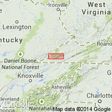
Type section: along VA Highway 624, between Keokee, Lee Co., VA, and Morris Gap at crest of Little Black Mountain, VA-KY State line, beginning at gentle curve, 1,000 ft north-northwest of junction of VA Highways 606 and 624 in north part of town of Keokee, and ending at top of Little Black Mountain on dirt road, 200 ft west of Morris Gap, Lee Co., southwestern VA. Named from Clover Fork of Cumberland River, [along KY-side of Black Mountain, in northwestern corner of] Keokee 7.5-min quadrangle, Harlan Co., southeastern KY.
[See also Miller and Roen, 1971, USGS Geol. Quad. Map GQ-851, geol. map Keokee quadrange, VA-KY. Exposures of Clover Fork Sandstone Member of Wise Formation in Kentucky are limited to small areas along Clover Fork of Cumberland River in northwestern corner of quadrangle.]
Source: Publication; GNU records (USGS DDS-6; Reston GNULEX); US geologic names lexicon (USGS Bull. 1520, p. 66).
- Usage in publication:
-
- Clover Fork Sandstone Member
- Modifications:
-
- Areal extent
- AAPG geologic province:
-
- Appalachian basin
GNU Staff, 1991, GNU Staff remark by E.D. Koozmin. Clover Fork Sandstone Member.: U.S. Geological Survey Digital Data Series, DDS-6, 1 CD-ROM., release 3
Summary:
Even though Miller (1969) shows Clover Fork Sandstone Member of the Wise Formation in KY (see entry under Wise), GNU records show that Ralph Miller (personal commun., 1976) advised GNU to restrict the Wise Formation from KY. Therefore, the Clover Fork cannot be present in KY (until such time as someone recognizes the Wise Formation in KY).
Source: GNU records (USGS DDS-6; Reston GNULEX).

- Usage in publication:
-
- Clover Fork Sandstone Member
- Modifications:
-
- Areal extent
- AAPG geologic province:
-
- Appalachian basin
Summary:
Corr. chart. Clover Fork Sandstone Member of Wise Formation. Sandstone. Recognized in southwestern Virginia; [not recognized in Kentucky]. Lies below Marcum Hollow Sandstone Member and above the "Cannelton shale (limestone)" of Virginia Geological Survey usage (1994), both in Wise Formation. Capped by Taggart Marker coal bed. Separated from underlying "Cannelton" by unnamed sandstone, siltstone, and shale beds, and several coal beds (descending) Wilson, Upper St. Charles, Kelly, Imboden (Campbell Creek, Pond Creek), and Imboden Marker. Age is Middle Pennsylvanian (Westphalian; Atokan).
[Rice and others (1994, GSA Spec. Paper 294, p. 122) state the Clover Creek is a member of the Breathitt Formation in Kentucky, and a member of the Wise Formation in Virginia, lying between the Taggart Marker (above) and Wilson coals (citing Miller, 1969). [Miller does not mention the Breathitt.] Rice and Hiett (1994, USGS Misc. Field Studies Map MF-2275) show the Taggart Marker and Wilson coals in the Breathitt of the Upper Cumberland River district (Harlan subdistrict), southeastern Kentucky, sans an intervening Clover Fork Sandstone Member.]
Source: Publication.
For more information, please contact Nancy Stamm, Geologic Names Committee Secretary.
Asterisk (*) indicates published by U.S. Geological Survey authors.
"No current usage" (†) implies that a name has been abandoned or has fallen into disuse. Former usage and, if known, replacement name given in parentheses ( ).
Slash (/) indicates name conflicts with nomenclatural guidelines (CSN, 1933; ACSN, 1961, 1970; NACSN, 1983, 2005, 2021). May be explained within brackets ([ ]).