- Usage in publication:
-
- Clough Quartzite*
- Modifications:
-
- Overview
- Biostratigraphic dating
- AAPG geologic province:
-
- New England province
Summary:
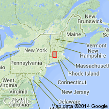
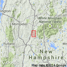
Used as Clough Quartzite of Early Silurian age. Consists of quartz-pebble conglomerate, quartzite, and minor mica schist and calc-silicate rocks. Fossils at Bernardston are similar to those at Croyden Mountain, NH, which indicate a Llandoverian age.
Source: GNU records (USGS DDS-6; Reston GNULEX).

- Usage in publication:
-
- Clough Formation*
- Modifications:
-
- Areal extent
- Overview
- AAPG geologic province:
-
- New England province
Summary:
Parts of the Littleton and Partridge Formations, and Clough Quartzite in MA are here reassigned to the Rangeley Formation [here geographically extended to MA]. The four mapped areas of Clough Quartzite in the Amherst area west of the Connecticut Valley border fault are now interpreted as conglomerate lenses in the Rangeley. Clough is considered the key stratigraphic unit in Bronson Hill anticlinorium because 1) it is dominated by distinctive, readily recognizable rock types, 2) where present, it is base of Silurian-Devonian sequence, resting with detectable unconformity on older rocks, and 3) it contains late Llandoverian fossils at several localities in western NH and adjacent VT, and at Bernardston, MA. Consists mostly of quartz-pebble conglomerate in which pebbles are typically deformed; other lithologies are quartz grit or white to pink, well-bedded quartzite. Locally contains some mica schist beds. On the MA State bedrock geologic map (Zen and others, 1983), thickness is locally exaggerated because at many localities, the unit was only a few meters or less thick and could not be shown at a scale of 1:250,000. Maximum thickness is 200 m on west limb of Northfield syncline. Unconformably overlies Fourmile Gneiss in Pelham dome and in Kempfield anticline, or Ammonoosuc Volcanics over most gneiss domes. Partridge Formation occurs along Clough-Ammonoosuc contact as lenses in many areas. [Papers presented as chapters in U.S. Geological Survey Professional Paper 1366 are intended as explanations and (or) revisions to MA State bedrock geologic map of Zen and others (1983) at scale of 1:250,000.]
Source: GNU records (USGS DDS-6; Reston GNULEX).

- Usage in publication:
-
- Clough Quartzite*
- Modifications:
-
- Areal extent
- AAPG geologic province:
-
- New England province
Summary:
Bronson Hill autochthonous sequence, separated from Piermont allochthon by Foster Hill sole fault, consists of the mainly basaltic facies of the lower member of Ammonoosuc Volcanics (Middle Ordovician), Partridge Formation (Middle Ordovician), Clough Quartzite (Lower Silurian), Fitch Formation (Upper Silurian), and Littleton Formation (Lower Devonian). Report includes geologic map and correlation chart.
Source: GNU records (USGS DDS-6; Reston GNULEX).

- Usage in publication:
-
- Clough Quartzite*
- Modifications:
-
- Revised
- Areal extent
- Age modified
- Biostratigraphic dating
- AAPG geologic province:
-
- New England province
Summary:
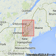
Unit is geographically extended into ME. Mapped in Bronson Hill-Boundary Mountains anticlinorium with certainty everywhere except for body just east of Parmachenee Lake in Cupsuptic, ME, 15-min quad (there tentatively assigned to Clough). In western sequence of central Maine trough, mapped near northwest end of Kennebago Lake, Kennebago Lake, ME, 15-min quad where it includes rocks previously mapped as member C of the Rangeley Formation by Moench and Pankiwskyj (1988). Same rocks were also assigned to the Clough by Moench and Boudette (1987) [but information wasn't published in time for inclusion by Moench and Pankiwskyj's map] on the basis of lithologic similarity to type Clough in western NH. Exposed at same stratigraphic level as fossiliferous member C of Rangeley Formation in Kennebago Lake quad. Age refined to late Llandoverian based on fossils found just south of map area by Boucot and Thompson (1963).
Source: GNU records (USGS DDS-6; Reston GNULEX).

- Usage in publication:
-
- Clough Quartzite*
- Modifications:
-
- Overview
- AAPG geologic province:
-
- New England province
Summary:
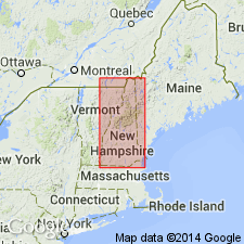
Used as Early Silurian (late Llandoverian) Clough Quartzite. Consists of orthoquartzite, quartz metaconglomerate, muscovite schist, and minor polymict metaconglomerate. Fossiliferous. Lies disconformably below Fitch Formation and unconformably on Ordovician formations. Equivalent in part to member C of Rangeley Formation of ME. Mapped undivided with Fitch Formation in places. Report includes geologic map, cross sections, correlation chart, and four 1:500,000-scale derivative maps.
Source: GNU records (USGS DDS-6; Reston GNULEX).
For more information, please contact Nancy Stamm, Geologic Names Committee Secretary.
Asterisk (*) indicates published by U.S. Geological Survey authors.
"No current usage" (†) implies that a name has been abandoned or has fallen into disuse. Former usage and, if known, replacement name given in parentheses ( ).
Slash (/) indicates name conflicts with nomenclatural guidelines (CSN, 1933; ACSN, 1961, 1970; NACSN, 1983, 2005, 2021). May be explained within brackets ([ ]).

