

- Usage in publication:
-
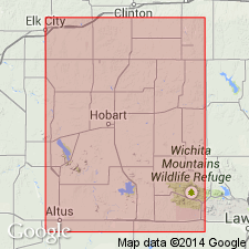
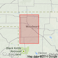
- Cloud Chief formation
- Modifications:
-
- Original reference
- Dominant lithology:
-
- Gypsum
- Shale
- AAPG geologic province:
-
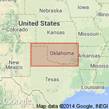
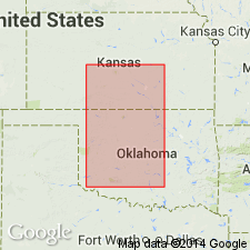
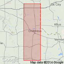
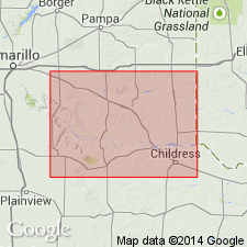
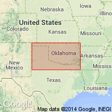
- Anadarko basin
Summary:
Cloud Chief formation. Two or more ledges of massive gypsums interbedded in red clay shale; the gypsums vary much in number and thickness. Includes what was originally described as "eastern area" of the Greer. The name "Cyril" was used for this gypsum in Cement area by Clapp, who erroneously considered it to be = the Blaine. Reeves recognized Clapp's error in correlation, but himself falls into error when he states that "only the basal part of the Greer is present in this area, where it is represented by Cyril member." In point of fact, so far as can be determined, the entire Greer is present at Cement. Because of fact that both geologists who have used the name Cyril have fallen into error in use of the term, in order to avoid additional confusion, it appears wise to introduce an entirely new name. Therefore the name Cloud Chief is proposed for this formation. Typically exposed near town of Cloud Chief in western Washita County, southwestern Oklahoma. Rests on Day Creek dolomite and is overlain by Quartermaster formation, with erosional unconformity according to Beede. [Age is Permian.]
Source: US geologic names lexicon (USGS Bull. 896, p. 468-469).
- Usage in publication:
-
- Cloud Chief gypsum
- Modifications:
-
- Areal extent
Summary:
Pg. 95. [Cloud Chief gypsum.] Stated that this formation varies in thickness up to 115 feet. [Age is Permian.]
Source: US geologic names lexicon (USGS Bull. 896, p. 468-469).
- Usage in publication:
-
- Cloud Chief gypsum
- Modifications:
-
- Revised
Summary:
Pg. 14-15. Recognized no formation between Cloud Chief gypsum and Whitehorse sandstone in Oklahoma. [Age is Permian.]
Source: US geologic names lexicon (USGS Bull. 896, p. 468-469).
- Usage in publication:
-
- Cloud Chief gypsum
- Modifications:
-
- Revised
Summary:
Suggested that "it might be well to consider the Day Creek [dolomite] the basal part of the Cloud Chief gypsum." [Age is Permian.]
Source: US geologic names lexicon (USGS Bull. 896, p. 468-469).
- Usage in publication:
-
- Cloud Chief gypsum
- Modifications:
-
- Mapped
Summary:
Placed Cloud Chief gypsum below Quartermaster formation and above Day Creek dolomite. [Age is Permian.]
Source: US geologic names lexicon (USGS Bull. 896, p. 468-469).
- Usage in publication:
-
- Cloud Chief formation
- Modifications:
-
- Revised
- AAPG geologic province:
-
- Anadarko basin
- South Oklahoma folded belt
Summary:
In Kiowa and Washita Counties Cloud Chief formation overlies Whitehorse sandstone and underlies Quartermaster formation. The term "Day Creek dolomite" of Cragin has been applied to Weatherford dolomite, Greenfield dolomite, and Quartermaster dolomite. It is believed its continued use will only serve to confuse. Writer does not know what bed, if any, in southwest Oklahoma, corresponds to Day Creek dolomite of Kansas. [Age is Permian.]
Source: US geologic names lexicon (USGS Bull. 896, p. 468-469).
- Modifications:
-
- Not used
- AAPG geologic province:
-
- Anadarko basin
Summary:
Evidences in field suggest Cloud Chief is not a geologic unit, but rather that it represents a group of more or less continuous stratigraphic units. Writer believes Cloud Chief as a formation name should be dropped and that another formation name should be adopted to include the beds from the base of Day Creek up to base of Quartermaster. [See further details under Quartermaster formation.]
Source: US geologic names lexicon (USGS Bull. 896, p. 468-469).
- Usage in publication:
-
- Cloud Chief gypsum
- Modifications:
-
- Not used
- AAPG geologic province:
-
- Anadarko basin
Summary:
Does not regard Evans' [1931, AAPG Bull. 15, no. 4, p. 408-432] interpretation of stratigraphic relations of the various formations as proved.
Source: US geologic names lexicon (USGS Bull. 896, p. 468-469).
- Usage in publication:
-
- Cloud Chief gypsum
- Modifications:
-
- Revised
- AAPG geologic province:
-
- Anadarko basin
Summary:
Day Creek dolomite overlies Cloud Chief gypsum, and Cloud Chief should be made a member of Whitehorse formation. [Age is Permian.]
[See also entry under Buckstaff (1931, same vol., p. 434-437) and see under Quartermaster formation.]
Source: US geologic names lexicon (USGS Bull. 896, p. 468-469).
- Usage in publication:
-
- [Cloud Chief gypsum]
- Modifications:
-
- Revised
Summary:
Pg. 700. Believes there is no way of retaining Cloud Chief as a formational name; if used at all it should be as a zone name. [Age is Permian.]
Source: US geologic names lexicon (USGS Bull. 896, p. 468-469).

- Usage in publication:
-
- [Cloud Chief formation]
- Modifications:
-
- Overview
Summary:
Pg. 146. Placed Cloud Chief below Quartermaster and above Whitehorse. On p. 184 he stated that the Cloud Chief and Whitehorse formations are not seperable in Texas either on the surface or underground. [Age is Permian.]
Source: US geologic names lexicon (USGS Bull. 896, p. 468-469).
- Usage in publication:
-
- Cloud Chief member
- Modifications:
-
- Revised
- AAPG geologic province:
-
- Anadarko basin
Summary:
Pg. 1454, 1458, 1473. Quartermaster formation is here divided into (descending): (1) Elk City sandstone member; (2) Doxey shale member; and (3) Cloud Chief member (consisting of sandstone, gypsum, and dolomite facies). The stratigraphic section in which the gypsums at Cloud Chief are developed is predominantly a sandstone section, when considered in a large area, in which the gypsum facies occur as lenses, and has maximum thickness of 300 feet, as shown by a sample log of well south of Cordell, in sec. 23, T. 9 N., R. 17 W. At type locality the basal 100 feet is solid gypsum and next 50 feet lenticular gypsums in sandstone. To northwest of Clinton the contact of the Cloud Chief with Doxey member is occurrence of Quartermaster dolomites, which in many places suggest chemical alteration from gypsum to dolomite. Many exposures indicate that Cloud Chief gypsum facies and Quartermaster dolomites are in same stratigraphic horizon. Which of these dolomites, if any, is = Day Creek dolomite of northwest Oklahoma is open question. [Age is Permian.]
Source: US geologic names lexicon (USGS Bull. 896, p. 468-469).
- Usage in publication:
-
- Cloud Chief gypsum
- Modifications:
-
- Revised
Summary:
[Cloud Chief gypsum] mapped in Double Mountain group. [Age is Permian.]
Source: US geologic names lexicon (USGS Bull. 1200, p. 845-846).
- Usage in publication:
-
- Cloud Chief gypsum member
- Modifications:
-
- Revised
Summary:
Pg. 1527-1529. Upper member of Whitehorse group. Cloud Chief dolomite facies of Weatherford area should not be considered as Quartermaster as was proposed by Green (1936, AAPG Bull., v. 20, no. 11). Overlies Rush Springs sandstone; underlies Doxey shale of Quartermaster group. [Age is Permian.]
Source: US geologic names lexicon (USGS Bull. 1200, p. 845-846).
- Usage in publication:
-
- Cloud Chief formation
- Modifications:
-
- Areal extent
Summary:
Pg. 421-433. Cloud Chief formation mentioned in general discussion of loose application of Kansas formation names in Texas. [Age is Permian.]
Source: US geologic names lexicon (USGS Bull. 1200, p. 845-846).
- Usage in publication:
-
- Cloud Chief gypsum member
- Modifications:
-
- Revised
Summary:
Pg. 313. Table shows Cloud Chief gypsum as member of Whitehorse formation. Whitehorse and Quartermaster formations are placed in Custer group. [Age is Permian.]
Source: US geologic names lexicon (USGS Bull. 1200, p. 845-846).
- Usage in publication:
-
- Cloud Chief gypsum
- Modifications:
-
- Revised
- AAPG geologic province:
-
- Permian basin
Summary:
Pg. 668, pl. 2. Cloud Chief gypsum. Uppermost formation in Whitehorse group. [Age is Permian.] Term †Double Mountain group abandoned.
Source: US geologic names lexicon (USGS Bull. 1200, p. 845-846).
- Usage in publication:
-
- [Cloud Chief formation]
- Modifications:
-
- Mapped 1:500k
Summary:
Formation as mapped includes Day Creek dolomite member in northwestern Oklahoma and Weatherford member in central western part. Shown above Whitehorse group. [Age is Permian.]
Source: US geologic names lexicon (USGS Bull. 1200, p. 845-846).
- Usage in publication:
-
- Cloud Chief formation
- Modifications:
-
- Areal extent
- AAPG geologic province:
-
- Anadarko basin
- South Oklahoma folded belt
Summary:
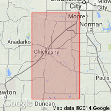
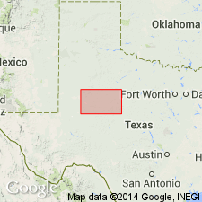
Pg. 75-77. In Grady County, Cloud Chief formation is about 15 feet thick. Unconformably overlies Rush Springs sandstone. Crops out in widely scattered outliers so only lower part is present. [Age is Permian.]
Source: US geologic names lexicon (USGS Bull. 1200, p. 845-846).
- Usage in publication:
-
- Cloud Chief formation
- Modifications:
-
- Areal extent
- AAPG geologic province:
-
- Anadarko basin
Summary:
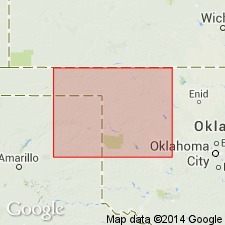
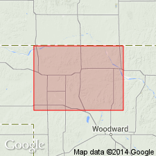
Pg. 40-43. In Harper County, name Cloud Chief formation applied to dolomite, red shale, and gypsum overlying Whitehorse group. Thickness 25 feet; only lower part present. Includes Day Creek dolomite member at base. Doubtfully referred to Ochoan series. Correlated with Taloga formation and Day Creek dolomite of Kansas. [Age is Permian.]
Source: US geologic names lexicon (USGS Bull. 1200, p. 845-846).
- Usage in publication:
-
- [Cloud Chief formation]
- Modifications:
-
- Areal extent
Summary:
Chart 7. Permian. Correlation chart shows Cloud Chief present in Oklahoma but not in Texas. [Age is Permian.]
Source: US geologic names lexicon (USGS Bull. 1200, p. 845-846).
- Usage in publication:
-
- Cloud Chief Gypsum
- Modifications:
-
- Areal extent
- AAPG geologic province:
-
- Permian basin
Summary:
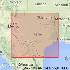
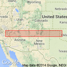
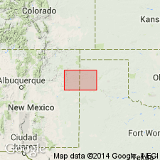
Area of report is central Texas; in this area the Whitehorse Sandstone and Cloud Chief Gypsum are mapped undivided. Separately mapped units of Whitehorse and Cloud Chief include (ascending): Childress Dolomite, Eskota Gypsum, and Claytonville Dolomite. Whitehorse Sandstone and Cloud Chief Gypsum (undivided) are mapped in Nolan, Coke, and Stonewall Counties, Texas. Whitehorse Sandstone, Cloud Chief Gypsum, and Blaine Formation (undivided) are mapped in Runnels and Nolan Counties, Texas. Whitehorse, Cloud Chief, and Blaine (undivided) overlie Permian San Angelo Formation and underlie Permian Quartermaster Formation. Age is Permian. Geologic map.
Source: Modified from GNU records (USGS DDS-6; Denver GNULEX).
- Usage in publication:
-
- Cloud Chief Gypsum
- Modifications:
-
- Areal extent
- Dominant lithology:
-
- Gypsum
- Shale
- AAPG geologic province:
-
- Palo Duro basin
- Amarillo arch
Summary:
Is Permian formation mapped undivided with Quartermaster Formation (above) and Whitehorse Sandstone (below) in two areas along Canadian River drainage in Texas Panhandle in this map sheet. Is mapped in northwest Oldham County, Texas, [Palo Duro basin] and in vicinity of Tecoyas Creek in western Potter County, Texas, [Amarillo arch]. Map unit described as sandstone, sand, siltstone, shale, gypsum, and dolomite; interbedded. Sandstone and sand, fine-grained quartz, scattered to locally abundant frosted and polished coarse quartz grains, silty, massive, friable to indurated, various shades of red and orange, orange-brown, and grayish-green. Shale and siltstone, sandy in part, indistinctly bedded to massive, indurated, thin interbeds and veins of satin spar in upper part, various shades of red and orange, reddish-brown, and grayish-green. Gypsum, white, gray, and pink.
Source: Modified from GNU records (USGS DDS-6; Denver GNULEX).

- Usage in publication:
-
- Cloud Chief Gypsum
- Modifications:
-
- Areal extent
- Dominant lithology:
-
- Gypsum
- Dolomite
- AAPG geologic province:
-
- Palo Duro basin
- Permian basin
Summary:
Cloud Chief Gypsum (Permian). Mapped undivided with overlying Whitehorse Sandstone (Permian) in mostly continuous north-south trending belt in east-central part of map sheet, east of Caprock Escarpment. Map unit described as sandstone, sand, shale, gypsum, and dolomite; interbedded. Sand and sandstone, fine-grained quartz, silty, thin-bedded to massive, friable, orange-brown, various shades of red mottled grayish green. Shale, sandy in part, indistinctly bedded to massive, red. Gypsum, massive, in part banded, beds up to 12 feet thick, white, pink. Dolomite, thin, discontinuous beds associated with gypsum, gray. Thickness (map unit) 650+/- feet. Unranked subunits separately mapped (descending): Claytonville Dolomite, Eskota Gypsum, and Childress Dolomite. Marine megafossils scarce. Overlies Blaine Formation (Permian).
Source: Modified from GNU records (USGS DDS-6; Denver GNULEX).
For more information, please contact Nancy Stamm, Geologic Names Committee Secretary.
Asterisk (*) indicates published by U.S. Geological Survey authors.
"No current usage" (†) implies that a name has been abandoned or has fallen into disuse. Former usage and, if known, replacement name given in parentheses ( ).
Slash (/) indicates name conflicts with nomenclatural guidelines (CSN, 1933; ACSN, 1961, 1970; NACSN, 1983, 2005, 2021). May be explained within brackets ([ ]).