- Usage in publication:
-
- Clinch Mountain sandstone
- Modifications:
-
- Named
- Dominant lithology:
-
- Sandstone
- Conglomerate
- AAPG geologic province:
-
- Appalachian basin
Summary:
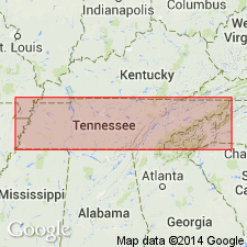
Name Clinch Mountain sandstone introduced for light-gray, generally thick-bedded sandstone exposed on Clinch Mountain in northeastern TN. At many points contains abundant fucoids and sometimes contains layers of conglomerate with pebbles the size of small peas. In some places upper [lower?] part is red and highly ferruginous. [If upper were meant, the red beds are part of Rockwood formation; if lower were meant, as in all of Safford's later reports, the red beds are the Ordovician Sequatchie formation. In some of Safford's later reports this lower red shale was called Clinch Mountain red shale and Clinch Shale.] Thickness several hundred feet. Is the great protecting rock of many high ridges in northeastern TN. Underlies 200 or 300 ft of shales with thin fine sandstone and iron ore. Overlies Nashville or top member of Hudson River group. Age is Early Silurian.
Source: GNU records (USGS DDS-6; Reston GNULEX).
- Usage in publication:
-
- Clinch Mountain sandstone
- Modifications:
-
- Revised
- AAPG geologic province:
-
- Appalachian basin
Safford, J.M., 1869, Geology of Tennessee: Nashville, TN, 550 p.
Summary:
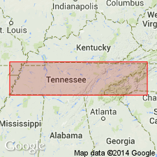
Clinch Mountain sandstone also referred to as Clinch group or Clinch sandstone in this report. Described as hard sandstone, mostly white or grayish-white, 400 or more ft thick, overlying 400 ft of red calcareous shales, provisionally included in formation [and called Clinch red shale at several places in report.] Unit confined to eastern TN. Included in Niagara group. Underlies White Oak Mountain sandstones and overlies Nashville or Nash group.
Source: GNU records (USGS DDS-6; Reston GNULEX).

- Usage in publication:
-
- Clinch sandstone*
- Modifications:
-
- Overview
- AAPG geologic province:
-
- Appalachian basin
Summary:
In 1895 (USGS Knoxville folio, no. 16) and 1896 (USGS Loudon folio, no. 25 and Morristown folio, no. 27) A. Keith restricted Clinch sandstone to upper massive white sandstone of Safford's Clinch Mountain sandstone and applied new name Bays sandstone to underlying red sandstones and shales. He defined Bays sandstone as underlying white Clinch sandstone and overlying Sevier shale, and as 300 to 1,100 ft thick. Later work by several geologists indicated that the red sandstones of Bays Mountain (type locality of Bays sandstone) are older than the red sandstones underlying Clinch sandstone on Clinch Mountain. (See under Bays sandstone.) The formation underlying Clinch sandstone is now [ca. 1938] called Juniata formation in eastern belt and Sequatchie formation in western belt. The overlying formation is of Clinton age. E.O. Ulrich and C. Butts correlate Clinch sandstone with Albion sandstone of New York.
Source: US geologic names lexicon (USGS Bull. 896, p. 464).
- Usage in publication:
-
- Clinch sandstone*
- Modifications:
-
- Revised
- AAPG geologic province:
-
- Appalachian basin
Summary:
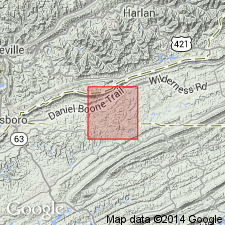
Sandstone, in the Rose Hill district, Lee Co., VA, is 257 thick and is here divided into Hagan and Poor Valley Ridge members (both new). Overlies Sequatchie formation; underlies Clinton shale.
Source: GNU records (USGS DDS-6; Reston GNULEX).
- Usage in publication:
-
- Clinch sandstone
- Modifications:
-
- Age modified
- Overview
- AAPG geologic province:
-
- Appalachian basin
Summary:
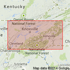
Safford's description makes it clear that in Clinch Mountain area he included in the Clinch the whole thickness of rocks now classed in the Silurian system. Keith (1896, Morrison folio; 1901, Maynard folio) followed this same usage in mapping this belt. Probably both lower and middle Silurian rocks are included. A few feet of upper Silurian or even lower Devonian is present at top, but representatives of the different series do not appear to be separately mappable. On present map the whole unit is this belt is mapped as Clinch sandstone. Clinch sandstone and Rockwood formation are mainly contemporaneous phases of lower and middle Silurian. In areas intermediate between the two type localities, they grade into each other, though in any one section the sandstone lies chiefly below. Thickness of Clinch sandstone about 500 ft on Clinch Mountain. Overlies Juniata formation.
Source: GNU records (USGS DDS-6; Reston GNULEX).
- Usage in publication:
-
- Clinch Sandstone*
- Modifications:
-
- Areal extent
- AAPG geologic province:
-
- Appalachian basin
Summary:
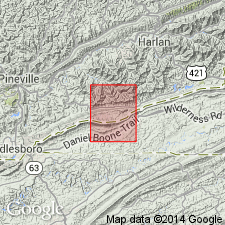
Clinch Sandstone extended into subsurface of eastern KY.
Source: GNU records (USGS DDS-6; Reston GNULEX).
- Usage in publication:
-
- Clinch Sandstone
- Modifications:
-
- Areal extent
- Overview
- AAPG geologic province:
-
- Appalachian basin
Summary:
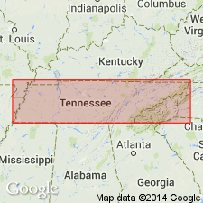
Powell Mountain is westernmost structural slice containing Lower Silurian rocks for which author would use Clinch Sandstone nomenclature of basal Hagan Shale Member. Author uses name Rockwood Formation further west in Cumberland Gap. Poor Valley Ridge Member is 28.4 m thick and Hagan Shale Member, 23.6 m. Underlies Lower Silurian Rose Hill Formation at Powell Mountain; unconformably underlies Lower Devonian Wildcat Valley Sandstone at Beans Gap. Age assignments are inexact as Clinch lacks datable fossils. Assigned here to early Llandoverian.
Source: GNU records (USGS DDS-6; Reston GNULEX).
For more information, please contact Nancy Stamm, Geologic Names Committee Secretary.
Asterisk (*) indicates published by U.S. Geological Survey authors.
"No current usage" (†) implies that a name has been abandoned or has fallen into disuse. Former usage and, if known, replacement name given in parentheses ( ).
Slash (/) indicates name conflicts with nomenclatural guidelines (CSN, 1933; ACSN, 1961, 1970; NACSN, 1983, 2005, 2021). May be explained within brackets ([ ]).

