


- Usage in publication:
-
- Clayton group
- Midway group
- Modifications:
-
- Original reference
- Dominant lithology:
-
- Sand
- Sandstone
- Clay
- Limestone
- AAPG geologic province:
-
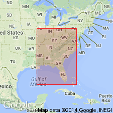
- Mid-Gulf Coast basin
Summary:
Pg. 589-605. Midway or Clayton group. Consists of (descending): (1) 200 feet of white calcareous sand containing few casts of OSTREA(?); sometimes irregularly indurated; in upper 10 feet pockets of white sand enclosed in black clay; (2) light-yellow siliceous limestone, large OSTREA and many obscure casts, 10 feet; (3) massive coarse-grained sandstone, almost a conglomerate, 8 feet. Underlies Black Bluff group [Sucarnoochee (Porters Creek) clay] and overlies Ripley group. [Age is early Eocene.]
[Named from exposures near Clayton, Barbour Co., southern AL.]
Source: US geologic names lexicon (USGS Bull. 896, p. 456).

- Usage in publication:
-
- Clayton formation*
- Modifications:
-
- Overview
- AAPG geologic province:
-
- Mid-Gulf Coast basin
- South Georgia sedimentary province
- Upper Mississippi embayment
Summary:
Clayton formation of Midway group. Is now [ca. 1938] treated as basal formation of Midway group, the foregoing narrow use of Midway having been discontinued. (See entry under Midway group, broad sense, and under Midway series, narrow sense.) It is a marine deposit. Recognized in southern Alabama, southwestern Georgia, northeastern Mississippi, southern Tennessee, and southeastern Missouri. Age is early Eocene.
Named from exposures near Clayton, Barbour Co., southern AL.
Source: GNU records (USGS DDS-6; Reston GNULEX).
- Usage in publication:
-
- Clayton formation
- Modifications:
-
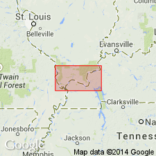
- Areal extent
- AAPG geologic province:
-
- Illinois basin
Summary:
Clayton is exposed at a few places in southern Illinois, but is probably generally present at base of Tertiary sediments. Characteristically a more or less marly glauconitic sand generally about 5 to 8 feet thick. Formerly considered a member of Porters Creek formation. Overlies McNairy formation; underlies Porters Creek clay.
Source: GNU records (USGS DDS-6; Reston GNULEX).
- Usage in publication:
-
- Clayton formation*
- Modifications:
-
- Revised
- Overview
- Biostratigraphic dating
- AAPG geologic province:
-
- Mid-Gulf Coast basin
Summary:
East of Butler Co., AL, name Clayton is used for all of Midway beds. In Butler Co. and westward in AL and MS, it is used only for beds below Porters Creek clay. In Butler and Wilcox Cos., includes McBryde limestone member and Pine Barren member (both new). In western AL and MS, the Clayton is represented by single unit, the Chalybeate limestone member (new). In western AL and east-central MS, the Clayton thins to a few ft and may be overlapped by Porters Creek clay in places. From Chickasaw Co. northward in MS, formation thickens and in northern MS is probably 60 ft thick. At Clayton, AL, section consists of lower zone of about 35 ft of sand and limestone, grading from noncalcareous, HALMENITES-bearing sand at base, through coarse sandy limestone to sand-free hard white limestone at top, and an upper zone of about 15 ft of hackly gray clay. Formation thickens eastward to nearly 130 ft in Chattahoochee River, where upper clay is represented by smooth-textured argillaceous limestone. In northern MS, includes a bed of calcareous siltstone formerly regarded by Mississippi Geological Survey as base of Porters Creek. This revision is made to make base of the clay consistently the base of the Porters Creek in MS and also because this siltstone carries the large nautiloid HERCOGLOSSA ULRICHI, a marker for upper part of Clayton in central AL.
Source: GNU records (USGS DDS-6; Reston GNULEX).
- Usage in publication:
-
- Clayton formation*
- Modifications:
-
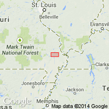
- Areal extent
- AAPG geologic province:
-
- Illinois basin
- Ozark uplift
Summary:
Clayton described in Pulaski County, Illinois, where it unconformably overlies McNairy sand. Described in Stoddard County, Missouri, where it underlies Porters Creek clay and unconformably overlies Owl Creek formation. Thickness 5 to 10 feet.
Source: GNU records (USGS DDS-6; Reston GNULEX).
- Usage in publication:
-
- Clayton Formation*
- Modifications:
-
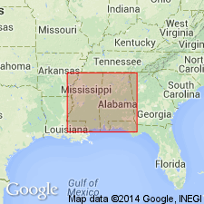
- Areal extent
- AAPG geologic province:
-
- Arkla basin
Summary:
Clayton Formation identified in Arkansas.
Source: GNU records (USGS DDS-6; Reston GNULEX).

- Usage in publication:
-
- Clayton Formation
- Modifications:
-
- Overview
- AAPG geologic province:
-
- Mid-Gulf Coast basin
Summary:
According to author, Clayton Formation of Midway Group was named by Eugene Smith (1892). Exposures at the type locality, in a Central of Georgia Railroad-cut, 1 mi east of Clayton, are described as 12 feet of dense, crystalline, gray limestone underlain by a tan clayey sand. The section depicted in Fig. 8 (Barbour Co.) measures 23 feet total thickness. The Clayton of Wilcox Co., according to LaMoreaux and Toulmin (1953) consists of 140 feet of massive limestone with some basal sand. In extreme western Alabama, the Clayton consists of less than 20 feet of limestone. Clayton is divided into lower Pine Barren Member (125 feet) and upper McBryde Limestone Member (30 feet) in central Alabama only. Age is Paleocene.
Source: GNU records (USGS DDS-6; Reston GNULEX).

- Usage in publication:
-
- Clayton Formation
- Modifications:
-
- Overview
- AAPG geologic province:
-
- Mid-Gulf Coast basin
Summary:
Clayton Formation of Midway Group is undivided in westernmost Alabama and is composed of 5 to 20 feet of marl and limestone. In Wilcox, Lowndes and Butler Counties, the Clayton is subdivided into two members. The lower Pine Barren Member consists of 150 feet of medium-gray fossiliferous calcareous silt, glauconitic sand, and thin beds of gray sandy limestone. The upper McBryde Limestone Member consists of gray to white marl and clayey chalk 20 to 50 feet thick. The undivided Clayton in eastern Alabama consists of 5 to 10 feet of basal gravelly sand overlain by 10 to 380 feet of sandy fossiliferous limestone. Crops out in the Coastal Plain of south Alabama where it unconformably overlies Late Cretaceous Selma Group strata (Prairie Bluff Chalk or Providence Sand) and gradationally underlies Porters Creek Formation. Sharply underlies Midway Group undifferentiated in subsurface of southwest Alabama. Age is early Paleocene (Danian).
Source: GNU records (USGS DDS-6; Reston GNULEX).

- Usage in publication:
-
- Clayton Formation
- Modifications:
-
- Overview
- AAPG geologic province:
-
- Mid-Gulf Coast basin
Summary:
Author disagrees with Reimers (1986) who described Clayton lithostratotype as 23 ft of limestone with basal sand and clay. Formation is here described as 7.1 m of sand, local limestone, and a unit of dark gray to black clay in the middle of the section. Fluegeman argues that the original type section is north of the RR crossing as described by MacNeil (1946) and that the first use of the name was by D.W. Langdon (1891) [which agrees with GNU records]. He suggests that Reimers' section is a carbonate facies of Clayton Formation, east of the type area.
Source: GNU records (USGS DDS-6; Reston GNULEX).

- Usage in publication:
-
- Clayton Formation
- Modifications:
-
- Overview
- AAPG geologic province:
-
- Mid-Gulf Coast basin
Summary:
Author disagrees with Fluegeman (this volume) as to the location of the type section and the lithology of the Clayton. Credits name to Smith et al (1894: AL Geol. Survey Special Rept. 6). Claims support of Alabama Geological Survey in regarding limestone section as the original type. Also cites Gulf Coast Association of Geological Societies (1970) type locality project as supporting section east of Clayton as original type. Claims Fluegeman's section may be Nanafalia Formation or sandy facies of Clayton.
Source: GNU records (USGS DDS-6; Reston GNULEX).
- Usage in publication:
-
- Clayton Formation*
- Modifications:
-
- Biostratigraphic dating
- AAPG geologic province:
-
- Mid-Gulf Coast basin
Summary:
Clayton Formation shown as Paleocene (Midway) age on fig. 1. Midway age based on CRASSATELA AQUIANA collected from Wilcox County, central Alabama.
Source: GNU records (USGS DDS-6; Reston GNULEX).
For more information, please contact Nancy Stamm, Geologic Names Committee Secretary.
Asterisk (*) indicates published by U.S. Geological Survey authors.
"No current usage" (†) implies that a name has been abandoned or has fallen into disuse. Former usage and, if known, replacement name given in parentheses ( ).
Slash (/) indicates name conflicts with nomenclatural guidelines (CSN, 1933; ACSN, 1961, 1970; NACSN, 1983, 2005, 2021). May be explained within brackets ([ ]).