- Usage in publication:
-
- Clarno formation
- Modifications:
-
- First used
- Dominant lithology:
-
- Tuff
- AAPG geologic province:
-
- Blue Mountains province
Summary:
Typically exposed at Clarnos ferry on John Day river, OR. Composed entirely of tuffs, ashes, and lavas. Contains many plant remains and is apparently in part fresh-water formation. Underlies John Day formation at Clarnos ferry. Is presumably Eocene age.
Source: GNU records (USGS DDS-6; Menlo GNULEX).
- Usage in publication:
-
- Clarno formation
- Modifications:
-
- Named
- Dominant lithology:
-
- Rhyolite
- Andesite
- Tuff
- AAPG geologic province:
-
- Blue Mountains province
Summary:
Typical exposures are at Clarno's Ferry on John Day River east of Antelope near town of Fossil, on Cherry Creek, and near Burnt Ranch [Wasco and Jefferson Cos, OR]. Is made up of erupted materials, rhyolite and andesite flows grading from ashy shale to coarse tuff. Colors are usually gray to buff but sometimes brilliant shades of red, green and blue. Thickness is over 400 feet. Contains many fossil plants. Beds at Bridge Creek are considered to be upper Eocene; those on Cherry Creek are held to be earlier. [Unconformably underlies John Day formation and overlies Chico formation (of Late Cretaceous age). Is presumably Eocene age.
Source: GNU records (USGS DDS-6; Menlo GNULEX).
- Usage in publication:
-
- Clarno formation*
- Modifications:
-
- Biostratigraphic dating
- AAPG geologic province:
-
- Blue Mountains province
Summary:
Flora from beds at Bridge Creek (upper part of Clarno formation) are assigned to late Eocene age; flora from Cherry Creek (lower part of Clarno formation) are assigned to early Eocene age.
Source: GNU records (USGS DDS-6; Menlo GNULEX).
- Usage in publication:
-
- Clarno formation*
- Modifications:
-
- Mapped
- AAPG geologic province:
-
- Blue Mountains province
Summary:
Mapped in north-central part of Oregon. Also occurs on Clackamas River, north Santiam, and Middle Fork of Willamette River under Cascade Mountains. Underlies John Day formation. Is Eocene age determined largely by fossil leaves.
Source: GNU records (USGS DDS-6; Menlo GNULEX).
- Usage in publication:
-
- Clarno formation*
- Modifications:
-
- Mapped
- AAPG geologic province:
-
- Blue Mountains province
Summary:
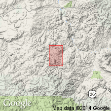
Oldest rocks in Horse Heaven district are andesite, tuffs, and tuffaceous sediments that constitute part of Eocene Clarno formation. Divided into 4 informal units (ascending): (1) andesite flows interbedded with layers of clay, thickness about 600 ft; (2) 1350 ft of tuff and few andesite flows; (3) about 1700 ft thick; and (4) white coarse-grained tuff and sandy tuff large rhyolite with thickness at least 2100 ft. Base and top not exposed.
Source: GNU records (USGS DDS-6; Menlo GNULEX).
- Usage in publication:
-
- Clarno formation*
- Modifications:
-
- Biostratigraphic dating
- AAPG geologic province:
-
- Blue Mountains province
Summary:
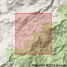
CRYPTOCOLAX CLARENSIS R.A. Scott n. sp. was collected in NE/4 SW/4 SE/4 sec.27 T7S R19E, Wheeler Co, OR, in Clarno formation of middle(?) Eocene age.
Source: GNU records (USGS DDS-6; Menlo GNULEX).
- Usage in publication:
-
- Clarno formation*
- Modifications:
-
- Mapped
- AAPG geologic province:
-
- Blue Mountains province
Summary:
Mapped near Deschutes River. Described as altered dark-greenish-gray andesite and some quartz basalt, hypersthene basalt, and dacite flows and mud-flow breccia; generally includes one or more red saprolite layers at or near top of unit. Correlated with rocks east of map area with age in part late Eocene on basis of fossil plants (Scott, 1954) and vertebrates (J.A. Shotwell, 1958, written commun.).
Source: GNU records (USGS DDS-6; Menlo GNULEX).
- Usage in publication:
-
- Clarno Formation*
- Modifications:
-
- Revised
- AAPG geologic province:
-
- Blue Mountains province
Summary:
In Willowdale and Ashwood area, northeast Jefferson Co, OR, Clarno Formation as mapped by Hodge (1932) is stratigraphically restricted in that upper two units are herein reallocated to overlying John Day Formation, because they unconformably overlie Clarno Formation, contain flora of late Oligocene age at their base, and extend eastward into type John Day Formation. Age of Clarno is Eocene.
Source: GNU records (USGS DDS-6; Menlo GNULEX).
- Usage in publication:
-
- Clarno Formation*
- Modifications:
-
- Revised
- AAPG geologic province:
-
- Blue Mountains province
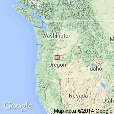
Summary:
Shown in schematic cross-section. Top of Clarno Formation raised in report area at expense of John Day Formation to agree with usage in adjacent areas. K-Ar age of 41.0 +/-1.2 Ma from formerly "post-Clarno rocks" suggest they should be reassigned to Clarno Formation. Age remains Eocene and early Oligocene.
Source: GNU records (USGS DDS-6; Menlo GNULEX).
- Usage in publication:
-
- Clarno Formation*
- Modifications:
-
- Overview
- Age modified
- AAPG geologic province:
-
- Blue Mountains province
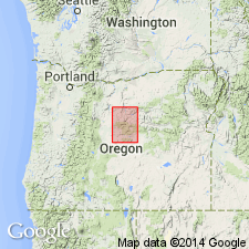
Summary:
Lithologic facies separately mapped. Review of literature and age changes. Age is late Eocene to early Oligocene based on floras (at Cherry and Currant Creek, near Clarno, and along west branch of Bridge Creek (Knowlton, 1902; Arnold, 1953; Scott, 1954; Hergert, 1961; Wolfe and Hopkins, 1967) and K-Ar ages of 41.0 +/-1.2 Ma (Swanson and Robinson, 1968) to 37.5, 36.5 +/-0.9, and 34.2 Ma from upper several 100 ft of unit in Bridge Creek and Clarno areas (Evernden and James, 1964; Evernden and others, 1964)
Source: GNU records (USGS DDS-6; Menlo GNULEX).
- Usage in publication:
-
- Clarno Formation*
- Modifications:
-
- Biostratigraphic dating
- AAPG geologic province:
-
- Blue Mountains province
Summary:
Age of Clarno Formation is given as middle Eocene to early Oligocene based on flora of temperate to subtropical climate. Middle part of formation includes highly distinctive flora: CHAMAECYPARIS, PINUS, POPULUS, BETULA, MAHOMA ...
Source: GNU records (USGS DDS-6; Menlo GNULEX).
- Usage in publication:
-
- Clarno Group
- Modifications:
-
- Revised
- AAPG geologic province:
-
- Blue Mountains province
Summary:
Clarno "Group" subdivided informally into "Lower" Clarno and "Upper" Clarno units in Mitchell area because the two sequences of similar flows and volcanic-derived sedimentary rocks are separated by angular unconformity. Fossil vertebrates and leaves found in Clarno sedimentary rocks indicate age of late Eocene. K-Ar ages (Enlows and Parker, 1972) suggest Clarno in Mitchell area accumulated between 46 and 30 Ma (late Eocene and early Oligocene).
Source: GNU records (USGS DDS-6; Menlo GNULEX).
- Usage in publication:
-
- Clarno Formation*
- Modifications:
-
- Mapped
- AAPG geologic province:
-
- Blue Mountains province
Summary:
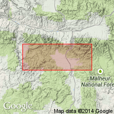
Small outcrop shown north of Vance Creek in Aldrich Mountains, Grant Co, OR. Described as andesitic flows along Canyon Creek in John Day quad. Age given as Eocene. [no basis given]
Source: GNU records (USGS DDS-6; Menlo GNULEX).
- Usage in publication:
-
- Clarno Formation*
- Modifications:
-
- Geochronologic dating
- AAPG geologic province:
-
- Blue Mountains province
Summary:
Clarno Formation was emplaced from about 46 to about 29 Ma (Eocene and Oligocene).
Source: GNU records (USGS DDS-6; Menlo GNULEX).
- Usage in publication:
-
- Clarno Formation
- Modifications:
-
- Overview
- AAPG geologic province:
-
- Eastern Columbia basin
Summary:
Middle Eocene (Bridgerian) mammals occur with fossil wood, fruits, and seeds related to Eocene London Clay. Flora occur together in beds near top of Clarno, near its type locality.
Source: GNU records (USGS DDS-6; Denver GNULEX).
- Usage in publication:
-
- Clarno Formation*
- Modifications:
-
- Geochronologic dating
- AAPG geologic province:
-
- Blue Mountains province
Summary:
Age is Eocene and early Oligocene based on K-Ar ages ranging from 53.7 to 33.7 Ma. Remanent magnetization directions at 46 sites in lavas provide paleomagnetic pole at 84 deg N, 278 deg E with 95 percent confidence cone of 7 deg which indicates Clarno Formation has rotated 15.7 +/-9.5 deg clockwise which is significant at 95 percent confidence level (Diehl and others, 1983) but has undergone no significant latitudinal displacement.
Source: GNU records (USGS DDS-6; Menlo GNULEX).
- Usage in publication:
-
- Clarno Formation*
- Modifications:
-
- Age modified
- AAPG geologic province:
-
- Blue Mountains province
Summary:
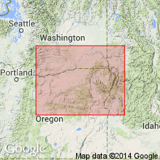
Age is Eocene and earliest Oligocene(?) based on K-Ar ages ranging mainly between 55 and 40 Ma [some ages younger than about 35 Ma are suspect] and based on stratigraphic relations.
Source: GNU records (USGS DDS-6; Menlo GNULEX).
For more information, please contact Nancy Stamm, Geologic Names Committee Secretary.
Asterisk (*) indicates published by U.S. Geological Survey authors.
"No current usage" (†) implies that a name has been abandoned or has fallen into disuse. Former usage and, if known, replacement name given in parentheses ( ).
Slash (/) indicates name conflicts with nomenclatural guidelines (CSN, 1933; ACSN, 1961, 1970; NACSN, 1983, 2005, 2021). May be explained within brackets ([ ]).

