

- Usage in publication:
-
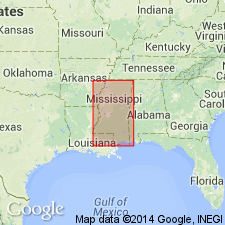
- Claiborne sands
- Modifications:
-
- Biostratigraphic dating
- Dominant lithology:
-
- Sand
- AAPG geologic province:
-
- Mid-Gulf Coast basin
Summary:
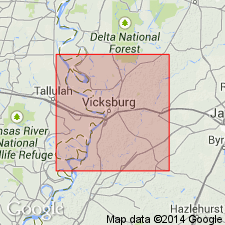
Pg. 280-282. Claiborne sands. [Described 105 new fossil species from Eocene of vicinity of Vicksburg, Mississippi. Divided the Eocene into "Upper or Newer Eocene," and "Lower or Older Eocene," and stated that Vicksburg group belongs to former and Claiborne sands to latter. Neither Vicksburg group nor Claiborne sands was described.]
Source: US geologic names lexicon (USGS Bull. 896, p. 448-449).
- Usage in publication:
-
- Claiborne group
- Modifications:
-
- Biostratigraphic dating
- AAPG geologic province:
-
- Mid-Gulf Coast basin
Summary:
Pg. 257-258. Claiborne group. [This report lists "groups of characteristic fossils" from "Newer Eocene" and "Older Eocene" of Mississippi. The "Older Eocene" is divided into (descending) Jackson and Claiborne groups. The Claiborne (fossil group Nos. 1-3) includes OSTREA SELLAEFORMIS, CARDITA DENSATA, and CYCLAS; see also entry under Vicksburg.]
Source: US geologic names lexicon (USGS Bull. 896, St. Stephens entry p. 1886, Vicksburg entry p. 2246).
- Usage in publication:
-
- Claiborne group
- Modifications:
-
- Revised
- AAPG geologic province:
-
- Mid-Gulf Coast basin
Summary:
Pg. 108, 123-128. Described Claiborne group as consisting of:
"Calcareous Claiborne group (marls and limestone, white, sometimes indurate, and blue).
Lignitic clays and sands of North Clarke County.
Siliceous Claiborne group (siliceous sandstone and claystones)."
Source: US geologic names lexicon (USGS Bull. 896, p. 448-449).
- Usage in publication:
-
- Claiborne group proper
- Modifications:
-
- Revised
- AAPG geologic province:
-
- Mid-Gulf Coast basin
Summary:
Pg. 33. Claiborne group proper. The blue marl and white marlstone which I designate "Calcareous Claiborne" group in my report, are strictly = the typical fossiliferous sand at Claiborne with the underlying limestone bed. Underlies Jackson group and overlies Siliceous Claiborne or Buhrstone group. [This restricted definition of Claiborne group was used for many years.]
Source: US geologic names lexicon (USGS Bull. 896, p. 448-449).

- Usage in publication:
-
- Claiborne group*
- Modifications:
-
- Overview
- AAPG geologic province:
-
- Mid-Gulf Coast basin
Summary:
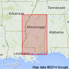
Claiborne group. Age is middle Eocene. Recognized in Gulf Coastal Plain from Georgia to southern Texas.
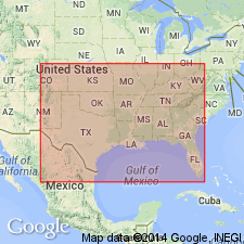
In 1894 (Amer. Jour. Sci., 3rd ser., v. 47, p. 303-304) G.D. Harris included the †Buhrstone (Tallahatta formation) in his Lower Claiborne stage, but other writers continued for several years to exclude it from Claiborne group. In 1900 T.W. Vaughan (USGS Mon. 39) included it in his Claibornian stage, but E.A. Smith of Alabama Geol. Survey, continued to exclude it. In 1920, however, J.E. Brantly (Alabama Geol. Survey Bull., no. 22) included Tallahatta formation in the Claiborne group. The USGS has since 1906 included Tallahatta in Claiborne group. The Claiborne group as now understood is characterized by a distinctive fauna, is overlain by Jackson formation and underlain by Wilcox group. It is chiefly of marine origin and in Mississippi is divided into following formations (descending): Yegua (†Cockfield) formation = Gosport sand of Alabama and includes †Claiborne sand and †OSTREA SELLAEFORMIS beds of earlier reports.
St. Maurice formation of Louisiana = Lisbon formation (type in Alabama) and Tallahatta formation (†Buhrstone); (type in Alabama).
In Texas it is divided into (descending) Yegua, Cook Mountain, and Mount Selman formations and Carrizo sand.
Named from exposures at Claiborne Bluff and Claiborne Landing, on Alabama River, Monroe Co., southwestern AL. (The Tallahatta formation is not there exposed, but is exposed a few mi up the river.)
Source: US geologic names lexicon (USGS Bull. 896, p. 448-449).
- Usage in publication:
-
- Claiborne group
- Modifications:
-
- Revised
- AAPG geologic province:
-
- East Texas basin
Summary:
Pg. 20 (table), 58-160. Claiborne group. Comprises (ascending) Carrizo sand; Reklaw formation with Newby glauconitic sand and Marquez shale members (both new); Queen City sand with Omen glauconitic sand member; Weches glauconite marl with Tyrus marl, Viesca glauconitic marl and Therril clay members (all new); Sparta sand; Stone City beds (formation); Crockett formation with Wheelock marl, Landrum shale, Spiller sand, and Mount Tabor shale members (all new); and Yegua formation. Overlies Sabinetown shale of Wilcox group; underlies Uvalde(?) formation. Age is middle Eocene.
Study area in Leon Co., TX.
Source: US geologic names lexicon (USGS Bull. 1200, p. 813-815).
- Usage in publication:
-
- Claiborne group*
- Modifications:
-
- Revised
- AAPG geologic province:
-
- Mid-Gulf Coast basin
Summary:
Pg. 337-340. Claiborne group. Gosport sand of Alabama, heretofore classified as topmost formation of Claiborne group (Eocene), and only known formation of "upper Claiborne" age, proves to be nearly equivalent to Moodys marl of Mississippi, the basal formation of Jackson group. Recommended that name Gosport be replaced by Moodys and that Claiborne group be restricted to formations heretofore classified as lower Claiborne.
Source: US geologic names lexicon (USGS Bull. 1200, p. 813-815).
- Usage in publication:
-
- Claiborne group
- Modifications:
-
- Areal extent
- AAPG geologic province:
-
- Florida platform
- South Georgia sedimentary province
Summary:
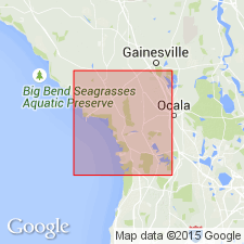
Pg. 1732-1733. Claiborne group. Avon Park limestone, Tallahassee limestone (with nonfossiliferous facies) and Lake City limestone (early middle Eocene) represent Claiborne group in Florida Peninsula, and where all three units are present they appear to make, in most places, a conformable sequence. In J.S. Cosden's Lawson well No. 1, Marion County, Georgia, beds of lignite occurring at contact of Lake City with nonfossiliferous limestone are believed to indicate local unconformity. Along northeast coast of Florida and in south half of peninsula, nonfossiliferous limestone is not present and the Avon Park rests on Lake City limestone.
Source: US geologic names lexicon (USGS Bull. 1200, p. 813-815).

- Usage in publication:
-
- Claiborne group
- Modifications:
-
- Areal extent
- AAPG geologic province:
-
- Mid-Gulf Coast basin
Summary:
Pg. 10-11. Claiborne group, in Alabama, comprises (ascending) Tallahatta, Lisbon, and Gosport formations. Overlies Hatchetigbee formation of Wilcox group; underlies Moodys Branch marl of Jackson group. [Age is middle Eocene.]
Source: US geologic names lexicon (USGS Bull. 1200, p. 813-815).
- Usage in publication:
-
- Claiborne group*
- Modifications:
-
- Revised
- AAPG geologic province:
-
- Mid-Gulf Coast basin
Summary:
Claiborne group. In Quitman fault zone (Mississippi and Alabama), group includes Tallahatta formation, Zilpha clay, Winona sand, Kosciusko sand, Wautubbee formation, and Cockfield formation. [Age is middle Eocene.]
Source: US geologic names lexicon (USGS Bull. 1200, p. 813-815).
- Usage in publication:
-
- Claiborne group
- Modifications:
-
- Mapped
- AAPG geologic province:
-
- Mid-Gulf Coast basin
Summary:
Claiborne group. As mapped, group includes Tallahatta formation, Zilpha clay, Winona sand, Neshoba sand, Sparta sand, Cook Mountain formation, and Cockfield formation. [Age is middle Eocene.]
Source: US geologic names lexicon (USGS Bull. 1200, p. 813-815).
- Usage in publication:
-
- Claiborne group
- Modifications:
-
- Areal extent
- AAPG geologic province:
-
- Florida platform
Summary:
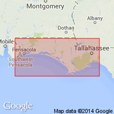
Pg. 47-51. Claiborne group in subsurface in western Florida is subdivided into Lisbon and Tallahatta formation in accordance with usage in Alabama. Overlying Gosport formation also was formerly included in Claiborne, but is now generally considered lower Jackson in age. Overlies Wilcox group not subdivided in subsurface of western Florida. [Age is middle Eocene.]
Source: US geologic names lexicon (USGS Bull. 1200, p. 813-815).
- Usage in publication:
-
- Claiborne group*
- Modifications:
-
- Areal extent
- AAPG geologic province:
-
- Mid-Gulf Coast basin
- South Georgia sedimentary province
Summary:
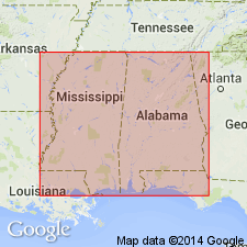
Claiborne group, in Alabama and Georgia, comprises (ascending) Tallahatta formation, Lisbon formation, and Gosport sand. [Age is middle Eocene.]
Source: US geologic names lexicon (USGS Bull. 1200, p. 813-814).
- Usage in publication:
-
- Claiborne group
- Modifications:
-
- Areal extent
- AAPG geologic province:
-
- Florida platform
Summary:
Pg. 88-111. Rocks assigned to Claiborne group of peninsular Florida differ in faunal content and lithology from those recognized throughout Gulf Coast elsewhere. In general, Claiborne group of northern and peninsular Florida is composed of carbonates and evaporites and that of western Gulf Coast is composed of clastics, largely sands and clays. An occasional fossil common to both sections support stage-age assignments, but these are insufficient to allow extension of Gulf Coast formational nomenclature to carbonate rocks of Florida. Applin and Applin (1944) erected three formations in the Claiborne group: Lake City limestone (early middle Eocene), Tallahassee limestone (late middle Eocene), and Avon Park limestone (late middle Eocene). In western Florida, Claiborne group is not present at surface, but two-fold division can be recognized in subsurface. Gosport at top and Lisbon formation at base. Disconformably underlies Moodys Branch formation of Jackson group. Claiborne-Jackson contact discussed [see Jackson group].
Source: US geologic names lexicon (USGS Bull. 1200, p. 813-815).
- Usage in publication:
-
- Claiborne group
- Modifications:
-
- Areal extent
- AAPG geologic province:
-
- Gulf Coast basin
Summary:
Pg. 77-78, pls. 11, 12. Current usage of Claiborne group is in time-stratigraphic sense, including within its limits many lithologic types deposited during several advances and retreats of sea. Recommended that Claiborne be utilized strictly as group name for clastic facies in central and western Gulf Coast Plain below Jackson stage and above Wilcox group. So used, it would be partially the arenaceous counterpart of calcareous Lisbon group of eastern Gulf Coast. [Age is middle Eocene.]
Source: US geologic names lexicon (USGS Bull. 1200, p. 813-815).
- Usage in publication:
-
- Claiborne group
- Modifications:
-
- Areal extent
- AAPG geologic province:
-
- Black Warrior basin
Summary:
Pg. 10. In Yalobusha County, Mississippi, Claiborne [group] includes (ascending) Meridian formation, Tallahatta, Winona, Zilpha, and Kosciusko formations. [Age is middle Eocene.]
Source: US geologic names lexicon (USGS Bull. 1200, p. 813-815).
- Usage in publication:
-
- Claiborne group
- Modifications:
-
- Areal extent
- AAPG geologic province:
-
- Arkla basin
Summary:
Pg. 85-94, maps. Claiborne group, in Sabine Parish, Louisiana, comprises (ascending) Cane River, Sparta, Cook Mountain (with Dodson member equivalent, Milams and Saline Bayou members), and Cockfield formations. Overlies Wilcox group (rock term); underlies Jackson group. [Age is middle Eocene.]
Source: US geologic names lexicon (USGS Bull. 1200, p. 813-815).
- Usage in publication:
-
- Claiborne Group*
- Modifications:
-
- Areal extent
- AAPG geologic province:
-
- Mid-Gulf Coast basin
Summary:
Middle Eocene Claiborne Group and its Lisbon-equivalent and underlying Tallahatta Formations geographically extended in subsurface into westernmost FL panhandle. Underlies Ocala Limestone; overlies Hatchetigbee Formation of Wilcox Group.
Source: GNU records (USGS DDS-6; Reston GNULEX).
- Usage in publication:
-
- Claiborne(?) Formation*
- Modifications:
-
- Areal extent
- AAPG geologic province:
-
- Illinois basin
Summary:
Claiborne(?) Formation used in western KY rather than Claiborne(?) Group.
Source: GNU records (USGS DDS-6; Reston GNULEX).
- Usage in publication:
-
- Claiborne Group*
- Modifications:
-
- Revised
- AAPG geologic province:
-
- Gulf Coast basin
Summary:
Claiborne Group. In Texas Coastal Plain, north of Frio River to Sabine uplift, includes (descending) Yegua Formation, Cook Mountain Formation, Sparta Sand, Weches Formation, Queen City Sand, Reklaw Formation, and Carrizo Sand. South of the Frio, in Rio Grande embayment, includes (descending) Yegua Formation, Laredo Formation, El Pico Clay, Bigford Formation, and Carrizo Sand. Overlies Wilcox Group. Age is middle Eocene.
Source: Publication; Changes in stratigraphic nomenclature, 1968 (USGS Bull. 1294-A, p. A5).
- Usage in publication:
-
- Claiborne Group*
- Claiborne Formation*
- Modifications:
-
- Revised
- Areal extent
- AAPG geologic province:
-
- Illinois basin
Summary:
In subsurface of westernmost KY, the Eocene Claiborne Group is recognized and is divided on the basis of lithology by geophysical logs, spores, and pollen into (ascending) Tallahatta Formation, Sparta Sand, Cook Mountain Formation. Cockfield Formation in this report is undivided with overlying Jackson Formation, and not part of Claiborne. Formations of Claiborne not recognized at the surface. Claiborne Formation used instead.
Source: GNU records (USGS DDS-6; Reston GNULEX).
- Usage in publication:
-
- Claiborne Formation*
- Modifications:
-
- Revised
- Areal extent
- AAPG geologic province:
-
- Upper Mississippi Embayment
Summary:
Claiborne Formation instead of Claiborne Group used in the Mississippi Embayment part of western TN according to the usage of the Tennessee Division of Geology, the cooperators of the map.
Source: GNU records (USGS DDS-6; Reston GNULEX).
- Usage in publication:
-
- Claiborne Group*
- Modifications:
-
- Age modified
- Biostratigraphic dating
- Geochronologic dating
- AAPG geologic province:
-
- Mid-Gulf Coast basin
Summary:
In eastern AL and western GA Gulf Coastal Plain, Bashi Marl Member (lower) of Hatchetigbee Formation and its "unnamed upper member" are time equivalent, and all facies of Hatchetigbee were deposited during earliest early Eocene (lower half of calcareous nannofossil Zone NP10, radiometric age of 53.0-53.5 m.y.). Hatchetigbee generally accepted as top of Wilcox Group, and overlying Tallahatta Formation with its Meridian Sand Member (not in GA) generally accepted as base of Claiborne Group. Lower Tallahatta-Meridian beds indicate placement in late early Eocene (calcareous nannofossil Zone NP13, radiometric age of 49.3-50.4 m.y.), suggesting hiatus between Wilcox-Claiborne unconformity of minimum time of 2.6 m.y. Therefore Wilcox-Claiborne boundary is in early Eocene, and Claiborne-Tallahatta-Meridian age changed from early middle Eocene to late early and early middle Eocene.
Source: GNU records (USGS DDS-6; Reston GNULEX).
- Usage in publication:
-
- Claiborne Group*
- Modifications:
-
- Areal extent
- AAPG geologic province:
-
- Ozark uplift
Summary:
Claiborne Group geographically extended from AL, MS, LA, TX, GA, AR, TN, and KY into southeastern MO.
Source: GNU records (USGS DDS-6; Reston GNULEX).

- Usage in publication:
-
- Claiborne Group
- Modifications:
-
- Overview
- AAPG geologic province:
-
- Mid-Gulf Coast basin
Summary:
The Claiborne Group of AL State usage comprises the Tallahatta Formation (with its Meridian Sand Member at base), the Lisbon Formation, and the Gosport Sand, in ascending order. Gosport and Meridian absent in subsurface of southwest AL. Age is early and middle Eocene (Ypresian, Lutetian, and Bartonian).
Source: GNU records (USGS DDS-6; Reston GNULEX).
- Usage in publication:
-
- Claiborne Group
- Modifications:
-
- Overview
Summary:
Claiborne Group. Divided into (descending) Cockfield, Cook Mountain, Sparta, Cane River, and Carrizo formations. Well-developed diagenetic ironstone occurs locally at surface and shallow subsurface of north Louisiana. Age is Eocene.
Source: Publication.
- Usage in publication:
-
- Claiborne Group*
- Modifications:
-
- Overview
- AAPG geologic province:
-
- Arkla basin
- Upper Mississippi embayment
Summary:
Pg. 34. Claiborne Group. Chiefly nonmarine in origin but does contain some marine intervals. Consists of medium to very-fine sands, silts, and silty clays. The sands tend to be light- to dark-gray, white, brown, or red depending on
the degree of weathering. The silts and clays are light to dark gray and sometimes variegated. Intervals enriched in carbonaceous material are dark brown to black. The silts are usually clayey and the clays are normally silty or sandy. Lignite beds are found in this interval and seem to be environmentally rather than stratigraphically controlled. In the subsurface the Claiborne Group has been divided into the Carrizo Sand, Cane River Formation, Sparta Sand, Cook Mountain Formation, and Cockfield Formation. Fossils include fish and reptile bones and teeth, leaf impressions and lignitic wood, and trace fossils. The lower contact of the Claiborne is poorly known but considered unconformable. Thickness ranges from a thin edge to as much as 1,500 feet. [Age is middle Eocene.]
Occurs in west Gulf Coastal Plain of southern AR and Crowley's Ridge in eastern AR; Gulf Coastal Plain from GA to southern TX.
Source: Publication.
- Usage in publication:
-
- Claiborne Group
- Modifications:
-
- Overview
- AAPG geologic province:
-
- Mid-Gulf Coast basin
Summary:
Claiborne Group. In updip (north) area, includes (descending) Cockfield Formation, Cook Mountain Formation, Kosciusko Formation, Zilpha Shale, Winona Formation, Tallahatta Formation, and Meridian Sand. In downdip (south) area, includes (descending) Cockfield Formation, Gosport Sand, Cook Mountain Formation, CAMERINA limestone, Kosciusko Formation, Cane River Formation, and Meridian Sand. Separated by unconformities from overlying Jackson and underlying Wilcox Groups. Age is early to middle Eocene (Ypresian to Bartonian); nannofossil zones NP12 to NP17, planktic foram zones P7 to P14 (H. ARAGONENSIS to T. ROHRI).
Source: Publication.
For more information, please contact Nancy Stamm, Geologic Names Committee Secretary.
Asterisk (*) indicates published by U.S. Geological Survey authors.
"No current usage" (†) implies that a name has been abandoned or has fallen into disuse. Former usage and, if known, replacement name given in parentheses ( ).
Slash (/) indicates name conflicts with nomenclatural guidelines (CSN, 1933; ACSN, 1961, 1970; NACSN, 1983, 2005, 2021). May be explained within brackets ([ ]).