The National Geologic Map Database is migrating to a new infrastructure. We apologize for any service disruptions during this process.
|
|---|


- Usage in publication:
-
- Chugwater formation*
- Modifications:
-
- Original reference
- Dominant lithology:
-
- Sandstone
- Shale
- Gypsum
- AAPG geologic province:
-
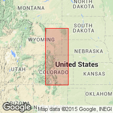
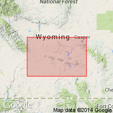
- Denver basin
- Powder River basin
Summary:
Pg. 394-401. Chugwater formation. Proposed for series of red beds extending along foot of Bighorn Range southward through Wyoming and Colorado. In Black Hills region the red beds are divided near base by a limestone designated Minnekahta, and although there appears to be a continuous representative of this limestone in Bighorn uplift, a definite correlation cannot be ventured, so that a name is required for the undivided red beds. Thickness (1,250 feet) is also greater than in Black Hills, but the formation is believed to correlate with Spearfish, Minnekahta, and Opeche of that region. It unconformably underlies Sundance formation (Jurassic), overlies Tensleep sandstone (Carboniferous), and is of Permian and Triassic(?) age. [Age is Permian and Triassic.]
Named from Chugwater Creek near Iron Mountain, [Platte Co.], WY. [Recognized in WY (rather widespread) and central southern MT.]
Source: US geologic names lexicon (USGS Bull. 896, p. 441).

- Usage in publication:
-
- Chugwater formation*
- Modifications:
-
- Overview
- AAPG geologic province:
-
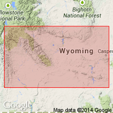
- Green River basin
Summary:
In 1908 (GSA Bull., v. 19, p. 403-463) Darton divided the red beds of southeastern Wyoming (Laramie basin region) into (descending) Chugwater formation (Permian or Triassic), Forelle limestone (Carboniferous), and Satanka shale (Carboniferous). He stated that the Forelle was separated on account of its fossils; but for which the limestone and underlying Satanka shale might be regarded as a portion of Chugwater formation.
Later it was found that in some areas the upper part of red beds included in Chugwater formation contained an Upper Jurassic (Sundance) marine fauna; and these beds are now included in Sundance formation. Still later the upper part of the restricted Chugwater was removed and named Popo Agie beds by Williston and Jelm formation by Knight, and this restricted definition is that now employed by the USGS. The Chugwater is almost wholly nonmarine, and as now interpreted is of Triassic and Permian age. It usually unconformably underlies Sundance formation, but in places is overlain by intervening Jelm formation. In Wind River Mountains the characteristic Chugwater redbeds rest on Dinwoody formation. In other parts of Wyoming. the redbeds occupy a much larger stratigraphic interval and rest on Tensleep sandstone. In southeastern Wyoming the Chugwater has been described as resting on Forelle limestone, which overlies the red Satanka shale; but H.D. Thomas, 1934 (AAPG Bull., v. 18, no. 12, p. 1670, 1687), described Forelle limestone as an eastern extension of middle part of Phosphoria formation, and Satanka shale as basal part of Chugwater formation as originally defined. He therefore applied Satanka tongue of Chugwater formation to Satanka shale of Darton, Forelle tongue of Phosphoria formation to Forelle limestone of Darton, and the new name Freezeout tongue of Chugwater formation to the red beds overlying the Forelle and underlying an eastern extension of Dinwoody formation which he named Little Medicine tongue of Dinwoody formation.
Source: US geologic names lexicon (USGS Bull. 896, p. 441).
- Usage in publication:
-
- Chugwater formation
- Modifications:
-
- Revised
- AAPG geologic province:
-
- Wind River basin
Summary:
Divided into (ascending order): Red Peak (new); Crow Mountain (new); Popo Agie (new rank); and Gypsum Spring (new) Members in southeastern end of Washakie Range, Fremont Co, WY in Wind River basin. Was measured on east side of Red Creek in sec 36, T7N, R4W, sec 1, T6N, R4W, and sec 6, T6N, R3W where a section 1246 ft 6 in was described. Is younger than Dinwoody formation and older than Sundance formation. Limited in report area to three other localities: 1) East Fork River 1 1/2 mi southwest of Duncan; 2) mouth of Wiggins Fork Canyon; 3) mouth of Caldwell Creek Canyon. Of Triassic age. Geologic map.
Source: GNU records (USGS DDS-6; Denver GNULEX).
- Usage in publication:
-
- Chugwater Formation
- Modifications:
-
- Revised
- AAPG geologic province:
-
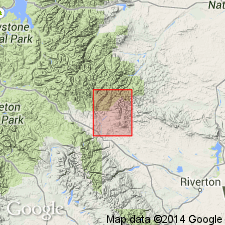
- Wind River basin
- Bighorn basin
Summary:
Revised in that unnamed red bed unit assigned to Chugwater; red bed unit occurs between Crow Mountain Sandstone (revised) and Popo Agie (revised) Members of Chugwater. Study area within Wind River and Bighorn basins, WY. Assignment of red bed unit to Chugwater modifies lower boundary of Popo Agie and upper boundary of Crow Mountain. At Red Grade section (sec 13, T5N, R6W, Fremont Co), red bed unit is 35 ft thick; in sections at Crooked Creek (sec 14, T1S, R2W, Fremont Co), south of Thermopolis (sec 22, T42N, R95W, Hot Springs Co), and Dallas Dome (sec 13, T32N, R99W, Fremont Co), red bed unit is about 100 ft thick. In Hudson Dome (sec 24, T2S, R1E, Fremont Co) and Red Canyon (sec 36, T31N, R99W, Fremont Co) sections, Crow Mountain is not well developed and interval from base of Popo Agie to top of underlying Alcova Limestone Member of Chugwater could be assigned to unnamed red bed unit [thickness of interval not given]. Lower part of unnamed red bed unit is in places a lateral facies of Crow Mountain; for this reason no formal name assigned to red bed unit. Red bed unit is characteristically grayish-red, pale reddish-brown, and dark reddish-brown well-sorted and poorly sorted siltstone, very fine grained sandstone, silty claystone, and shale. Popo Agie divided into four informal units, in ascending order: lower carbonate unit, purple unit, ocher unit, and upper carbonate unit. Cross section. Triassic age.
Source: GNU records (USGS DDS-6; Denver GNULEX).
- Usage in publication:
-
- Chugwater Group
- Modifications:
-
- Revised
- AAPG geologic province:
-
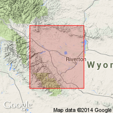
- Wind River basin
- Bighorn basin
- Green River basin
Summary:
Raised to group rank. Also raised in rank and assigned to Chugwater are, in ascending order: Red Peak Formation, Crow Mountain Formation and Popo Agie Formation. Each of formations of Chugwater is divided into informal units; Alcova Limestone Member is reduced in rank and assigned to Crow Mountain. Stratigraphic chart. Study area includes Bighorn, Wind River and Greater Green River basins, western WY. Conformably overlies Dinwoody Formation; unconformably underlies Nugget Sandstone or Gypsum Spring Formation. Early and Late Triassic age.
Source: GNU records (USGS DDS-6; Denver GNULEX).
- Usage in publication:
-
- Chugwater Group*
- Modifications:
-
- Revised
- AAPG geologic province:
-
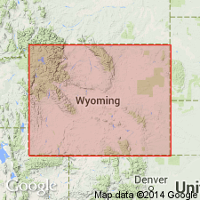
- Wind River basin
- Green River basin
Summary:
Raised to group rank in south-central WY in Wind River and Greater Green River basins. Divided into Red Peak Formation (base), Alcova Limestone, Jelm Formation (southeast) and its equivalent northwest of Granite Mountains, Crow Mountain Sandstone, and Popo Agie Formation (top). These formations were designated members of Chugwater in earlier reports. The Jelm divided into the newly named Red Draw (base) and Sips Creek (top) Members. The Popo Agie divided into the newly named Brynt Draw (base) and Lyons Valley (top) Members. Of Triassic age.
Source: GNU records (USGS DDS-6; Denver GNULEX).
- Usage in publication:
-
- Chugwater Group
- Modifications:
-
- Revised
- AAPG geologic province:
-
- Wind River basin
- Green River basin
Summary:
In Wind River and Greater Green River basins, central WY, Chugwater consists of, in ascending order: Red Peak, Crow Mountain, Jelm, and Popo Agie Formations. Chugwater correlates with Thaynes and Ankareh Formation in western WY at Munger Mountain (sec 21, T39N, R116W) and Red Mountain (secs 6, 7, T42N, R113W) both in Teton Co, Yellowstone province. Oldest unit studied; unconformably underlies Nugget Sandstone. Correlation chart; cross sections. Early to Late Triassic age.
Source: GNU records (USGS DDS-6; Denver GNULEX).
- Usage in publication:
-
- Chugwater Group*
- Modifications:
-
- Areal extent
- AAPG geologic province:
-
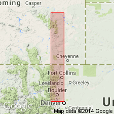
- Denver basin
- Powder River basin
Summary:
Triassic Red Peak Formation of Chugwater Group recognized from Mesa Mountain, Converse Co, WY in Denver basin north to Douglas, Converse Co, WY in Powder River basin. Southward, Red Draw Member of Jelm Formation, Chugwater Group recognized from a point north of Mesa Mountain, Laramie Co, WY to point between Little Thompson and Four Mile Canyon, Boulder Co, CO in Denver basin. Underlies Canyon Springs Member of Sundance Formation unconformably. In CO overlies Lykins Formation unconformably. Measured sections shown graphically.
Source: GNU records (USGS DDS-6; Denver GNULEX).
- Usage in publication:
-
- Chugwater Group*
- Modifications:
-
- Revised
- AAPG geologic province:
-
- Powder River basin
Summary:
In study area of southwestern Powder River basin, WY, Chugwater divided into (ascending) Red Peak Formation, Alcova Limestone, Crow Mountain Sandstone, unnamed red beds, and Popo Agie Formation. This nomenclature has following differences from Chugwater of Picard (1978; WGA 30th Ann. Fld. Conf. Guidebook [this nomenclature is based on High and Picard (1967)]): 1) Red Peak includes variegated sandy facies that Picard assigned to lowermost part of Crow Mountain; 2) Alcova raised to formation rank rather than a member of Crow Mountain; 3) Crow Mountain includes only the basal sandstone and upper sandstone and siltstone facies of Picard's Crow Mountain; 4) unnamed red beds (probably equivalent to Sips Creek Member of Jelm Formation) used rather than Jelm Formation [unnamed red beds of Popo Agie used by High and Picard (1967)]; is an unranked unit between Crow Mountain and Popo Agie. Chugwater conformably overlies Dinwoody or Goose Egg Formations; unconformably underlies Nugget Sandstone. Triassic age.
Source: GNU records (USGS DDS-6; Denver GNULEX).

- Usage in publication:
-
- Chugwater Formation*
- Modifications:
-
- Areal extent
- AAPG geologic province:
-
- Powder River basin
Summary:
Identified throughout the subsurface of the Powder River basin in MT and WY where it overlies Goose Egg Formation and underlies Gypsum Spring Formation, or locally unconformably Sundance Formation. Of Triassic age. [This nomenclature shown on 22 cross sections in this OC series.]
Source: GNU records (USGS DDS-6; Denver GNULEX).
For more information, please contact Nancy Stamm, Geologic Names Committee Secretary.
Asterisk (*) indicates published by U.S. Geological Survey authors.
"No current usage" (†) implies that a name has been abandoned or has fallen into disuse. Former usage and, if known, replacement name given in parentheses ( ).
Slash (/) indicates name conflicts with nomenclatural guidelines (CSN, 1933; ACSN, 1961, 1970; NACSN, 1983, 2005, 2021). May be explained within brackets ([ ]).