The National Geologic Map Database is migrating to a new infrastructure. We apologize for any service disruptions during this process.
|
|---|


- Usage in publication:
-
- Chuar group*
- Modifications:
-
- Original reference
- Dominant lithology:
-
- Shale
- Sandstone
- Limestone
- AAPG geologic province:
-
- Southern Rocky Mountain region
Summary:
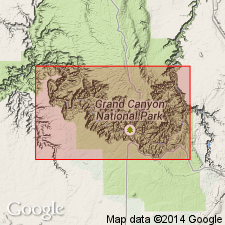
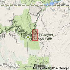
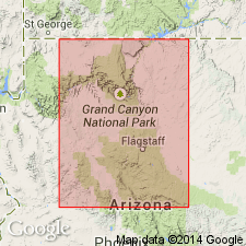
Pg. 439-442, 484. Chuar group. Sandy and clay shales with interbedded sandstones and limestones, which are exposed in inner canyon valleys of Grand Canyon of the Colorado. Top group of Grand Canyon series. Overlies unconformably the Grand Canyon group [Unkar group]. [Age is pre-Cambrian.]
[Named from Chuar Valley, Grand Canyon region, northern AZ.]
Source: US geologic names lexicon (USGS Bull. 896, p. 440).
- Usage in publication:
-
- Chuar terrane
- Chuar group*
- Modifications:
-
- Revised
- AAPG geologic province:
-
- Southern Rocky Mountain region
Summary:
Pl. 60, etc. Chuar terrane. Upper division consists of 1,700 feet of sandstones and shales with some limestone beds, reddish, brown, black, gray, buff, etc. in color; base is massive bed of reddish brown sandstone. Lower division consists of 3,420 feet of shales and sandstones with some limestone beds; of brown, gray, black, drab, and chocolate color; basal part consists of argillaceous shales resting on massive magnesium limestone. Unconformably underlies Tonto and overlies Unkar terrane. [Chuar group adopted by the USGS. Age is pre-Cambrian.]
Source: US geologic names lexicon (USGS Bull. 896, p. 440).
- Usage in publication:
-
- Chuar Group
- Modifications:
-
- Revised
- AAPG geologic province:
-
- Plateau sedimentary province
- Southern Rocky Mountain region
Summary:
Chuar Group. Subdivided into 3 newly named formations (descending): Sixty Mile [Sixtymile] Formation, mostly chert and breccia, 120 feet (36 m) thick, [chart accompanying geol. map (fig. 1) shows the Sixtymile excluded from Chuar Group]; Kwagunt Formation, mostly shale, 2,218 feet (676 m) thick; and Galeros Formation, mostly shale, 4,272 feet (1,302 m) thick. [See entries under individual formations.] Total thickness 6,610 feet (2,014 m). Unconformably underlies Cambrian Tapeats Formation and unconformably overlies Nankoweap Group. Fossils. Age is late Precambrian.
Source: Publication.
- Usage in publication:
-
- Chuar Group*
- Modifications:
-
- Revised
- AAPG geologic province:
-
- Southern Rocky Mountain region
Summary:
Assigned as the upper group (undivided on geologic maps) of the Precambrian Grand Canyon Supergroup (new rank; formerly Grand Canyon Series) in the Grand Canyon area of northern AZ in the Southern Rocky Mountain region. Lies unconformably above the Nankoweap Formation of the Grand Canyon Supergroup and unconformably below the Cambrian Tapeats Sandstone of the Tonto Group.
Source: GNU records (USGS DDS-6; Denver GNULEX).
- Usage in publication:
-
- Chuar Group*
- Modifications:
-
- Revised
- AAPG geologic province:
-
- Southern Rocky Mountain region
Summary:
Is a Proterozoic unit and part of the Grand Canyon Supergroup in northern AZ, Southern Rocky Mountain region, that is restricted to only the lower two formations--the Galeros and Kwagunt. The Sixtymile Formation is removed from the Chuar because of its different lithology and environment of deposition. Galeros and Kwagunt are predominantly dark-gray, marine shale, locally stromatolite-bearing carbonates and subordinate redbeds. Sixtymile is a very fine to coarse grained, landslide- and breccia-bearing redbed deposit of continental origin. Three horizons of algal stromatolitic limestone and CHUARIA found within shale units of the Chuar. Microflora and chitinozoan-like microfossils found in the Kwagunt. Galeros and Kwagunt are 1,900 m thick. Columnar section.
Source: GNU records (USGS DDS-6; Denver GNULEX).
- Usage in publication:
-
- Chuar Group*
- Modifications:
-
- Age modified
- AAPG geologic province:
-
- Southern Rocky Mountain region
Summary:
A group in the Grand Canyon Supergroup of northern AZ in the Southern Rocky Mountain region whose age is changed from Proterozoic Y to Late Proterozoic, the age term applied to rocks younger than 900 Ma and older than 570 Ma. Shown as spanning the interval between 900 Ma (est) and older than 825 Ma (est). Predominately finely laminated dark shale sequence with widely spaced dolomite beds that provide a means for separating the sequence. Is a shallow-water lacustrine deposit with stromatolites of tidal flat origin, and red beds that have sedimentary structures indicating intermittent flooding. Divided into Galeros Formation and its Tanner (base), Jupiter, Carbon Canyon, and Duppa Members and the overlying Kwagunt Formation and its Carbon Butte (base), Awatubi, and Walcott Members. Unconformably overlies Nankoweap Formation. Unconformably underlies Sixtymile Formation. Is 1,632 m thick. Has a variety of micro- and planktonic fossils. Acritarch fossils indicate Late Proterozoic age. Microbiota identical to those found in Uinta Mountain Group. Predates Windermere Supergroup of CN. Probably correlates with Mackenzie Mountains Supergroup of CN. Columnar section. Little polar motion occurred during Chuar time.
Source: GNU records (USGS DDS-6; Denver GNULEX).
- Usage in publication:
-
- Chuar Group*
- Modifications:
-
- Overview
- AAPG geologic province:
-
- Southern Rocky Mountain region
Summary:
In northern AZ, Southern Rocky Mountain region, Middle-Late Proterozoic boundary is at unconformity between Chuar and underlying Nankoweap Formation, both of Grand Canyon Supergroup. Although boundary is placed at unconformity, no appreciable structural disturbance is recognized in Grand Canyon rocks. Nominal age of boundary is 900 Ma. Boundary separates Middle Proterozoic redbed rocks from overlying early Late Proterozoic rocks that record a time of flourishing of plankters and a general suppression of redbeds. Middle-Late Proterozoic boundary previously (Elston, 1979, USGS Prof. Paper 1092; Elston, McKee, 1982) drawn to correspond with Grand Canyon-Mackenzie Mountains orogeny at top of Grand Canyon Supergroup to which nominal age of 800 Ma was assigned. Late Proterozoic age.
Source: GNU records (USGS DDS-6; Denver GNULEX).
- Usage in publication:
-
- Chuar Group*
- Modifications:
-
- Overview
- AAPG geologic province:
-
- Southern Rocky Mountain region
Summary:
Chuar Group of Grand Canyon Supergroup of northern AZ in the Southern Rocky Mountain region correlates with Uinta Mountain Group. CHUARIA-bearing acritarchs and vase-shaped chitinozoan-like microfossils have been reported from the Kwagunt Formation and from a sandstone in the Uinta Mountain Group beneath the Red Pine Shale. Strata bearing these fossils predate the Windermere Supergroup. Paleontologic correlation between these two groups is supported by the coincidence of their paleomagmetic poles. They have normal polarity in the lower part and they have a westward polar shift of some reversely polarized rocks in the upper part. Uinta Mountain thought to have been deposited at the north margin of the shallow Chuar sea or saline Chuar lake. Stratigraphic chart. Correlation chart. Late Proterozoic age.
Source: GNU records (USGS DDS-6; Denver GNULEX).
For more information, please contact Nancy Stamm, Geologic Names Committee Secretary.
Asterisk (*) indicates published by U.S. Geological Survey authors.
"No current usage" (†) implies that a name has been abandoned or has fallen into disuse. Former usage and, if known, replacement name given in parentheses ( ).
Slash (/) indicates name conflicts with nomenclatural guidelines (CSN, 1933; ACSN, 1961, 1970; NACSN, 1983, 2005, 2021). May be explained within brackets ([ ]).