

- Usage in publication:
-
- Christmas Canyon Formation*
- Modifications:
-
- Named
- Dominant lithology:
-
- Sandstone
- Conglomerate
- AAPG geologic province:
-
- Mojave basin
Summary:
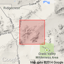
Named for Christmas Canyon about 1 mi east of type section which is designated as exposures SW/4 NW/4 sec.8 T28S R43E Lava Mountains, San Bernardino Co, CA. Consists of 2 distinct facies. Sandstone facies occurs in strip about .5 mi wide south of and parallel to Garlock fault; also it occurs north of fault. Boulder conglomerate facies characterized by small percentage of vesicular andesite, basaltic, and rhyolitic boulders 1 to 2 ft across is present both on top of and south of sandstone facies. Thickness is 50 to 500 ft. Conglomerate facies unconformably overlies Bedrock Spring Formation (new). Christmas Canyon Formation is younger than Almond Mountain Volcanics and Lava Mountain Andesite (both new). On basis of fossil hoof bone (whose identity is admittedly inconclusive) and presence of Pleistocene(?) lava bounders, age of Pleistocene(?) is assigned.
Source: GNU records (USGS DDS-6; Menlo GNULEX).
- Usage in publication:
-
- Christmas Canyon Formation*
- Modifications:
-
- Areal extent
- AAPG geologic province:
-
- Mojave basin
Summary:
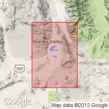
Geographically extended to southern Slate Range, north of Garlock fault. Geologic map of Slate Range describes unit as lake silts and sands of Pleistocene(?) age. Lithology and mineral content of Christmas Canyon Formation both in Slate Range and in Lava Mountains show it was formed in closed basins that were elongate parallel to Garlock fault.
Source: GNU records (USGS DDS-6; Menlo GNULEX).
- Usage in publication:
-
- Christmas Canyon Formation*
- Modifications:
-
- Age modified
- Geochronologic dating
- AAPG geologic province:
-
- Mojave basin
Summary:
Zircon fission-track age of 0.57 +/-0.20 Ma (C.W. Naeser, written commun., 1978) was obtained on Lava Creek B ash in Christmas Canyon Formation. Sample collected at SW/4 SW/4 sec.8 T28S R43E, Searles Lake 15' quad, San Bernardino Co, CA. Age therefore is Pleistocene.
Source: GNU records (USGS DDS-6; Menlo GNULEX).
For more information, please contact Nancy Stamm, Geologic Names Committee Secretary.
Asterisk (*) indicates published by U.S. Geological Survey authors.
"No current usage" (†) implies that a name has been abandoned or has fallen into disuse. Former usage and, if known, replacement name given in parentheses ( ).
Slash (/) indicates name conflicts with nomenclatural guidelines (CSN, 1933; ACSN, 1961, 1970; NACSN, 1983, 2005, 2021). May be explained within brackets ([ ]).