- Usage in publication:
-
- Chouteau limestone
- Modifications:
-
- Named
- Dominant lithology:
-
- Limestone
- AAPG geologic province:
-
- Ozark uplift
Summary:
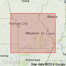
Named for Chouteau Springs, Cooper Co., central MO. In Cooper Co., region, upper part consists of thick-bedded, brownish-gray, earthy, silico-magnesian limestone, 40 to 50 ft thick; lower part consists of compact, blue or drab, thin-bedded limestone, 20 ft thick. Thins to the east and is only 10 to 30 ft thick in Marion Co. Underlies Encrinital limestone; overlies Vermicular sandstone and shales. Age is Devonian.
Source: GNU records (USGS DDS-6; Reston GNULEX).

- Usage in publication:
-
- Chouteau limestone
- Modifications:
-
- Revised
- Areal extent
- Overview
- AAPG geologic province:
-
- Lincoln anticline
- Ozark uplift
- Iowa shelf
Summary:
Assigned to Kinderhook group (revised) as upper of three formations. At Hannibal, Marion Co, MO and Louisiana, Pike Co, MO, both within Lincoln anticline, Chouteau has a thickness of 10 to 15 ft, thinning rapidly to north. Probably represented at Burlington, Des Moines Co, IA, Iowa shelf, by a few feet of buff calcareous layers lying at base of the great limestone located there. At Legrand, Marshall Co, IA, Iowa shelf, 50 ft of limestone that underlies Burlington limestone may be northward extension of Chouteau. Thickness increases southward in MO within Ozark uplift to 100 ft or more at Sedalia, Pettis Co; 50 ft near Springfield, Greene Co; and it is probably 75 to 100 ft near Ste. Genevieve, Ste. Genevieve Co. Unit is possibly quite thick beneath Coal Measures in northwestern MO. Overlies Hannibal shales (new) of Kinderhook; underlies lower Burlington limestone of Osage group. Mississippian age.
Source: GNU records (USGS DDS-6; Denver GNULEX).

- Usage in publication:
-
- Chouteau Limestone
- Modifications:
-
- Overview
- AAPG geologic province:
-
- Illinois basin
Summary:
Chouteau Limestone extends over almost all of IL south of a line from Calhoun Co. to northern Vermilion Co., but is exposed only in Calhoun and Jersey Cos. and in a small area around Hicks dome in Hardin Co. Well exposed in Pere Marquette State Park, southwestern Jersey Co., and in Meppen North Section, Calhoun Co. Consists of irregular beds of light-brownish- or greenish-gray, lithographic to very fine-grained limestone with wavy bedding planes. Locally a fine-grained dolomite. Macrofossils are common, conodonts are present in nearly all beds. Normally overlies Hannibal Shale with apparent conformity and in places grades laterally into upper part of Hannibal. In southwestern IL, Chouteau locally overlaps Hannibal and lies unconformably on Ordovician to Devonian formations. In central and eastern IL overlain by Borden Siltstone, in western IL by Burlington Limestone, in southwestern IL by Meppen or Fern Glen Formations, and in Union Co and vicinity by Springville Shale.
Source: GNU records (USGS DDS-6; Reston GNULEX).

- Usage in publication:
-
- Chouteau Limestone*
- Modifications:
-
- Overview
- AAPG geologic province:
-
- Illinois basin
Summary:
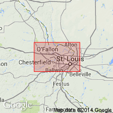
Chouteau Limestone mapped on both sides of Mississippi River in MO and IL near St. Louis, MO. Mapped undivided in places with Fern Glen Formation. Like Fern Glen, thickens westward out of Illinois basin. Locally includes Bushberg Sandstone because Bushberg is too thin to map in this area.
Source: GNU records (USGS DDS-6; Reston GNULEX).
For more information, please contact Nancy Stamm, Geologic Names Committee Secretary.
Asterisk (*) indicates published by U.S. Geological Survey authors.
"No current usage" (†) implies that a name has been abandoned or has fallen into disuse. Former usage and, if known, replacement name given in parentheses ( ).
Slash (/) indicates name conflicts with nomenclatural guidelines (CSN, 1933; ACSN, 1961, 1970; NACSN, 1983, 2005, 2021). May be explained within brackets ([ ]).

