The National Geologic Map Database is migrating to a new infrastructure. We apologize for any service disruptions during this process.
|
|---|


- Usage in publication:
-
- Chiulos shale member*
- Modifications:
-
- Areal extent
- AAPG geologic province:
-
- Great Basin province
- South Western Overthrust
Summary:
Pg. 12 (table 1), 90-93, 170, 172, 174-175, pls. 1, 21. Chiulos shale member of Great Blue Formation. Primarily black fissile shale with many interbedded ribs of quartzite near center. Thickness about 1,818 feet. Overlies a lower limestone member about 911 feet thick; in fault contact with upper limestone member that is about 1,410 feet thick. Age is Late Mississippian. Name credited to USGS.
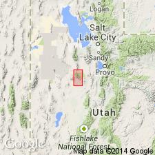
[Notable expousres in Sheeprock Mountains, Tooele and Juab Cos., Wasatch National Forest, western UT.]
Source: US geologic names lexicon (USGS Bull. 1200, p. 785).

- Usage in publication:
-
- Chiulos member*
- Modifications:
-
- Principal reference
- Dominant lithology:
-
- Shale
- Quartzite
- AAPG geologic province:
-
- Great Basin province
Summary:
Pg. 110-111, 112, pl. 3 (loc. 18c). Chiulos member of Great Blue formation. Lower half chiefly gray-green to greenish brown-weathering black shale; upper half chiefly massive, fine- to medium-grained, cross-bedded quartzite with a large proportion of shale and rare lenses of argillaceous, sand-streaked limestone. Thickness about 800 to 1,000 feet. Conformably underlies Poker limestone member and overlies Paymaster member (both of Great Blue formation). Age is considered Late Mississippian.
Source: Publication.
For more information, please contact Nancy Stamm, Geologic Names Committee Secretary.
Asterisk (*) indicates published by U.S. Geological Survey authors.
"No current usage" (†) implies that a name has been abandoned or has fallen into disuse. Former usage and, if known, replacement name given in parentheses ( ).
Slash (/) indicates name conflicts with nomenclatural guidelines (CSN, 1933; ACSN, 1961, 1970; NACSN, 1983, 2005, 2021). May be explained within brackets ([ ]).