- Usage in publication:
-
- Chisos beds
- Modifications:
-
- Original reference
- Dominant lithology:
-
- Tuff
- Sandstone
- Clay
- Conglomerate
- AAPG geologic province:
-
- Permian basin
Summary:
Pg. 17, 60-67. Chisos beds. Tuffaceous sediments, stratified in thin and well-defined ledges and layers. Great bulk of strata bluish gray or white stratified rock in even, thoroughly consolidated ledges, with occasional layers of clay and sandstone and even thin layers of conglomerate. Thickness at least 2,000 feet. Includes Crown conglomerate at top. Grades into underlying Tornillo clays. Underlies Tertiary. [Age is considered Late Cretaceous(?).]
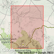
[Named from Chisos Mountains, Brewster Co., western TX.]
Source: US geologic names lexicon (USGS Bull. 896, p. 435).

- Usage in publication:
-
- Chisos Formation
- Modifications:
-
- Mapped 1:250k
- Dominant lithology:
-
- Conglomerate
- Sandstone
- Mudstone
- Tuff
- AAPG geologic province:
-
- Permian basin
Summary:
Chisos Formation (map unit Tc). Includes (descending) Tule Mountain, Mule Ear Spring, Bee Mountain, Ash Spring, and Alamo Creek Members; not separately mapped. Generally conglomerate, sandstone, mudstone, tuff, and igneous rock. Conglomerate beds up to 10 feet for intervals up to 30 feet thick, angular bodies of igneous rock up to 2 feet and rounded boulders of limestone up to 15 inches in size, matrix calcareous tuffaceous sandstone, brownish-yellow, gray, grayish-green. Sandstone in beds up to 5 feet form intervals up to 35 feet thick, poorly sorted volcanic arkose composed of many mineral species, wide variety of colors. Mudstone in beds less than a foot forms intervals up to 120 feet thick, wide variety of colors. Tuff common throughout lower portion, constitutes most of upper part of formation, well bedded tuff units up to 30 feet thick may be lake deposits, tuff contains wide variety of minerals. Thickness of Chisos Formation about 3,500 feet.
Tule Mountain Member, trachyandesite porphyry in several flows, feldspar up to half-inch in size in fine-grained groundmass produces a spotted appearance, gray to brownish-gray; weathers brown to reddish-brown; maximum thickness 350 feet; K-Ar age, 28.6 +/-1.5 m.y. (2 determinations).
Mule Ear Spring Tuff Member, punky ash to very hard, brittle, silicified ash-flow tuff with conchoidal fracture, various shades of pink and red; weathers brown; contains Oligocene vertebrate fossils; thickness 8 to 12 feet in Big Bend National Park, 3 to 40 feet in Bofecillos area; K-Ar age, 31.5 +/-2.0 m.y. (3 determinations).
Bee Mountain Basalt Member, fine- to medium-grained, several flows, scoriaceous and vuggy along flow contacts; 25 to 80 feet thick in high Chisos Mountains, 527 feet thick at Cerro Castellan, up to 250 feet thick in Bofecillos area, feathers out westward; K-Ar age, 22.6 +/-1.0 m.y. (2 determinations).
Ash Spring Basalt Member, 2 or more flows, coarsely porphyritic in eastern area, phenocrysts decrease in size westward, basal 10 feet scoriaceous; thickness up to 200 feet; K-Ar age, 33.6 +/-1.5 m.y. (2 determinations).
Alamo Creek Basalt Member, fine-grained, hard, dark, lava, base mostly scoriaceous; thickness of measured sections in Big Bend National Park, 20 to 208 feet, 5 to 95 feet in Bofecillos area. K-Ar age, 42.2 +/-2.0 m.y. (2 determinations); also 38.7 and 42.7 m.y.
Source: Publication.

- Usage in publication:
-
- Chisos Formation
- Modifications:
-
- Geochronologic dating
- AAPG geologic province:
-
- Permian basin
Summary:
Pg. 24-25. Chisos Formation. Samples from (in ascending order) Alamo Creek Basalt, Ash Spring Basalt, Bee Mountain Basalt, Mule Ear Spring Tuff, and Tule Mountain Trachyandesite [Members], in Brewster County, southwestern Texas, yielded K-Ar ages from about 47 to 34 Ma. Data from R.J. Chuchla, 1981 (Univ. Texas-Austin MS thesis, 199 p.), J.F. Evernden and others, 1964 (Amer. Jour. Sci., v. 262, p. 145-198), J.L. Gregory, 1981 (Univ. Texas-Austin MS thesis, 78 p.), C.D. Henry and J.G. Price, 1984 (Jour. Geophysical Res., v. 89, p. 8765-8786), R.A. Maxwell and others, 1967 (Univ. Texas-Austin Pub. 6711, 320 p.), and J.B. Stevens, 1969 (Univ. Texas-Austin PhD dissert., 129 p.); ages recalculated using decay constants of Steiger and Jager, 1977 (Earth Planet. Sci. Letters, v. 36, p. 359-362). [See also entries under individual members.]
[Age considered Eocene to Oligocene; Eocene-Oligocene boundary 36.6 (38-34) Ma (from Geologic Names Committee, USGS, 1983 ed. geol. time scale, with additions from N.J. Snelling, 1985, The Geol. Soc. Mem., no. 10).]
Source: Publication.
For more information, please contact Nancy Stamm, Geologic Names Committee Secretary.
Asterisk (*) indicates published by U.S. Geological Survey authors.
"No current usage" (†) implies that a name has been abandoned or has fallen into disuse. Former usage and, if known, replacement name given in parentheses ( ).
Slash (/) indicates name conflicts with nomenclatural guidelines (CSN, 1933; ACSN, 1961, 1970; NACSN, 1983, 2005, 2021). May be explained within brackets ([ ]).

