The National Geologic Map Database is migrating to a new infrastructure. We apologize for any service disruptions during this process.
|
|---|


- Usage in publication:
-
- Chisholm shales
- Modifications:
-
- Original reference
- Biostratigraphic dating
- AAPG geologic province:
-
- Great Basin province
Summary:
Pg. 409-410. Chisholm shales. Pinkish, compact, argillaceous shale with a few interbedded layers of limstone 3 to 15 inches thick. Thickness 100 to 125 feet. Contains Middle Cambrian fossils [listed]. Lies about 1,200 feet above Lower Cambrian.
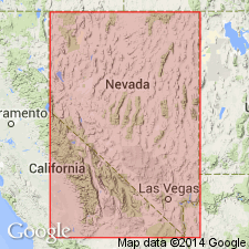
Type locality: in vicinity of Chisholm Mine and Half Moon Gulch, 2 to 3 mi northwest of Pioche [Pioche 7.5-min quadrangle, Lincoln Co.], eastern NV.
Source: US geologic names lexicon (USGS Bull. 896, p. 435).
- Usage in publication:
-
- Chisholm shale*
- Modifications:
-
- Adopted
- AAPG geologic province:
-
- Great Basin province
Summary:
See also Westgate and Knopf, 1927, Amer. Inst. Min. Met. Engrs. Trans., no. 1647, p. 5. Chisholm shale. Is 0 to 180 feet thick in Pioche region, eastern Nevada, where it conformably underlies limestone here named Highland Peak limestone and conformably overlies limestone here named Lyndon limestone. Is fine-grained, yellow brown to red, laminated, argillaceous shale that weathers to small flat debris; contains interbedded limestones. No mica. Fossils abundant (listed). Age is Middle Cambrian. [Chisholm shale of Walcott adopted by the USGS.]
Source: US geologic names lexicon (USGS Bull. 896, p. 435); supplemental information from GNU records (USGS DDS-6; Menlo GNULEX).

- Usage in publication:
-
- Chisholm shale*
- Modifications:
-
- Revised
- AAPG geologic province:
-
- Great Basin province
Summary:
Pg. 1158 (fig. 6), 1160. Chisholm shale. Thickness emended [type section] 137 feet. Overlies Lyndon limestone; underlies Highland Peak limestone. [Age is Middle Cambrian.]
Source: US geologic names lexicon (USGS Bull. 1200, p. 781-782).
- Usage in publication:
-
- Chisholm shale
- Modifications:
-
- Areal extent
- AAPG geologic province:
-
- Great Basin province
Summary:
Pg. 12 (fig. 2), 14-15. Chisholm shale. Underlies Peasley limestone (new); Highland Peak limestone restricted to exclude Peasley. [Age is Middle Cambrian.]
Source: US geologic names lexicon (USGS Bull. 1200, p. 781-782).
- Usage in publication:
-
- Chisholm shale
- Modifications:
-
- Biostratigraphic dating
- Areal extent
- AAPG geologic province:
-
- Plateau sedimentary province
Summary:
Pg. 1794, 1816-1817, pl. 1 (columnar sections). Chisholm shale. Geographically extended into western Grand Canyon area, [Mohave County], northwestern Arizona. Consists of maroon-red, dark-brown, and dark-green shales, about 99 feet thick. Underlies Peasley limestone and overlies Lyndon shale. Fossils (trilobites). Age is early Middle Cambrian; GLOSSOPLEURA trilobite biozone.
Source: Publication; US geologic names lexicon (USGS Bull. 1200, p. 781-782).
- Usage in publication:
-
- Chisholm shale
- Modifications:
-
- Areal extent
- AAPG geologic province:
-
- Great Basin province
Summary:
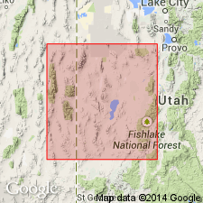
Pg. 32, 35. Chisholm shale. Geographically extended into Wah Wah Range, Utah, where it is 56 feet thick. Not distinguished from Peasley and Lyndon limestones in House Range, and here the undifferentiated unit is named Millard limestone. Through discovery of Lyndon limestone in southeastern California, the Chisholm could be differentiated there. In Nopah-Johnnie region, Chisholm shale includes members 5F and 5G of Hazzard's (1937, California Jour. Mines and Geology, v. 33, no. 4) Cadiz formation. [Age is Middle Cambrian.]
Source: US geologic names lexicon (USGS Bull. 1200, p. 781-782).
- Usage in publication:
-
- Chisholm shale
- Chisholm shale member
- Modifications:
-
- Areal extent
- AAPG geologic province:
-
- Plateau sedimentary province
Wheeler, H.E., and Mallory, V.S., 1953, Designation of stratigraphic units: American Association of Petroleum Geologists Bulletin, v. 37, no. 10, p. 2407-2421.
Summary:
Pg. 2413 (fig. 2), 2414. Generalized discussion of designation of stratigraphic units. Chisholm shale is included in Bright Angel group in one area, and classed as member of Bright Angel shale in another area. [Age is Middle Cambrian.]
Source: US geologic names lexicon (USGS Bull. 1200, p. 781-782).
- Usage in publication:
-
- Chisholm shale*
- Modifications:
-
- Areal extent
- AAPG geologic province:
-
- Great Basin province
Summary:
Pg. 339, pls. 32, 33. Chisholm shale. In Nye and Clark Counties, Nevada, underlies Jangle limestone (new); conformably overlies Lyndon limestone. [Age is Middle Cambrian.]
Source: US geologic names lexicon (USGS Bull. 1200, p. 781-782).
- Usage in publication:
-
- Chisholm formation
- Modifications:
-
- Revised
- AAPG geologic province:
-
- Great Basin province
Summary:
Pg. 48 (fig. 3), 49-50. Chisholm formation. Proposed here that name Chisholm formation be applied to unit in House Range [western Utah] that Wheeler (1948) designated as Burnt Canyon limestone. Wheeler assigned only a 35-foot shale unit to the Chisholm in the Wah Wah Range [western Utah]. A second 10-foot shale bed with a GLOSSOPLEURA [trilobite] fauna occurs about 150 feet above Chisholm shale of Wheeler. Proposed here that the entire 195-foot shale and limestone sequence be assignd to Chisholm formation. Elsewhere in eastern Great Basin, Chisholm shale occurs in middle of Millard limestone of Cohenour (1959) in Sheeprock Range and of Rigby (1958) in Stansbury Mountains [western Utah]. Further east, the Chisholm merges into lower part of Ophir shale and in Tintic and Ophir districts; to the west, the shales finger out. As defined in this paper, the Chisholm underlies the Dome and overlies the Howell in the House and Wah Wah Ranges and underlies the Peasley and overlies the Lyndon in Pioche district [eastern Nevada]. [Age is Middle Cambrian.]
Source: US geologic names lexicon (USGS Bull. 1200, p. 781-782).
- Usage in publication:
-
- Chisholm Formation*
- Modifications:
-
- Revised
- Redescribed
- Areal extent
- AAPG geologic province:
-
- Great Basin province
Summary:
Chisholm Shale is redescribed and the rank revised to Formation. Is extended into the Swasey Mountains, Juab and Millard Co., UT.
Source: GNU records (USGS DDS-6; Menlo GNULEX).
For more information, please contact Nancy Stamm, Geologic Names Committee Secretary.
Asterisk (*) indicates published by U.S. Geological Survey authors.
"No current usage" (†) implies that a name has been abandoned or has fallen into disuse. Former usage and, if known, replacement name given in parentheses ( ).
Slash (/) indicates name conflicts with nomenclatural guidelines (CSN, 1933; ACSN, 1961, 1970; NACSN, 1983, 2005, 2021). May be explained within brackets ([ ]).